Best Anchorages in Grenada: Sheltered Bays & Snorkel Cays
A practical, route-ready guide to Grenada anchorages for yacht charterers — GPS for each bay, mooring and provisioning options, clearance steps and volcanic-safety guidance.

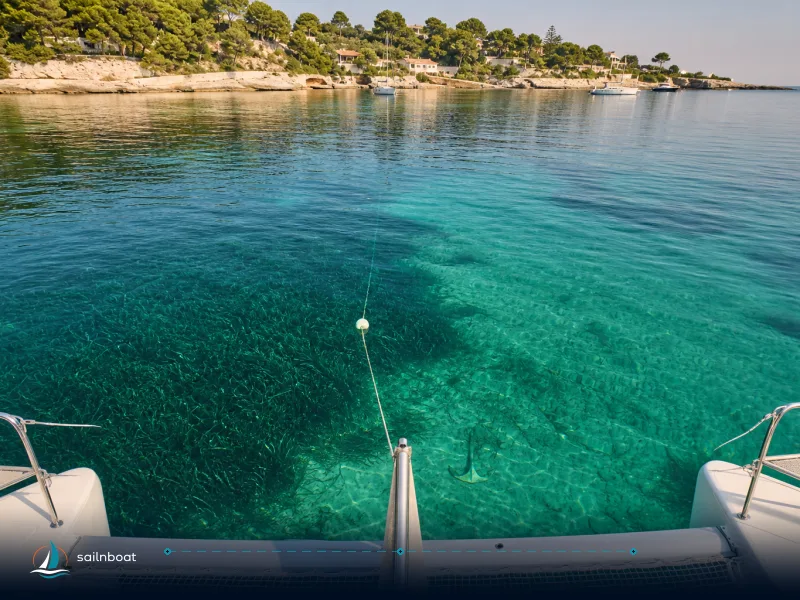
Grenada anchorages that combine reliable shelter, easy provisioning and good snorkelling are clustered along the south-west coast (Prickly Bay / Grand Anse / Hog Island) and in nearby Carriacou and the Grenadines (Tyrrel Bay, Sandy Island, Tobago Cays). Use Prickly Bay or Port Louis as your operational base for fuel, chandlery and formal clearance; move east and south for reefs and protected snorkel cays.
Top Anchorages in Grenada
Prickly Bay
- GPS: approximately 12°00' N, 61°45.7' W.
- Why choose it: largest protected bay beside St. George's with a formal marina, extensive moorings and a cluster of boat services (chandlery, fuel, haul‑out options). Moorsafe operates a maintained mooring field here and offers weekly inspections and bookings.
- Shelter & holding: good protection from easterly trades, anchoring permitted in depths commonly 5–15 m on sand/mud; keep clear of marked rocks (Porpoises) and observe local no‑anchor zones close to beaches.
- Facilities nearby: Spice Island Marine Services and Budget Marine (chandlery), dinghy dock, fuel and shore-side provisioning within short taxi/dinghy rides.
Grand Anse Beach
- GPS: seaward anchorage centered near 12.02505° N, 61.76031° W.
- Why choose it: the classic afternoon swim and easy shore access to restaurants and supermarkets; visibility for snorkelling is often best on calm mornings.
- Shelter & holding: the bay is exposed to long-period north swells at times — use the recommended offshore anchoring depths (consult current pilot charts) and keep a good scope; local marine‑protected area planning fixes seaward boundaries you should respect.
Hog Island
- GPS: roughly 12.000° N, 61.738° W (small islet off Grand Anse).
- Why choose it: short dinghy ride from Grand Anse; accessible reef snorkeling close to shore and calm water on the lee side when trades are steady.
- Notes: approach with care — reefs and shoals sit close to the islet; use local charted approach lines and reef markers from updated pilotage sources.
Quick comparison table
| Anchorage | GPS (approx) | Shelter (wind) | Snorkel/Dive | Moorings / Facilities | Best time |
|---|---|---|---|---|---|
| Prickly Bay | 12°00'N, 61°45.7'W | Good from E–NE trades | Nearby reefs, dive ops | Marina, moorings (Moorsafe), chandlery, fuel | Dec–Apr |
| Grand Anse Beach (offshore) | 12.025°N, 61.760°W | Moderate; exposed to N swell | Shore snorkel, beach access | Beach restaurants; dinghy landings | Dec–Apr |
| Hog Island | 12.000°N, 61.738°W | Sheltered lee in trades | Shallow reef snorkeling | Anchor-only, dinghy beach | Dec–Apr |
(Use official charts and local notices for final approach and set anchor alarms; conditions change with swell and squalls.)
Mooring Options and Local Marinas
Port Louis Marina
- Location: Port Louis, St George’s — marina commonly used for charter handovers and provisioning; confirm available services and proximity to airport and St. George’s town with the operator before arrival.
- Services: alongside berthing for visiting yachts, fuel nearby, shore services, security and marina mall amenities in the harbour complex. Operators commonly quote berth rates on request; expect seasonal variance and extras for electricity, water and tax.
- Contact note: marinas publish berth and service rates on request — call ahead to reserve during peak season.
Blue Lagoon Marina
- Location & context: local listings show an established marina presence in the south coast cluster (True Blue / Blue Lagoon area) offering repairs and shore services; seasonal fee structures are typical. Use the marina's own booking line to get up‑to‑date rates.
Moorsafe Marinas
- Moorsafe operates moorings at Prickly Bay and True Blue, offers booking, underwater hull services and a maintained mooring system; they publish contact (WhatsApp +1‑473‑456‑8895 / info@moorsafegroup.com) and terms for bookings. Mooring specs and booking rules are on their site.
- How to use them: reserve in busy months (Dec–Apr), provide proof of insurance if requested and expect a short check‑in procedure at the mooring office when you arrive.
Other facilities to know
- Clarkes Court Bay / Clarkes Court Boatyard: haul‑out and repair services, alongside berths and easy access to Grand Anse shopping; good for technical problems and shorter stays.
- Carriacou (Harvey Vale / Tyrrel Bay): duty‑free fuel, chandlery and a 100‑tonne travel lift at Carriacou Marine; useful for haul‑outs and re‑provisioning on a Grenada–Grenadines route.
Snorkeling and Diving Spots
Tobago Cays (SVG) — prime snorkelling, protected moorings
- GPS: about 12.634°N, 61.355°W (center of the Cays).
- What to expect: excellent coral, turtle feeding grounds and managed mooring buoys. The Tobago Cays Marine Park charges a per‑person entry fee and a vessel mooring fee (TCMP has published XCD 15 per person and XCD 60 per vessel per 24 h in recent schedules). Use the park moorings to avoid anchoring on coral.
Sandy Island (Carriacou)
- GPS: roughly 12.4856° N, 61.4822° W (small, shallow sand cay off Carriacou).
- Why stop: shallow, sheltered snorkel grounds and a postcard sand cay where you can beach a dink; popular day stop for cruisers based in Tyrrel Bay. Mooring fields and dinghy landings are commonly used; expect crowded weekends in high season.
Salt Whistle Bay (Mayreau) and surrounding Grenadines
- Use moorings where provided; park rules and daily visitor fees apply in protected areas like the Tobago Cays. Mooring availability and local repair services vary by season and by recovery status after storms — check the TCMP and local agents before arrival.
Kick ’em Jenny — do not ignore it
- Location & hazard: Kick ’em Jenny is an active submarine volcano north of Grenada; periodic unrest means authorities publish an exclusion zone you must respect. The exclusion radius is dynamic — UWI/NaDMA bulletins commonly set a 1.5 km exclusion at Yellow and up to 5 km at Orange; official advice is the authority for current radii. Treat the area as off‑limits to transit or anchoring while an exclusion is in force.
Customs and Immigration Procedures
- Filing and pre‑arrival: Grenada accepts pre‑arrival notification methods used across the Windward islands (SailClear is widely used and expedites processing; Grenada also operates an e‑arrival portal). Submit papers before you arrive to reduce time ashore.
- Where to clear: official ports of entry for yachts include Prickly Bay (Lance aux Epines), Port Louis (St George’s) and Carriacou (Hillsborough/Harvey Vale); clear at the first port you enter. The Grenada Ports Authority lists ports of entry and typical anchoring rules.
- Documents & practical steps: passports for everyone on board, vessel registration, proof of insurance, crew list and last port clearance; present these at the customs/immigration office ashore — bring photocopies and one physical vessel document. Processing is usually quick during office hours but overnight or weekend clearances commonly incur overtime charges.
- Fees: governments typically charge clearance/port/visitor fees that are length‑banded or per‑person; amounts change and often apply overtime surcharges outside standard hours. Expect to budget for a modest clearing fee, possible cruising permit and any park mooring charges you’ll meet en route. (See Tobago Cays fees above for an example of park charges.)
Safety Considerations
- Kick ’em Jenny exclusion zone: check UWI‑SRC and Grenada NaDMA advisories before plotting any track north of Grenada; the exclusion radius is updated with volcanic activity and has been publicly posted as 1.5 km (Yellow) and 5 km (Orange) in recent bulletins. If an exclusion is active, route around it by a safe margin.
- Marine protected areas & local no‑anchor rules: some bays (for example parts of Woburn/Clarkes Court MPA) prohibit anchoring to protect seagrass and reef; check Admiralty Sailing Directions and local port notices — do not assume anchoring is allowed even if the bay looks empty.
- Weather & sea state: the northeast trade winds (often 12–20 knots in season) make downwind passages reliable December–April but create choppier conditions in certain channels. Hurricane season runs June 1–November 30; charter operators commonly avoid rentals in peak hurricane months and many yachts are relocated to secure harbours — plan accordingly. Use PredictWind / NHC and local broadcasts every morning before leaving anchor.
- On‑the‑water practice: drop two independent anchors if conditions warrant, set a reliable anchor alarm, clear the approach well before daylight and check local tide/swell charts for ground swell or shoal warnings. Where moorings exist, prefer them to anchoring on coral or seagrass.
Best Times to Visit Each Anchorage
- High season (Dec–Apr): dry trade‑wind window; anchorages and beaches are at their calmest and clearest; marinas and moorings are busiest — book berths and plan clearance slots in advance.
- Shoulder months (May, November): quieter, lower prices and still generally good conditions; squalls increase so watch daily forecasts.
- Low / hurricane season (Jun–Oct/Nov): heavier rain and storm risk; some charter companies limit operations and some shoreside services reduce hours — only sail with strong local contingency plans and hurricane mooring arrangements.
Practical itinerary tips (operational)
- Base selection: if you need fuel, full provisioning and quick airport access, base yourself at Port Louis or Prickly Bay for the first 24–48 hours. Use Tyrrel Bay (Carriacou) as your southern Grenadines staging anchorage for Sandy Island and the Tobago Cays legs.
- Provisioning checklist: fresh produce, bottled water, engine spares, dinghy fuel, and reef‑safe sunscreen — supermarkets and a well‑stocked chandlery (Budget Marine / Spice Island Marine) are available in St George’s; Carriacou has useful duty‑free fuel and a smaller chandlery at Harvey Vale.
- Booking & clearances: submit arrival notices through SailClear or the national e‑arrival portal before you approach the first port of entry; arrive early in the day to avoid overtime charges and to sort any paperwork without rushing.
Plan your calls: spend a night in a marina for refuelling/clearance, then move to mooring fields and remote snorkel cays when the forecast is settled. If you must transit north of Grenada, consult the latest UWI/NaDMA KeJ advisory and give extra margin to exclusion zones.
Plan your yacht charter to Grenada today.
Frequently Asked Questions
Prickly Bay (Prickly/Bay/True Blue area), Grand Anse Beach (offshore anchoring), Hog Island (short dinghy to Grand Anse) and the south-coast marinas such as Port Louis offer the best mix of shelter, services and snorkel access.
Major options are Prickly Bay (moorings and Prickly Bay Marina/Moorsafe), Port Louis Marina (full-service) and Clarkes Court Bay/Clarkes Court Boatyard for haul-out and repair; Carriacou has Tyrrel Bay/Carriacou Marine at Harvey Vale.
File a pre-arrival notice (SailClear or the national e-arrival portal), present passports and vessel documents at an official port of entry (Prickly Bay, Port Louis, Tyrrel Bay/Hillsborough, etc.), and expect processing fees and overtime charges outside office hours.
Yes — observe the Kick ’em Jenny maritime exclusion zones, avoid anchoring in marine protected areas (some bays have anchoring prohibitions), and plan around trade-wind and swell patterns; always check local notices.
December–April is the high season with steady trade winds and the clearest conditions for snorkeling; June–November is hurricane season and brings heavier rain and greater operational risk.
Written by
Sailnboat Editorial
The Sailnboat editorial desk covers yacht and boat chartering worldwide — routes, bases, seasons, boat types, paperwork and the practical costs that decide a trip. We are a charter marketplace, not a boat owner or a local agency: what we sell is judgement and support, so our guides are written to help you make a decision, not to sell you a specific boat. Every guide is checked against live operator and marina data before it goes out.
Fact-checked against live operator and marina data, and published under our editorial standards. Last reviewed: .