Top Côte d'Azur Anchorages: Quiet Bays & Practical Tips
A practical, location-by-location guide to the best Côte d'Azur anchorages for yachts — GPS, depths, seabed, shelter, mooring rules and how to avoid Posidonia damage.

Intro paragraph (2–4 sentences): If you want quiet cote d'azur anchorages, pick coves with organised ZMEL buoys or sandy patches well outside Posidonia meadows — that preserves the seabed and keeps you legal. Below are the decision‑grade details you need: GPS coordinates, typical depth and seabed, shelter by wind quadrant, onshore access by tender, booking and fee information, and the local rules that matter when you anchor on the French Riviera.
Top Secluded Anchorages Along the Côte d'Azur
These are the anchorages charterers tell us they return to when they want calm evenings and easy shore access. Each entry includes GPS, typical depths and seabed, shelter summary and practical mooring notes.
Cap d'Antibes (Anse du Croûton / Abri de l'Olivette)
- GPS: approx. 43°33.34′ N, 7°07.06′ E (Anse du Croûton / Abri de l'Olivette area).
- Typical depths & seabed: commonly cited shallow sandy patches and sheltered water in the 3–6 m band near Garoupe; other spots toward the Croûton drop deeper — check your chart before committing.
- Shelter: good protection from easterly winds and a comfortable lee for afternoon breathes; exposed to strong northwesterly Mistral fetch in certain angles.
- Mooring & rules: Cap d'Antibes operates an organised ZMEL (bouées) in the Anse du Croûton — anchor is frequently prohibited inside the ZMEL; buoys are largely first‑come, with short stays enforced and QR‑code registration in season. Plan to use the buoys rather than drop anchor over seagrass.
Îles de Lérins (Sainte‑Marguerite & Saint‑Honorat)
- GPS (island centres): Sainte‑Marguerite ≈ 43.5193° N, 7.0497° E; Saint‑Honorat ≈ 43°30′27.7″ N, 7°02′45.3″ E (see SHOM / municipal notices for exact ZMEL positions).
- Typical depths & seabed: ZMEL bouées sit on sand patches and mixed seabeds in depths typically from ~6–18 m for the main buoy fields; some authorised sandy anchor patches exist but Posidonia meadows are widespread — anchor only where charts and park rules allow.
- Shelter: the Lérins archipelago provides excellent lee for Cannes and offers alternative shelter depending on wind quadrant — choose the north/east side in southerlies, the west side in easterlies.
- Mooring & rules: organised ZMELs operate seasonally with a mix of paid and free bouées depending on the zone; some ZMELs close to diving and swimming zones and enforce speed/behavior limits inside 300 m of the islands. Buoy tariffs and durations vary by season and zone — check the port authority or ZMEL manager before arrival.
Porquerolles (Plage d'Argent / Port area)
- GPS (Plage d'Argent vicinity): approx. 43.0039° N, 6.1790° E.
- Typical depths & seabed: nearshore coves and sand beaches present 3–12 m depths with sand and rocky mixes; the immediate seabed near the main beaches is often sand but Posidonia and protected zones exist nearby.
- Shelter: good lee from prevailing westerlies in many of the western coves; exposure changes rapidly with wind direction — Porquerolles can be comfortable except under an onshore swell or strong southerlies.
- Mooring & rules: Porquerolles lies inside or next to the Port‑Cros National Park maritime zoning; anchoring on Posidonia is restricted and the park operates buoy fields (ZMEL) with seasonal opening, paid night moorings and reservation rules evolving — night mooring at certain protected sites is charged and needs prior use of the park’s reservation portal where required.
Villefranche‑sur‑Mer (Rade de Villefranche)
- GPS (typical anchoring zone): ~43°42.2′ N, 7°19.4′ E; the rade is deep and wide.
- Typical depths & seabed: recommended anchoring spots commonly fall in the 8–25 m range with sand and mud bottoms that usually give good holding — historically a NATO anchorage because of its depth and shelter.
- Shelter: one of the best natural harbours on the Riviera — very good protection from southerly and easterly winds and excellent lee from northerly winds in parts of the rade; still check forecast for local gusts and swell.
- Mooring & rules: authorities operate ZMEL buoys and visiting‑berth systems; some bouées are paid and managed by the local régie — expect daily charges that rise in high season and a requirement to register at the capitainerie for overnight stays in regulated zones.
Saint‑Tropez (Pampelonne & Gulf)
- GPS (Pampelonne anchor area): approx. 43°13′10″ N, 6°40′15″ E for broad reference to the bay and beach anchorage zones.
- Typical depths & seabed: the main sand patches in Pampelonne sit around 5–12 m with sand and seagrass; holding on sand is good but the bay is exposed to the Mistral (NW) and can become uncomfortable.
- Shelter: fair lee from short onshore breezes, poor protection from strong NW Mistral; pick the western side of the bay for lees when the Mistral is forecast to build.
- Mooring & rules: the Gulf contains both free anchorage areas and a regulated ZMEL at Pampelonne — free sandy anchoring exists but ZMEL buoys and some port moorings are charged in high season; port fees in Saint‑Tropez harbour itself are high during peak weeks.
Popular Anchorages: Balancing Crowds and Comfort
If you prioritise facilities over privacy, these choices balance tender access, restaurants and shore services with reasonable shelter.
- Monaco / Port Hercule — very deep and well‑serviced berth options; sheltered but crowded and expensive; port operations and VHF are tightly managed by the Monaco port authority.
- Villefranche-sur‑Mer — large lee, excellent tender access to town and restaurants, often busy on summer evenings but still comfortable because of space.
- Saint‑Tropez (Pampelonne) — day‑time party scene and beach clubs; good for people who want a lively shore experience, less so for solitude.
(Table: quick comparison)
| Anchorage | GPS (approx.) | Typical depth (m) | Seabed | Shelter | Notes & fees |
|---|---|---|---|---|---|
| Cap d'Antibes (Croûton) | 43°33.34′ N, 7°07.06′ E | 3–6 (near beaches) | Sand / mixed | Good from east; exposed to NW Mistral | ZMEL bouées; anchor often prohibited inside ZMEL. |
| Îles de Lérins (Sainte‑Marguerite) | 43.5193° N, 7.0497° E | 6–18 (bouée fields) | Sand / mixed; Posidonia nearby | Excellent lee options | ZMEL bouées; paid/seasonal, rules enforced. |
| Porquerolles (Plage d'Argent) | 43.0039° N, 6.1790° E | 3–12 | Sand / rock | Good lee in several coves | Port‑Cros NP zoning; buoys/reservations for some sites. |
| Villefranche (Rade) | 43°42.2′ N, 7°19.4′ E | 8–25 | Sand / mud | Excellent natural harbour | ZMELs & paid buoys; deep anchorage. |
| Saint‑Tropez (Pampelonne) | 43°13′ N, 6°40′ E | 5–12 | Sand (some Posidonia) | Exposed to Mistral (NW) | Mix of free sand anchoring and paid ZMEL buoys; port fees high in summer. |
Environmental Regulations and Anchoring Tips
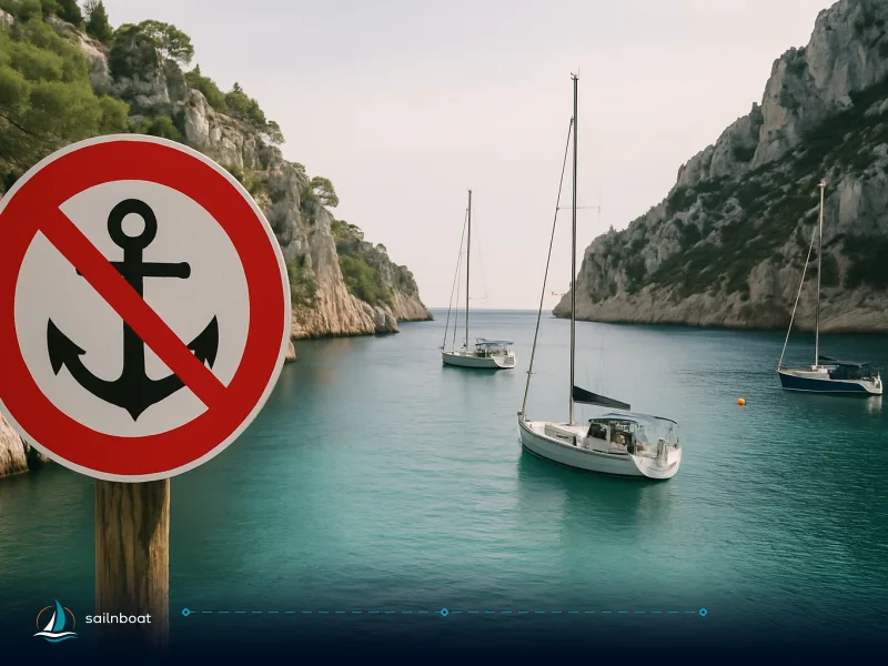
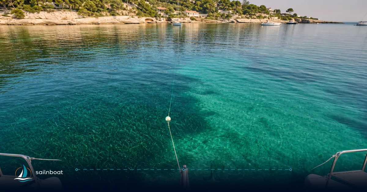
France has progressively tightened anchoring rules to protect Posidonia oceanica (seagrass) and other habitats. The maritime prefect issues prefectural decrees that designate where anchoring is prohibited, restricted to buoys, or subject to vessel‑length limits. Avoid anchoring where Posidonia is charted; many ZMELs were created expressly to remove anchoring pressure from meadows.
- Posidonia & legal framework: since 2019 a framework decree and multiple local prefectural orders regulate anchoring to protect Posidonia; some zones prohibit anchoring for larger vessels outright and require use of eco‑moorings. Expect local variations in vessel length thresholds and seasonal rules.
- Park zones (Port‑Cros / Porquerolles / Hyères): national‑park ZMELs enforce day/night rules, reservations and paid overnight mooring in core marine areas — Port‑Cros operates a booking and payment portal for certain buoy fields and charges for night stays.
- Tools to check seabed & rules: the Donia/Posidonia mapping apps and SHOM charts are the practical sources skippers use pre‑arrival to identify sand patches versus seagrass and to see regulated ZMEL areas. Use them before you decide to anchor.
Mooring fees — what to expect:
- Typical ZMEL/day and buoy rates cited by local guides and port régies commonly sit between about €20 and €80 per night for small‑to‑mid length craft; high‑demand locations and private harbour berths can be substantially higher (especially Saint‑Tropez and Monaco). Use the ZMEL or port manager’s current tariff list for exact charges.
Onshore Attractions Accessible from Anchorages
- Cap d'Antibes: La Garoupe beach, Villa Eilenroc gardens and short tender rides to Juan‑les‑Pins restaurants and marina services.
- Îles de Lérins: Fort Royal and the museum on Sainte‑Marguerite (Man in the Iron Mask history), the fortified abbey and vineyards on Saint‑Honorat — both are 5–20 minute tenders from typical buoy fields.
- Porquerolles: cycling inland to vineyards, Plage d'Argent and the small village — tender to the main quay or pick a beach cove for a short dinghy landing.
- Saint‑Tropez: Pampelonne beach clubs (Club 55, etc.) by tender; the old port and village shops are a short shuttle ride.
- Villefranche: medieval old town, restaurants and easy shore access — one of the easiest anchor‑to‑restaurant transitions on the Riviera.
Depths and Seabed Conditions at Key Anchorages
- Recommended operational depths: for overnight anchoring choose areas where charted depths leave comfortable margin for tide, squat and bow height; on the Côte d'Azur this commonly means 3–25 m depending on the bay and your yacht’s draft. Deeper anchorages (e.g., Villefranche) may require longer chain and more scope.
- Seabed composition and holding: sand and mud give the best holding; sand patches adjacent to meadows are the preferred target for minimal environmental impact. Posidonia reduces holding but is legally protected — do not drag or anchor in it. Use sonar, local charts and the Donia mapping tool to find sand.
Best Practices for Anchoring in the Côte d'Azur
Practical, safety‑first steps that will keep your crew comfortable and your charter security intact.
- Pre‑plan with official charts and ZMEL maps: identify sand patches, ZMEL boundaries and any no‑anchor polygons for the leg you are planning; use the Donia app / local port notices for up‑to‑date restrictions.
- Anchor scope and rode: aim for a scope of roughly 5:1 in calm, sheltered conditions and 7:1 when overnight, in gusty weather or on uncertain ground — more scope improves holding but needs swing room. Carry ample chain/rode for the deepest anchorage you expect.
- Use eco‑moorings where offered: pick park or ZMEL bouées — they protect Posidonia and are usually sited on sand. Port‑Cros, Sainte‑Marguerite and other ZMELs enforce eco‑moorings seasonally.
- Setting & testing the set: approach slowly into the wind/current, lower the anchor paying rode, reverse gently to set, then take bearings and run a short drag test before leaving the chain to settle. Keep a watch or anchor alarm overnight.
- Night and safety: display the required anchor light and clear day shapes; know your swing circle and the location of nearby shoals, moored vessels and the shipping approach. If you cannot achieve safe scope without sweeping into another boat or into shallow water, move on.
Final operational checklist before dropping the hook
- Confirm ZMEL status and whether buoys require payment or reservation (Port‑Cros SmartWaters / park portals and local capitaineries publish the rules).
- Verify seabed type and depth on your chartplotter and with an echo sounder; look for sand pockets and avoid areas indicated as Posidonia.
- Plan rode length to achieve 5:1–7:1 scope with swing room; brief the crew on anchor watch and recovery procedures.
Plan your next trip Plan your route to combine one or two quiet coves (Cap d'Antibes, Lérins or Porquerolles) with one night in a serviced port (Villefranche, Cannes or Saint‑Tropez) if you need fuel, stores or technical support — save the ZMEL nights for places where anchoring would otherwise damage Posidonia and book bouées early in high season when allowed.
Plan your next yacht charter to the Côte d'Azur and explore these anchorages.
Frequently Asked Questions
Choose protected coves with sandy seabeds and organised buoys: Cap d'Antibes (Anse du Croûton), the Îles de Lérins (Sainte-Marguerite / Saint-Honorat ZMELs), Porquerolles (Plage d'Argent / Notre-Dame areas), and the less-visited calanques around Cap Taillat. Each offers different shelter profiles and onshore options; details and GPS are in the article.
France enforces Prefectural Decrees to protect Posidonia; many areas prohibit anchoring on seagrass and use ZMEL buoys instead. Large vessels face stricter rules; expect seasonal limits, night charges and reservation requirements in national-park zones.
Typical safe anchorage depths on the Côte d'Azur run from roughly 3–25 m: sheltered coves 3–12 m (sand/sand with rocks), Villefranche 8–25 m (mud/sand), offshore anchorages deeper; consult local charts and ZMEL descriptions for precise depths.
Villefranche-sur-Mer and the lee of Îles de Lérins give the most consistent shelter from southerly and easterly conditions; Porquerolles and western Hyères islands shelter from typical sea breezes but are exposed to certain mistral angles—choose your bay based on the forecasted wind quadrant.
From anchor: Cannes Lérins islands (Fort and monastery visits), Antibes beaches and Villa Eilenroc, Porquerolles vineyards and Plage d'Argent, Saint-Tropez beach clubs (Pampelonne) and village markets — many accessible by short tender runs or water taxis.
Yes — many ZMEL buoys charge per night and some require advance reservation or online payment (Port-Cros/Porquerolles, Sainte-Marguerite, Villefranche). Fees commonly fall between €20–€80 per night depending on length and season; high-season port fees can be much higher.
Written by
Sailnboat Editorial
The Sailnboat editorial desk covers yacht and boat chartering worldwide — routes, bases, seasons, boat types, paperwork and the practical costs that decide a trip. We are a charter marketplace, not a boat owner or a local agency: what we sell is judgement and support, so our guides are written to help you make a decision, not to sell you a specific boat. Every guide is checked against live operator and marina data before it goes out.
Fact-checked against live operator and marina data, and published under our editorial standards. Last reviewed: .