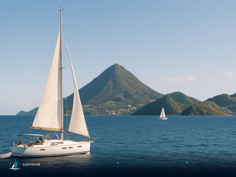
Martinique 7-Day Itinerary: Le Marin-Based Sailing Loop
A compact, practical 7‑day sailing loop from Le Marin that covers Les Salines, Anses d’Arlet, Saint‑Pierre and Diamond Rock with daily mileages, mooring options and clearance notes.

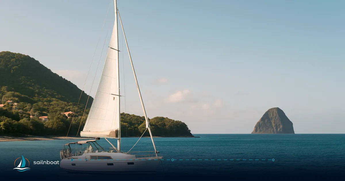
This martinique 7 day itinerary is a clockwise, Le Marin‑based loop that totals roughly 70 nautical miles of direct legs (plan extra for inshore routing): the longest open water hop is typically one of the Saint‑Pierre or southern legs, while most other days are short, protected sails ideal for snorkel stops and shore visits. Below you get a day‑by‑day schedule with rhumb‑line mileages, two speed‑band time estimates, mooring options and the practical clearance and weather information you need to decide whether to book.
Overview of Your Martinique 7-Day Itinerary
This loop starts and finishes at Marina du Marin and concentrates sail time on the western (Caribbean) coast with a single longer passage to the north (Saint‑Pierre) and the historic Rocher du Diamant (Diamond Rock). Key stops: Les Salines (Sainte‑Anne), Grande Anse/Anses d’Arlet, Saint‑Pierre (Montagne Pelée), the Rocher du Diamant and back to Le Marin. The itinerary suits an intermediate crew that wants protected anchorages, short shore excursions and one day of more open‑water sailing.
What this plan delivers
- Short, sheltered daily passages with one longer leg to Saint‑Pierre and a visit (view) of Diamond Rock.
- Practical mooring choices: marina berths at Le Marin, organised buoys or regulated anchorages at the popular bays, and a port call/stopover option at Saint‑Pierre. Some ZMO buoys are currently not available — read the mooring notes later.
- Digital clearance requirements for arrivals/departures in the French Antilles: file the prescribed online declaration or use an approved point ashore before you arrive or depart.
Day-by-Day Sailing Plan
Notes on how distances and times are presented
- Distances are direct rhumb‑line (great‑circle) estimates between the principal waypoints using public GNSS coordinates for each location (sources noted below). Allow 10–25% extra distance for inshore routeing, avoiding shallow ground, and detours to moorings.
- Estimated times are given for two typical cruising speeds: 6 knots (typical cruising for a loaded monohull) and 8 knots (typical for cruising catamarans or faster passagemaking). Adjust for your boat and sea state.
- All arrival plans assume daytime approaches; approaching Saint‑Pierre or the Diamond Rock at night is not recommended.
Daily legs table (direct distances and time estimates)
| Day | Leg | Distance (NM, rhumb‑line) | Est. time @ 6 kt | Est. time @ 8 kt | Primary mooring option |
|---|---|---|---|---|---|
| Day 1 | Le Marin → Les Salines (Sainte‑Anne) | typically 3–5 NM (direct; varies by anchorage and route). | 0:43 | 0:32 | Night at anchor off Les Salines / local playa; alternate Marina du Marin berth if weather unsettled. |
| Day 2 | Les Salines → Anses d’Arlet (Grande Anse) | typically 7–10 NM (direct; varies by route and anchorage). | 2:40 | 2:00 | Grande Anse organised buoy field (historically ZMO)—note current local restrictions (see moorings). |
| Day 3 | Anses d’Arlet → Saint‑Pierre (Port Lislet‑Geoffroy) | 15.1 NM. | 2:31 | 1:53 | Take a buoy or berth at the port; Saint‑Pierre operates a formal zone and publishes passage/berth tariffs. |
| Day 4 | Explore Saint‑Pierre (no long sail) | 0 NM | Museum, ruins, market — stay aboard or stay on a berth; short local trips to sites. | Saint‑Pierre pontoons/buoys — day stop or overnight at dock. | |
| Day 5 | Saint‑Pierre → Diamond Rock (view only) | distance varies by route; confirm with your operator. | 2:59 | 2:14 | Anchor off at a safe, respectful distance for snorkel/diving; landing on the rock is not permitted. |
| Day 6 | Diamond Rock → Anses d’Arlet | distance varies by route; confirm with your operator. | 0:44 | 0:33 | Revisit Grande Anse / Anse Dufour — anchoring or (if available) buoys; Anses d’Arlet town has restaurants and a ponton. |
| Day 7 | Anses d’Arlet → Le Marin (return) | typically 5–8 NM (direct; varies by anchorage and route). | 2:09 | 1:37 | Final night at Marina du Marin (check check‑out time with operator). |
Total planned direct miles are typically in the 75–80 NM range for a similar loop (sum of direct legs varies by route and source). Plan for 10–25% additional distance for inshore routing and reserve fuel/time for motoring when trades are light or when entering/exiting marinas.
Day notes and practical tips
- Day 1 (Le Marin → Les Salines): Les Salines is a beach anchorage, easy in settled conditions but exposed to southerly swell. Use the eastern, deeper approach and avoid anchoring in the 300‑m swim/rescue corridor where marked. Bring a dinghy anchor for shore runs.
- Day 2 (Les Salines → Anses d’Arlet): Expect the leg to cross from the south coast to the western (Caribbean) side; the approach to Grande Anse is busy in high season—if the organised bouées are unavailable, plan to anchor well clear of the bathing area.
- Day 3 (to Saint‑Pierre): This leg opens up to the lee of Montagne Pelée — conditions can swing with mountain funneling; approach Saint‑Pierre during daylight and follow the port’s marking and directions. Saint‑Pierre now hosts a ZMO and official mooring buoys.
- Day 5 (to Diamond Rock): The Rocher du Diamant is primarily a view and dive/snorkel stop; do not attempt to land — the site is protected and landing is prohibited. Keep well clear of bird nesting areas and anchored dive boats.
Mooring Options and Fees
General framing
- Martinique’s management of moorings uses a mix of marinas, municipal organised buoy fields (ZMO/ZMEL) and open anchorages; many ZMOs carry modest daily buoy fees when active, while municipal marina tariffs vary by port and boat size. Where possible, reserve berths in Le Marin in advance in high season.
Mooring at Les Salines (Sainte‑Anne)
- Typical options: anchored off the beach (shallow sand) or use any local moorings if present. Les Salines is an open beach anchorage; expect swell at times and watch swim zones. There is not a large organised buoy field like Anses d’Arlet; marinas and beach operators may offer tender services.
- Fees: where municipal buoys exist in the southern bays, ZMO fees in Martinique may vary; the exact charge depends on zone, vessel length, and season. Use local notices or Navily to confirm current rates.
Mooring at Anses d’Arlet
- Organisation: Anses d’Arlet historically had a sizeable organised buoy field (Baie du Bourg + Grande Anse), but the zone has been subject to legal and administrative actions and parts of the buoy field are closed to visiting yachts; local authorities have published closures through 31 Dec 2026 in recent notices. If the ZMO isclosed, anchor well outside the bathing area and expect to be asked to relocate by local agents; if open, bouées are organised by zone and a per‑night fee normally applies. Practical points:
- Approach Grande Anse/Anse Dufour in daylight and give the swimmer lanes a wide berth; anchor in sand at least 20–30 m off the beach where depth permits (typically 3–6 m close in).
- Buoy fees in western bays may vary widely depending on vessel length, managing authority, and season; confirm current rates locally.
- Town pontoons in Anses d’Arlet are limited and often reserved for local boats or tour operators — if you need a guaranteed berth, plan to return to Le Marin or use a paid marina berth on the next leg.
Mooring at Saint‑Pierre
- Options: a small public marina/harbour with pontoons and official stopover moorings, plus limited anchorages off the bay. The port publishes a tariff grid that differentiates by vessel length and service level; expect higher billed rates for berths with shore power and water. Local fees are commonly in the order of low tens of euros per night for simple stopovers, rising for full‑service berths — check the port’s current tariff sheet on arrival.
- Practical points:
- Approach Saint‑Pierre in daylight; the basin is marked and the harbour authority may assign you a berth.
- Customs and port administration operate in the town; if you intend to go ashore for the museum and ruins, plan your visit around harbour office opening hours.
- In rough northeasterly conditions the harbour offers better protection than exposed anchorages on the north coast.
Mooring at Diamond Rock (Rocher du Diamant)
- Diamond Rock has no public marina; the rock itself is a protected site and landing is prohibited. Mooring options are therefore limited to anchoring in the adjacent lee or rafting off a dive operator’s buoy if they permit it.
- Fees and restrictions:
- There is commonly no official nightly fee for anchoring in the surrounding waters, but local dive operators manage moorings for commercial use and may restrict access near dive sites.
- Natural reserve protections around parts of the rock mean anchoring may be restricted seasonally; expect direction from the maritime gendarmerie or local harbour masters.
- Practical points:
- Maintain a respectful distance from the rock; keep clear of dive operations and bird roosting areas.
- Use a long scope and good ground tackle when anchoring offshore; the seabed varies and can include sand, coral and rock.
Clearance Procedures and Documentation Entering and Exiting Martinique
- French rules apply: when you arrive in Martinique (a French overseas department) you must complete the required arrival formalities for pleasure craft with French customs/authorities. Many formalities are now dematerialised, and authorities encourage or require an electronic arrival declaration for pleasure craft.
- Typical documents you should have aboard and ready to present on arrival and departure:
- Passports for all crew (validity depends on nationality).
- Proof of vessel registration/ownership (official registration certificate).
- Crew list with full names and passport numbers.
- For charter boats: charter agreement and skipper identification as required by the charter company.
- Any required radio/operator certificates or licences if the yacht carries declared commercial passengers — this is a practice item for charterers.
- Timing and where to clear:
- Many ports have an official point for customs and maritime police in Fort‑de‑France, Le Marin and Saint‑Pierre — arrivals at lesser anchorages sometimes require you to travel ashore to an approved point for documentary clearance.
- Several charter companies and marinas assist with check‑in paperwork; many crews hand the documents to the base agent who completes the procedures electronically.
Current regulations and fees
- Regulations and the mode of submission (digital vs in‑person) change periodically; common practice is that arrivals and departures both require a formal declaration even for non‑commercial private yachts, and ports may charge administrative stopover fees.
- Typical charges: small administrative fees are possible for port formalities or tourist stopovers; marina berths and organised buoys are charged separately by the berth owner or municipality. Expect port tariff grids to be publicly posted at the harbour office; if you need an exact fee, request the current tariff on contact with the port before arrival.
- Legal versus charter practice:
- What the state requires (customs/immigration declarations, vessel registration proof) is distinct from what a charter company requires at handover (skipper qualifications, security deposit, insurance). Many charter companies ask to see a yacht licence/qualification; this is standard charter practice rather than a universal legal requirement.
Typical Weather Conditions in October Average Temperatures and Rainfall
- Temperature: daytime air temperatures typically sit in the mid‑20s to high‑20s °C (around 25–29 °C) with sea surface temperatures similar; nights cool slightly but remain warm.
- Rainfall: October is within the wet/hurricane season and is one of the rainier months — monthly rainfall totals in the Fort‑de‑France area commonly lie in the high hundreds of millimetres range compared with dryer winter months. Expect intermittent heavy showers and the possibility of several overcast or stormy days during a week in October.
- Practical advice:
- Pack for heat and for wet weather; plan shore excursions in the morning when showers are often lighter.
- Bring spare lines and canvas that can handle sudden squalls and store cockpit cushions quickly when rain cells pass.
Wind Patterns
- Trade winds: the prevailing trade is easterly to east‑northeasterly; during October the trades are often lighter and more variable than in winter months. Typical steady trade speeds in high season may be around 12–20 knots; in October you can see lighter days in the single digits and occasional gusty conditions ahead of tropical disturbances.
- Sea state and routing:
- Lighter trades make motoring likely on some legs, especially when hugging the lee shoreline for snorkel stops.
- When planning open water legs (Saint‑Pierre to Diamond Rock and back), look for an easterly window and avoid a strong onshore gale off the north coast — mountain funneling near Montagne Pelée can change local winds rapidly.
- Monitoring:
- Check both local forecasts (Météo‑France Antilles) and wider Atlantic hurricane advisories during the season; set up daily briefings and a secure plan to shelter in Le Marin or a protected harbour should a tropical system approach.
Historical and Cultural Highlights Saint‑Pierre
- Why you visit: Saint‑Pierre is the historical capital that was destroyed by Mount Pelée’s 1902 eruption; the city’s ruins, museum exhibits and memorials tell the story and make for a full day ashore.
- Key sites and experience:
- Ruins and reconstructed sites around the former urban centre where the eruption’s destruction is interpreted.
- Local museums that display artifacts and accounts from the 1902 disaster and the city’s pre‑eruption cultural life.
- A compact town center with cafés, a market and local guides who can provide context and walk you through the timeline.
- Practical detail:
- Allow a half‑day to a full day ashore; many skippers combine a morning museum visit with lunch and a short coastal walk.
- Harbour offices and local tourist offices provide opening hours and guided‑tour options.
Diamond Rock
- Naval history:
- In the Napoleonic wars the British occupied Diamond Rock and commissioned it as an armed sloop (commonly referred to as HMS Diamond Rock) to interrupt French shipping; the rock’s military history is a concise chapter that attracts history‑minded visitors.
- Current status:
- The rock is a protected marine and natural area with strict rules — landing is not permitted and the rock is a prime diving and snorkelling location.
- The surrounding reefs and drop‑offs provide excellent underwater visibility and show coral and pelagic life; dive operators operate regularly from southern bays.
- Practical visits:
- Treat the rock as a day‑trip anchor or dive site only; do not plan to land or climb it.
- Respect protected zone buoys and follow local instructions from marine police and dive operators.
Final practical checklist before you cast off
- Paperwork: passports, vessel registration, crew list, charter contract (if applicable) and digital customs entry prepared.
- Reservations: confirm your preferred berth in Marina du Marin for check‑in/check‑out and any required berths in Saint‑Pierre if you need shore power or a guaranteed pontoon.
- Weather: review five‑day and tropical outlooks the evening before each longer leg; re‑route to avoid squalls and land early if forecast shows unstable conditions.
- Fuel and water: top up in Le Marin; northern and western anchorages have limited refuelling options.
- Safety: brief your crew on man‑overboard procedures, lifejacket use, reef protection rules and the plan for a sudden shelter in Le Marin or Saint‑Pierre.
Useful on‑board checklist (print and keep)
- Passports for everyone
- Vessel registration / charter agreement
- Crew list with contact phone/email
- Harbour and customs contact numbers (Le Marin, Saint‑Pierre, Fort‑de‑France)
- Météo‑France and regional hurricane watch subscriptions set up
- Sufficient fuel, water and spare lines/anchors
Use our other resources: sailing tips for the Caribbean, best anchorages in Martinique and marine services in Le Marin for detailed local contacts and equipment lists.
Plan your trip This martinique 7 day itinerary balances protected sailing with one open passage and enough shore time to see Saint‑Pierre and appreciate Diamond Rock’s history. Book the Le Marin base berth early for high season, check the current ZMO buoy status for Anses d’Arlet, and build a weather‑monitoring routine into each day of the cruise. Plan your sailing adventure in Martinique today.
Frequently Asked Questions
Daily distances (rhumb‑line) range from ~4.3 NM to ~17.9 NM; at 6 knots allow the longer legs 3–4 hours and the short hops under 1 hour; at 8 knots plan ~20–35% less time (table in body).
Marina du Marin has berths and buoys; Anses d’Arlet has an organised buoy field that is currently closed; Saint‑Pierre publishes passage/berth tariffs; local buoy fees when available are usually modest (€5–€20/night depending on zone and size).
Since 1 Sept 2024 clearance declarations for pleasure craft in the French Antilles are dematerialised; submit the online form or visit an approved point in Martinique (Le Marin, Fort‑de‑France, Saint‑Pierre and others) before you leave or arrive.
October is warm (daily averages mid‑20s °C); it is one of the wettest months (Fort‑de‑France monthly rainfall often ~180–200 mm) and trade winds are commonly lighter or more variable than the high‑season trades.
On 8 May 1902 Mount Pelée produced a catastrophic pyroclastic flow that destroyed Saint‑Pierre and killed an estimated ~28,000–30,000 people; the ruins and the memorials are primary reasons to visit.
Monitor Météo‑France and NHC bulletins during hurricane season, plan sheltered nights in Le Marin or the western anchorages, and schedule the Saint‑Pierre leg on a day with a stable easterly or light wind window.
Written by
Sailnboat Editorial
The Sailnboat editorial desk covers yacht and boat chartering worldwide — routes, bases, seasons, boat types, paperwork and the practical costs that decide a trip. We are a charter marketplace, not a boat owner or a local agency: what we sell is judgement and support, so our guides are written to help you make a decision, not to sell you a specific boat. Every guide is checked against live operator and marina data before it goes out.
Fact-checked against live operator and marina data, and published under our editorial standards. Last reviewed: .