5-Day Sailing Itinerary: Exploring the Dutch Wadden Islands
A practical 5-day Wadden Islands itinerary linking Harlingen → Texel → Vlieland → Terschelling → Ameland → Schiermonnikoog (≈72 nm), with daily legs, mooring fees, tides and safety notes.

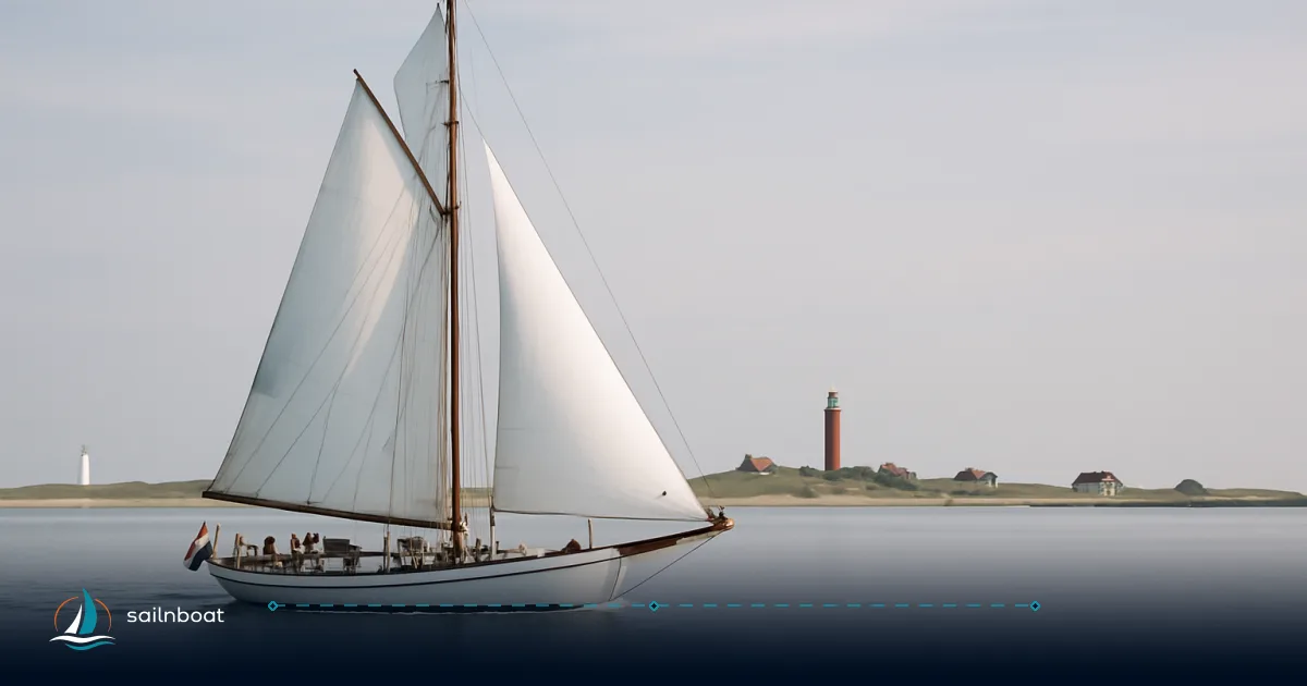
The 5-day wadden islands itinerary below gives you a compact, tidal-aware route with daily legs you can actually sail — not a postcard. The plan links Harlingen, Texel, Vlieland, Terschelling, Ameland and Schiermonnikoog over roughly 72 nautical miles in five short hops (10–25 nm per day). Use the daily legs, tidal notes and harbour options as an operational blueprint: adjust departure times to maximise favourable current and pick weather windows in October when frontal systems pass more often.
Overview of the Wadden Islands Itinerary
This itinerary is a clockwise transit across the Dutch Wadden Sea designed for intermediate to experienced crews who want short, tactical passages and time ashore. Expect:
- Five daytime passages that keep you inside buoyed fairways and narrow channels where tidal streams matter.
- Daily legs sized for 4–5 hour sails (typical cruising ~5–6 kt) so you arrive with time to spare and can replan if conditions change.
- Harbours with visitor berths, QR / I‑Marina payment systems and basic services (fuel, toilets, showers), but limited luxury services compared with the mainland.
Itinerary highlights
- Harlingen (start): maritime services, easy provisioning and VHF/ETA reporting to Harbour Coordination Centre.
- Texel (Oudeschild): full passanten jachthaven with fuel, 2.4 m LW depth noted on the harbour page and QR payment for liggeld. Recent published harbour info lists liggeld per m² and free basic services.
- Vlieland: compact, highly popular harbour on walking distance to the village and the Vliehors sand flats; reserving is not possible and the harbour fills in summer — check webcams/status.
- Terschelling and Ameland: well-served visitor harbours with published per‑m² rates, inclusive utilities and tourist tax charged on arrival.
- Schiermonnikoog: the most easterly island on this route; the harbour has limited berths and published tariffs may differ from neighbouring islands — confirm current rates with the harbour office.
Operational note: The Wadden Sea is a managed marine area — buoyed fairways, shifting sandbanks and busy ferry/working-boat traffic make up-to-date charts, local traffic information and a VHF listening watch essential. Brandaris/Harlingen traffic services handle coordination across the area.
Day 1: Harlingen to Texel
This is the longest scheduled leg of the trip and where you set the rhythm for tide-aware passages. If you can depart Harlingen around a rising tide you’ll reduce transit time through the outer channels.
Sailing Route and Distance
- Route: Harlingen (departure) → cross the main Wadden channels west/north of Harlingen → enter the Texel approaches → Oudeschild (Waddenhaven Texel).
- Distance: ≈ 25 nautical miles (direct route using buoyed channels). Confirm total itinerary distance with your charted route. Times below assume a cruising speed near 5–6 knots and favourable wind; allow more time if you expect motoring or an adverse tide.
- Navigation tips:
- File or broadcast your ETA with Harbour Coordination Centre Harlingen and keep Brandaris listening watch where instructed. Heavy traffic and commercial traffic use the TSSes nearby — stay in the buoyed fairways.
- Watch for local firing/practice areas around the Texel approaches shown in official sailing directions; consult the latest NtM before departure.
Mooring Options and Fees
- Waddenhaven Texel (Oudeschild) is the main visitor harbour; facilities include fuel, showers, water, 220V at fingerpiers and QR payment at each berth. The harbour publishes liggeld per m² — recent figures list approximately €0.95–€0.96 per m² per night and the harbour depth is about 2.4 m at LW (4.0 m HW noted). Expect a per-person tourist tax charged on arrival.
- Practical: expect to pay at the harbour office or by QR/I‑Marina on arrival; keep fenders and a long stern line ready — pontoons are modern but space fills in high season.
Attractions on Texel
- Ecomare seal centre and museum (hands‑on nature interpretation).
- Long beaches and dune cycling (bike hire available at the harbour).
- Fresh fish and island restaurants at the harbour; provision options are good in Oudeschild and nearby Den Burg.
Day 2: Texel to Vlieland
Sailing Route and Distance
- Route: Oudeschild (Texel) → cross the Vliestroom meandering fairway → enter Vlieland harbour.
- Distance: ≈ 15 nautical miles.
- Estimated sailing time: ~3 hours under sail at typical cruising speed; plan departure near a favourable tide through the Vliestroom to reduce steerage problems.
- Weather note: the Vliestroom and the plates between Texel and Vlieland can produce confused water if wind opposes the tidal stream — leave a cushion in your passage plan.
Mooring Options and Fees
- The municipal/managed Vlieland harbour has modern pontoons, shore power and free Wi‑Fi in many spots; the official 2025 passanten tariff is €0.93/m² per night, with tourist tax charged per person. The harbour can be full in summer — no online reservations in many cases.
- Practical: the harbour master often meets incoming boats in a RIB and assigns berths; follow local instruction on arrival and use long lines at low water where the seabed falls away.
Cultural Highlights of Vlieland
- The Vliehors sandplains (easy to reach by guided vehicle tours) and long, wild beaches.
- Village shops, cafés and restaurants within easy walking distance from the harbour.
- Quiet cycling routes and short nature walks; dune viewpoints for seals and seabirds.
Day 3: Vlieland to Terschelling
Sailing Route and Distance
- Route: Vlieland → cross the Schuitengat or the Westgat (route choice depends on tide and traffic) → West Terschelling harbour or town harbour.
- Distance: ≈ 10 nautical miles.
- Estimated sailing time: ~2 hours; tidal and sandbank navigation is the main operational factor.
- Tidal considerations: Schuitengat can be used with favourable tide windows but occasionally has speed limits and temporary restrictions — check Notices to Mariners and local VHF announcements.
Mooring Options and Fees
- Waddenhaven Terschelling publishes a passanten rate of about €0.96 per m² per night for 2026 with utilities included (diesel charged at daily price); tourist tax is billed per person on arrival. The harbour generally has comprehensive services: showers, waste facilities, bilge pumps and inclusive Wi‑Fi.
- Practical: some berths are reserved seasonally; follow harbour rules (e.g., where local regulations require bow-to-out mooring in certain months).
Activities on Terschelling
- Boschplaat nature reserve for birding and seal watching.
- Local cycling, small museums and island gastronomy.
- The island is larger, giving more scope for full-day land excursions.
Day 4: Terschelling to Ameland
Sailing Route and Distance
- Route: West Terschelling → cross the main Wadden channels → enter Ameland (Nes harbour is the main visitor harbour).
- Distance: ≈ 12 nautical miles.
- Estimated sailing time: 2–3 hours depending on tide and wind.
- Navigational tips: the Ameland approaches require attention to shifting shoals and correctly timed approaches through buoyed channels.
Mooring Options and Fees
- Waddenhaven Ameland (Nes) lists a passanten tariff around €0.96 per m² per night (published on the harbour’s site), with additional charter or commercial rates per metre where applied; tourist tax is charged on arrival. Facilities include showers, washing machines and water/electric connections — payment via QR/I‑Marina is available.
- Practical: water and shore power are commonly included; fuel availability may require a short tender run depending on berth.
Exploring Ameland
- The island lighthouse (climb for views), dunes and island museums.
- Good local restaurants and bicycle loops; hire options near the harbour.
Day 5: Ameland to Schiermonnikoog
Sailing Route and Distance
- Route: Nes (Ameland) → cross the Oostfriese Wad eastward → Schiermonnikoog harbour (Noorderhaven / town harbour).
- Distance: ≈ 10 nautical miles.
- Estimated sailing time: ~2 hours; tidal windows matter notably on the eastern Wadden crossings.
Mooring Options and Fees
- Schiermonnikoog’s harbour is smaller; published municipal rates have varied and may differ from neighbouring islands. Confirm current per‑m² or per‑metre costs with the harbour office and expect tourist tax to be added.
- Practical: berths are limited; check harbour status ahead, and be ready for sill and mud at low water in some berths.
Must-See Attractions on Schiermonnikoog
- Schiermonnikoog National Park: expansive beaches and birdlife.
- Village shops, small cafés and boat-to-island walks; the island is compact and easy to explore on foot or by bike.
Comparative day-by-day table
| Day | Leg | Distance (nm, approx.) | Typical time (hrs) | Key navigation note |
|---|---|---|---|---|
| 1 | Harlingen → Texel (Oudeschild) | 25 nm | 4–5 h | File ETA with Harlingen VTS; watch Texel approaches and firing zones. |
| 2 | Texel → Vlieland | 15 nm | ~3 h | Time the Vliestroom for best current; harbour can fill fast. |
| 3 | Vlieland → Terschelling | 10 nm | ~2 h | Schuitengat choice depends on tide; temporary speed measures sometimes apply. |
| 4 | Terschelling → Ameland | 12 nm | 2–3 h | Watch shifting shoals; use buoyed fairways. |
| 5 | Ameland → Schiermonnikoog | 10 nm | ~2 h | Eastern crossings need careful tidal planning; limited berths at Schier. |
(Times assume average 5–6 knots; if you cruise faster or have a catamaran expect shorter times.)
Mooring facilities and typical fees (quick reference)
| Island | Typical published rate (recent) | Tourist tax (example) | Notes / payment |
|---|---|---|---|
| Texel (Oudeschild) | €0.95–€0.96 per m² per night (harbour site). | Example: €2.60 pp/night cited on harbour page. | QR/I‑Marina and harbour office; fuel available. |
| Vlieland | €0.93/m² per night (2025 official tariff). | Tourist tax is €2.58 pp/night (2026). | No reservations; watch webcam/status. |
| Terschelling | €0.96 per m² per night (harbour 2026 tariff page). | Example tourist tax on page €2.40 pp/night. | Inclusive utilities; winter tariff listed for Nov–Mar. |
| Ameland (Nes) | €0.96 per m² per night (harbour pages). | Example tourist tax ~€2.55 pp incl. arrival levy (harbour page). | Pay at harbour office or via I‑Marina QR. |
| Schiermonnikoog | Published rates and municipal proposals have varied; confirm current per‑m² or per‑metre tariff with the harbour office. | Municipal tourist tax decisions noted in council papers. | Limited berths — check harbour status ahead. |
Calibrate expectations: many Wadden harbours show rates by m² (or per metre) and separately charge local tourist tax; winter and low-season tariffs are commonly lower. Harbours use QR/I‑Marina or pay-in-office systems — have the app and some cash/card backup.
Sailing Regulations and Weather Considerations
Sailing regulations in the Wadden Sea
- Traffic and reporting: Harlingen/Brandaris coordination controls movements and expects ETA/reporting for many passages; larger vessels and certain fairways require advance notice. File ETAs and keep VHF listening watch.
- Speed: Rijkswaterstaat guidance and recent enforcement actions make it clear the Wadden Sea is subject to speed measures for recreational craft on many stretches; confirm posted limits and local rules before passage. Respect posted speed limits and temporary measures; fines and administrative enforcement are used.
- Pilotage & fairways: pilotage is compulsory for some commercial routes and deeper-draft vessels; pleasure craft under local rules still must keep to marked fairways and avoid unmarked flats. Use official charts and local pilot instructions if your draft approaches restricted depth channels.
- Protected areas and anchoring: large parts of the Wadden are Natura 2000 and protected zones; there are seasonal or location-based restrictions on entering, anchoring or disturbing bird/breeding areas. Check the current list of restrictions before planning shore stops.
How to operate safely
- Carry up-to-date electronic and paper charts, local NtM and use the harbour’s getijdewijzer (tidal tables) to time channel transits.
- VHF: maintain a continuous listening watch on the channels specified by the harbour/Brandaris; call as instructed when entering fairways or harbours.
- Speed and wash: reduce wash near mudflats and nature reserves — smaller seas and shallow water mean your wash can damage birds and cause shoreline erosion.
Weather patterns and best times to sail (October guidance)
- October is a transition month: frontal systems and the chance of stronger westerly winds increase compared with late summer. The Netherlands Coast Pilot and maritime climatology note a marked rise in gale frequency from late September into October and beyond — plan short passages and pick clear weather windows for channel crossings.
- Forecast resources: KNMI (national weather service), Brandaris broadcasts and the Netherlands Coast Pilot / local harbour weather pages are the primary operational sources. In autumn, watch synoptic charts for blocking lows and deep Atlantic fronts that can bring quickly changing wind strength and direction.
- Practical window: for this five-day itinerary expect to start on a day with a stable anticyclonic or weak-wind window; if a frontal passage is forecast, delay an offshore crossing day and use inland or sheltered harbour time instead.
Final practical checklist (what to sort before you cast off)
- Charts and tide tables for the exact routes and the harbour getijdewijzers; confirm your escape options if weather closes in.
- Check harbour availability and opening hours (some winter reductions apply) and have the I‑Marina/QR payment methods ready. Example harbours list QR/I‑Marina on their pages.
- Safety kit: lifejackets for all, charged EPIRB if venturing offshore, basic tool spares, first‑aid kit and means to retrieve lines in mud (long fenders/shoreline).
- Insurance and qualifications: carry your documents and be explicit with your charter company about Wadden plans; some companies will note tidal navigation limitations for heavier drafts.
- Final brief to crew on tides, likely hours under way each day, and harbour‑arrival routine (VHF call, slot times).
Plan your sailing adventure through the Wadden Islands today — pick a stable 2–3 day weather window, time your departures to tide, and use the harbour pages and traffic services mentioned above for live harbour status and payment. Safe voyage.
Frequently Asked Questions
This itinerary covers Harlingen → Texel (≈25 nm), Texel → Vlieland (≈15 nm), Vlieland → Terschelling (≈10 nm), Terschelling → Ameland (≈12 nm), Ameland → Schiermonnikoog (≈10 nm); total ≈72 nm. Daily times assume an average cruising speed of about 5–6 knots and favourable weather; adjust for tides and wind.
All five islands have organized marinas/passer-by harbours with visitor berths and QR payment systems (I‑Marina or harbour office). Typical rates vary by island — many bases publish per-m² rates; recent published examples: Texel and Terschelling list ~€0.95–€0.96/m² per night, Ameland lists €0.96/m², Vlieland historically around €0.70/m²; Schiermonnikoog traditionally ranks higher (municipal documents referenced past tariffs ~€0.75/m² or more). Fees, tourist tax and winter tariffs vary — check each harbour before arrival.
October is a transitional month with more frequent frontal systems and a higher gale probability than late summer; gale frequency rises compared with September and increases through autumn. Expect stronger, often westerly winds, cooler temperatures and shorter daylight — pick short weather windows for the crossings and monitor local forecasts closely.
Key regulations include adherence to buoyed fairways and traffic measures, speed restrictions on Rijkswateren (the Wadden Sea usually observes a 20 km/h maximum for recreational vessels in many areas), pilotage/reporting rules for larger vessels, and numerous protected / Natura 2000 zones where anchoring or entering may be restricted; carry charts, keep VHF watch and follow Brandaris/Harlingen traffic instructions.
Written by
Sailnboat Editorial
The Sailnboat editorial desk covers yacht and boat chartering worldwide — routes, bases, seasons, boat types, paperwork and the practical costs that decide a trip. We are a charter marketplace, not a boat owner or a local agency: what we sell is judgement and support, so our guides are written to help you make a decision, not to sell you a specific boat. Every guide is checked against live operator and marina data before it goes out.
Fact-checked against live operator and marina data, and published under our editorial standards. Last reviewed: .