Best Anchorages in the Peloponnese: A Sailor's Guide
A compact, operational guide to the best anchorages in the Peloponnese: where to drop, what depth and bottom to expect, local services, likely winds and the hazards you must plan for.

Best Anchorages in the Peloponnese: A Sailor's Guide
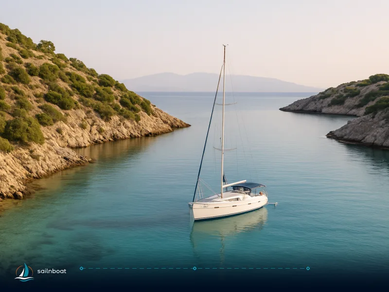
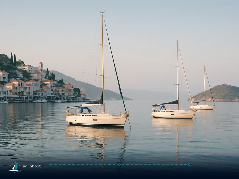
Peloponnese anchorages span from deep, all-weather bays where you can ride out a squall, to compact harbours where you moor stern-to beneath ancient fortifications. When planning your route, prioritize Kalamata for full marina services and reliable holding in the Messiniakos Gulf, Nafplio (Karathona) for versatile shelter and easy reprovisioning, Pylos (Navarino Bay) for deep anchoring zones and access to Voidokilia, and Monemvasia for a historic stop—when the weather is stable. Below, you’ll find operational details for each, including mooring fees, restrictions, service notes, and practical advice for larger yachts.
Top Anchorages in the Peloponnese: Location, Fees, and Large Yacht Logistics
Kalamata (Messiniakos Gulf)
- Shelter: Good protection from northerly and north-west winds within the gulf. Exposed to southerly swell during strong storms.
- Depth and bottom: Anchorage zones in this gulf typically offer depths of 4–8 m over mixed sand and rock, but always check your chart for local soundings. Kalamata Marina berths generally provide about 3 m alongside, and the main quay accommodates yachts up to around 25 m LOA. Larger yachts should call ahead to confirm space and depth.
- Holding: Mixed sand and rock. Choose a sandy patch and set extra scope if the wind is shifting.
- Facilities: Full-service marina: fuel dock, potable water, chandlery, supermarkets, mechanical and electrical services. The town centre is within walking distance.
- Mooring/anchoring fees: For a 45-foot yacht in high season, marina berths typically range from €45–€90 per night, depending on berth type and included services. Anchoring outside the marina is free; marina services (water, shore power, garbage) are charged separately if used.
- Restrictions: No-anchor zones are marked near the fuel quay and marina entrance. In summer, swimming zones may extend further out—observe local notices.
- Large yachts: Space for yachts above 30 m LOA is limited; turning space is usually sufficient in the outer harbour, but berth availability should be confirmed well in advance with the marina office.
- Why stop: Efficient for reprovisioning and technical support, with an easy walk to restaurants and markets.
Nafplio (Argolic Gulf — Karathona Bay / Town)
- Shelter: The Argolic Gulf is semi-sheltered. Karathona Bay (southeast of town) offers protection from north and northwest; open to southeast.
- Depth and bottom: Karathona Bay provides 5–12 m over sand/mud—good holding. The town harbour shoals to 2–4 m, suitable for yachts with draft under 2.5 m. Larger yachts anchor in the bay and tender ashore.
- Facilities: Town provisioning, restaurants, and some seasonal marina services. Nafplio’s new marina expansion is increasing capacity, but berths fill quickly in high season.
- Mooring/anchoring fees: Town quay typically charges €10–€20 per night for a 12–16 m yacht, with water and power (if available) usually costing €5–€10 extra. Karathona anchorage is free, though shore facilities are limited.
- Restrictions: Anchoring is restricted near the ferry dock and swimming areas. No-anchor zones are posted seasonally.
- Large yachts: Town quay can handle yachts up to roughly 20 m LOA; larger vessels should anchor in Karathona Bay, which offers ample swinging room but is exposed in strong southeast winds.
- Why stop: Convenient access to Palamidi fortress and the Venetian old town. Full reprovisioning available.
Monemvasia (Palaia Monemvasia Bay)
- Shelter: Fair in settled weather. The harbour offers limited protection and is best for a short stop or a calm overnight.
- Depth and bottom: Harbour depths range from 2–3 m (shallow for yachts above 14 m or with more than 2 m draft). The outer anchorage provides 5–8 m over sand/weed. Larger yachts anchor off and use tenders.
- Facilities: Basic marina infrastructure. Small shops and tavernas on the rock; no significant technical support.
- Mooring/anchoring fees: No recent data was found confirming a specific fee for Monemvasia quay. Fees, if charged, are generally modest for yachts up to 15 m, but confirm with the local port authority on arrival. Anchoring outside is free; no charge for tender landings.
- Restrictions: No anchoring allowed within marked swimming zones west of the causeway and at the ferry jetty. The old harbour is often full by afternoon—arrive early or have a backup anchorage planned.
- Large yachts: Turning space inside the harbour is tight; for yachts over 18 m, anchoring outside is the practical option. Depths and room are generally adequate, but the anchorage is exposed if the wind shifts south.
- Why stop: Medieval town immediately ashore—ideal for a short visit, not for technical work or extensive provisioning.
Pylos / Navarino Bay
- Shelter: Large, deep bay with several anchoring zones. Offers protection from most directions, but the outer bay can experience surge in westerly winds.
- Depth and bottom: Depths in Navarino Bay vary; outer areas are generally deep, and inshore coves provide shallower water, but always check your chart for precise soundings. Sand and mud bottoms predominate.
- Facilities: Town quay with water available; fuel is often delivered by road tanker—call ahead to arrange. Marina upgrades are ongoing, but berthing for larger yachts is not always guaranteed.
- Mooring/anchoring fees: Town quay charges typically range from €10–€25 per night for a 12–18 m yacht; water and electricity are extra. Anchoring is free, but quay services are charged if used.
- Restrictions: No anchoring near the ferry landing or marked swimming areas along the north shore. Some areas are protected wetlands—anchoring is prohibited or restricted in posted conservation zones.
- Large yachts: Navarino Bay offers deep water and swinging room for yachts 30 m and above. Berth availability on the quay is limited for large yachts—contact the port in advance. The turning basin is suitable for superyachts.
- Why stop: Voidokilia beach, Nestor’s cave, and a quiet, deep anchorage.
Porto Heli
- Shelter: Well-protected harbour; rarely closed by weather.
- Depth and bottom: Marina and anchorage depths are typically 3–6 m over sand/mud, but check your chart for the latest soundings.
- Facilities: Modern marina with full services: fuel, water, technical support, and provisioning. The town offers restaurants, supermarkets, and some yacht repair facilities.
- Mooring/anchoring fees: No confirmed data for 60 m berths or quoted fee range; marina can accommodate a range of yacht sizes, and fees vary by length and season. Contact the marina directly for current rates and maximum yacht size.
- Restrictions: Standard harbour rules apply; no anchoring in marked swimming or ferry zones.
- Large yachts: Marina is one of the few in the region able to accommodate superyachts; always confirm berth in advance.
- Why stop: The eastern technical and provisioning hub before crossing to Spetses or Hydra.
Saronic / Eastern Peloponnese: Spetses, Poros, Hydra (Short Notes)
- Spetses: Anchorages at Zogeria, Agioi Anargyroi, and Baltiza. Town quay is shallow (2–3 m) and often crowded—most yachts anchor off. Mooring fees: €10–€20/night; anchoring is free.
- Poros / Galatas: The channel is busy with ferries and has shoals. Town quay: €10–€25/night for 12–16 m yachts. Fuel and water available. Larger yachts may need to anchor off.
- Hydra: Town harbour is narrow and fills by midday. No fuel quay. Mooring fees: €20–€35/night. Large yachts anchor outside and tender in.
Secondary Anchorages
Elafonisos
- Shelter: Simos Beach anchorage is open to the east but offers good holding in settled weather.
- Depth and bottom: 4–10 m, sand—excellent holding.
- Facilities: No port infrastructure; basic tavernas in the village.
- Restrictions: Exposed in strong easterlies; no services for large yachts.
- Why stop: Clear water, relaxed atmosphere, and a useful stop between Monemvasia and Kythera.
Kyparissia
- Shelter: Harbour and outer bay provide moderate shelter except in strong westerlies.
- Depth and bottom: Harbour: 2–4 m; anchorage: 5–10 m, sand/mud.
- Facilities: Small-town shops, limited fuel and water.
- Restrictions: Harbour silts up; check depths before entry.
- Why stop: Convenient stop on the west coast between Pylos and Katakolo.
Anchorage Comparison Table: Depth, Fees, Services, Large Yacht Suitability
| Anchorage | Typical Depth (m) | Bottom | Mooring/Anchoring Fees (45ft, high season) | Max Yacht Size (quay) | Large Yacht Options | Services (fuel, water, repair) |
|---|---|---|---|---|---|---|
| Kalamata (Messiniakos) | 4–8 (anchorage), 3 (marina) | Sand/rock | €45–€90 (marina); free at anchor | ~25 m | Outer anchorage, call ahead | Full marina, all services |
| Nafplio (Karathona) | 5–12 (bay), 2–4 (town quay) | Sand/mud | €10–€20 (quay); free (bay) | ~20 m | Karathona bay anchoring | Town shops, water, seasonal marina |
| Monemvasia (harbour) | 2–3 (quay), 5–8 (anchorage) | Sand/weed | Modest; free at anchor | ~15 m | Anchor off, tender in | Limited; basic shops/tavernas |
| Pylos / Navarino | Variable; check charts | Sand/mud | €10–€25 (quay); free at anchor | ~18 m (quay) | Deepwater anchoring | Fuel (by truck), water, marina upgrades |
| Spetses / Poros / Hydra | 2–4 (quays), 5–15 (coves) | Sand/rock | €10–€35 (varies); free at anchor | ~16 m (quays) | Anchor off, tender in | Poros/Porto Heli full, Hydra limited |
| Porto Heli | 3–6 (marina) | Sand/mud | Varies (contact marina); anchoring free | Confirm with marina | Berths for large yachts | Full marina, technical, fuel |
| Elafonisos | 4–10 (anchorage) | Sand | Free | N/A | Anchor only | None; basic tavernas |
| Kyparissia | 2–4 (harbour), 5–10 (bay) | Sand/mud | Free or modest (limited quay) | Small harbour | Anchor only | Limited; small town |
Garbage, Pump-Out, and Water Refill Logistics
| Anchorage | Garbage Disposal | Pump-Out/Black Water | Water Refill | Medical/Emergency Access |
|---|---|---|---|---|
| Kalamata | Bins at marina/town quay | Not standard; ask marina | Marina taps (metered) | City hospital 2 km from marina |
| Nafplio | Bins at quay and town | Limited; not always available | Water at quay; seasonal | Regional health centre in town |
| Monemvasia | Bins at quay, limited | Not available | Limited, arrange in advance | Small clinic, nearest hospital ~15 km |
| Pylos | Bins at quay, main square | Not standard; usually not available | Water from quay (ask) | Health centre in town |
| Porto Heli | Bins at marina | Some pump-out available | Full marina water | Medical clinic in town |
| Elafonisos | Limited bins ashore | Not available | Not available | Small medical post in village |
| Kyparissia | Bins at quay | Not available | Limited, check availability | Town clinic |
- Notes: Pump-out stations are rare in the Peloponnese; holding tanks should be used and emptied offshore. Garbage bins are provided at most quays, but recycling options are limited. Water supply is generally available at marina or quay taps, but can be rationed in summer—always ask before filling large tanks. For medical issues, regional clinics are available in every major port, and Kalamata has a full hospital.
Navigational Considerations and Hazards in Peloponnese Anchorages
Navigational Hazards
- Rocky Outcrops and Reefs: Saronic islands (Spetses, Poros approaches, Baltiza) and approaches to Monemvasia and Kalamata have near-surface rocks. Mark these on your chart and reduce speed in low visibility.
- Shallows and Bars: Messiniakos Gulf has nearshore bars and some beaches with shoals at 2–5 m. Use buoyed channels where marked, especially near Kalamata and Nafplio.
- Ferries and Fast Craft: Poros channel and Saronic lanes are busy—keep a sharp lookout, especially in late afternoon.
- Current and Surge: The region is largely tideless, but strong winds cause wave run-up, especially in Messiniakos after a southerly blow. Surges can occur in extreme weather.
Essential Tools and Routines
- Updated paper or electronic charts for Argolic, Messinian, and Saronic waters.
- AIS and radar for busy traffic zones (Poros, Pylos).
- Depth sounder with a shallow alarm; always check soundings on approach.
- Local pilot info: Call the port authority on arrival, or hail on VHF. For larger marinas (Kalamata, Porto Heli), call ahead in high season to reserve.
Provisioning and Services Near Anchorages
Kalamata
Supermarkets, chandlery, and diesel are at the marina, with a full-service town nearby. For specialty parts, electronics, or out-of-hours supplies, notify the marina in advance or use the larger city supermarkets. Gas refills are available at hardware stores or petrol stations within a short taxi ride.
Nafplio
Multiple supermarkets, bakeries, and restaurants in a compact town. For specialty foods or technical items, check the main square and side streets. Gas refills (Campingaz) are available at hardware stores. Out-of-hours groceries can be found at kiosks and minimarkets near the quay.
Monemvasia
Small shops and tavernas provide basics. No technical services or significant fuel deliveries. For gas refills, check with local petrol stations or arrange before arrival. Limited out-of-hours options—stock up in Kalamata or Nafplio.
Pylos / Porto Heli / Poros
Pylos: Arrange fuel deliveries by tanker; basic town shops and bakeries. Porto Heli and Poros are the main refit and fuel hubs in the east, with full marina provisioning, gas refills, and hardware stores. For after-hours needs, Porto Heli has late-night minimarkets.
Elafonisos / Kyparissia
Elafonisos: Village tavernas and a minimarket for essentials. No yachting shops or technical support. Kyparissia: Small supermarkets and local shops; limited yacht services. Refill gas and stock up before arrival.
Seasonal Weather Patterns in the Peloponnese Anchorages
Summer (June–September)
- Dominant wind: The Etesian (Meltemi), persistent from the north, strongest in July–August. In exposed spots, expect 4–7 Beaufort, with stronger gusts in funnelled channels. Anchor in bays with leeward protection when Meltemi is forecast.
Winter (October–April)
- Variable: Frequent northwest and southerly storms, shorter daylight, heavier seas. Messiniakos Gulf is particularly exposed to southerly storms—avoid open anchorages in winter gales. Monitor local forecasts and allow wider weather windows for passages.
Anchoring Restrictions and Protected Areas
- Natura 2000 zones: Some areas of Navarino Bay and the Voidokilia lagoon are protected wetlands—anchoring is prohibited or limited in marked areas. Always respect posted signs and nautical charts.
- Swimming zones: Especially near Nafplio, Monemvasia, and Spetses, swimming zones are marked and anchoring inside is not allowed during summer.
- Harbour rules: Many town quays restrict rafting or anchoring near ferry docks. Always check for posted restrictions and confirm with the port authority on arrival.
Cultural and Historical Sites Accessible from Anchorages
- Nafplio: Palamidi Fortress, Bourtzi islet, and the Venetian Old Town are within easy reach.
- Monemvasia: The medieval town is directly ashore; explore Byzantine churches and alleys on foot.
- Pylos: Voidokilia beach, Nestor’s cave, and archaeological sites are accessible from the bay.
- Kalamata: City markets, archaeological sites, and inland excursions—an efficient reprovisioning stop with cultural interest.
Sample 7-Day Peloponnese Sailing Itinerary
| Day | Route | Distance (NM) | Suggested Anchorage | Notes |
|---|---|---|---|---|
| 1 | Kalamata → Pylos | ~30 | Navarino Bay | Deep anchorage, explore Voidokilia |
| 2 | Pylos → Kyparissia | ~32 | Kyparissia Harbour | Small-town stop, check depths |
| 3 | Kyparissia → Nafplio | ~60 | Karathona Bay | Long leg, good holding |
| 4 | Nafplio (explore) | 0 | Town quay or Karathona | Day ashore, fortress visit |
| 5 | Nafplio → Monemvasia | ~45 | Outer anchorage | Arrive early for space |
| 6 | Monemvasia → Elafonisos | ~25 | Simos Beach | Relaxed anchorage, swim |
| 7 | Elafonisos → Porto Heli/Spetses | ~40 | Porto Heli marina | Full services, prep for return or continue to Saronic |
- Adjust for weather and crew experience. Distances are approximate and assume direct routes; allow extra time for wind shifts or delays.
Final Practical Notes — Planning, Safety, and Emergency Readiness
- Scope: In the Med, plan on 5:1–7:1 scope; increase in high winds or mixed holding. Use a heavier set in rocky bottoms.
- Overnight in small harbours: Be ready to re-anchor if wind shifts or traffic increases. Monitor VHF and set an anchor alarm.
- Confirm services: Fuel delivery (tanker vs. fuel quay) varies—call ahead if you need diesel or a pump-out.
- Garbage and water: Bring rubbish bags for disposal ashore; water may be rationed in summer. Pump-outs are rare—use holding tanks and empty offshore.
- Medical: Every major port has at least a clinic; Kalamata has a full hospital. For emergencies, dial 112 or contact the local port authority.
How to Plan Your Peloponnese Cruise
- Route planning: Use Kalamata and Pylos for services and deeper water, Nafplio for shelter and town life, Monemvasia for a historic stop in settled weather. Porto Heli is your eastern technical hub.
- Charts and forecasts: Keep charts up to date and check wind forecasts, especially for Meltemi activity (June–September).
- Large yachts: Notify marinas in advance, especially for berths above 20 m LOA. Anchor off and use tenders if in doubt.
- Next steps: For a custom route, Med mooring tips, or operational advice, contact us before you depart.
A well-planned Peloponnese cruise delivers reliable shelter, cultural depth, and practical logistics. For tailored support or a detailed itinerary, reach out to our team.
Frequently Asked Questions
Kalamata (Messiniakos Gulf), Nafplio (Argolic Gulf / Karathona Bay), Pylos (Navarino Bay), Monemvasia (Palaia Monemvasia bay) and the Saronic-side islands (Spetses, Poros, Hydra) are the prime choices for shelter, services or scenic value.
Typical bay depths: Kalamata anchoring zones ~3–5 m, Nafplio’s Karathona 5–12 m, Monemvasia harbour 2–4 m; Pylos/Ormos Navarino has deeper outer anchorages (teens of metres) and sheltered coves closer in.
Kalamata marina and the town have full provisioning and fuel; Porto Heli/Poros are the main service hubs for the eastern Peloponnese; Monemvasia has limited shops—plan ahead.
From June–September northerly Etesian/Meltemi winds dominate the Aegean side (strongest July–August); the Ionian/Messinia side is generally calmer but can experience strong southerly storm waves.
Many anchorages accommodate medium-sized monohulls and cats, but shallow harbours (Monemvasia, town quays) restrict larger drafts—check local depths and breakwater openings before committing.
Written by
Sailnboat Editorial
The Sailnboat editorial desk covers yacht and boat chartering worldwide — routes, bases, seasons, boat types, paperwork and the practical costs that decide a trip. We are a charter marketplace, not a boat owner or a local agency: what we sell is judgement and support, so our guides are written to help you make a decision, not to sell you a specific boat. Every guide is checked against live operator and marina data before it goes out.
Fact-checked against live operator and marina data, and published under our editorial standards. Last reviewed: .