Discovering Mylopotas Bay: Top Anchorage Spots Revealed
Practical, nautical guidance for anchoring in Mylopotas Bay on Ios — shelter, holding, depths, facilities and the best spots to drop anchor.

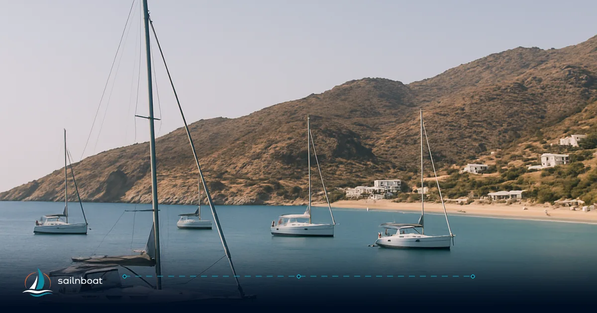
Mylopotas Bay offers yacht crews a practical lee from the summer meltemi, with sand-and-weed holding and depths suitable for most charter yachts. These are the operational reasons many skippers select Mylopotas when the north wind is up. In practice: expect shallow water close to the beach (2–4 m), a mid-bay anchoring band ideal for overnight stays (5–8 m), and a gradual slope to deeper water farther out—outer bay depths are typically 10–14 m. Beach facilities and minimarkets are a short dinghy ride from anywhere in the anchorage.
Overview of Mylopotas Bay Anchorages
Mylopotas (Ormos Mylopotas) is Ios’s long, sandy bay on the southern shore, known for its broad beach and reliable shelter from the north. The bay’s shape gives it more protection from the prevailing summer meltemi than most of Ios, making it a regular overnight stop for cruising yachts.
Key Anchorage Locations
- Mylopotas Beach anchorage (central bay): The most popular spot for immediate beach access and provisioning.
- Western and eastern pocket coves: Smaller, quieter corners on either end of the bay curve. These suit crews seeking less traffic, but space and depth are limited.
- Outer bay: Depths increase to 10–14 m. Larger yachts or those needing more swing room use this area, though it’s more exposed to southerly swell.
Anchorage Comparison Table
| Spot | Typical depth (m) | Seabed / holding | Shelter from meltemi | Shore facilities |
|---|---|---|---|---|
| Mylopotas Beach (central) | 3–8 | Sand with weed patches—good | Good lee from N | Full: tavernas, shops, watersports |
| Bay edges / small coves | 3–6 | Sand; some weed; quieter | Good in moderate meltemi, check wind | Minimal—dinghy to shore for supplies |
| Outer bay (deeper) | 10–14 | Sand and weed; more swing room | Still lee, more exposed to swell | Dinghy to main beach for access |
Shelter, Restrictions, and Holding Conditions
Protection from Winds
Mylopotas faces south to southwest. This orientation means the bay is typically calmer than Ios’s north- or east-facing anchorages during meltemi conditions. Gusts and a short chop are still possible in strong north winds, but you’re rarely exposed to the full force. Note: the bay is not a storm refuge—if the wind is forecast to swing south or southeast, seek a more protected harbour.
Seasonal Patterns and Arrival Timing
Late June to early September brings heavy yacht traffic. The mid-bay anchoring band often fills by early afternoon, especially in July and August. Arrive before noon for your choice of depth and swing room. Shoulder season (May, late September) is quieter, but some services may be limited.
Local Anchoring Restrictions and Swim Zones
Anchoring is generally permitted in Mylopotas Bay, but several practical restrictions apply:
- Swim zones: The central stretch of beach is marked by buoys in summer to separate swimmers from boats. Do not anchor or motor your dinghy inside these zones. The exact swim zone extent varies, but expect a significant area off-limits near the busiest beach clubs.
- Prohibited areas: Avoid anchoring directly in front of beach clubs and areas marked with local signage or buoys. Harbour authorities may adjust these zones seasonally.
- Night noise: High season brings late-night music and events. For quieter nights, anchor toward the bay edges or farther out.
- Mooring/anchoring fees: As of 2024, there is no widely enforced formal anchoring or mooring fee for dropping anchor in Mylopotas Bay. However, this can change—local authorities may introduce seasonal charges. Confirm the current status with your charter base or the local harbourmaster before arrival.
Depth Variations and Anchoring Considerations
Depth Insights
The bay shelves steadily:
- Near the beach: 2–4 m—ideal for shallow-draft yachts or day stops, but beware of swim zones.
- Mid-bay (main anchoring band): 5–8 m—most yachts anchor here for overnight.
- Outer bay: 10–14 m—good for larger yachts, or when more swing room is needed. The bottom remains mostly sand with weed; check charts for isolated rock patches, especially at the bay’s edges.
Matching Depth to Your Yacht
- Monohulls and catamarans up to 15 m: Anchor comfortably in 5–8 m if you can let out 30–50 m of chain.
- Larger/deeper-draft vessels: The outer bay gives ample depth and swing room, but you’ll need a longer scope (50–70 m) and a reliable windlass.
Anchoring Techniques
- Scope: Use at least 5:1 in settled weather; 7:1 or more when meltemi gusts are forecast. For example, in 8 m depth with 1 m freeboard, plan on 45–60 m of rode.
- Rode composition: All-chain is ideal for sand/weed bottoms. With a mixed rode, ensure at least one boat length of chain at the anchor.
- Setting the anchor: Lower until touching bottom, motor slowly astern, and check for drag. If the chain pulls taut without a steady catenary, reset in a sand patch.
- Anchor alarms: Crowding is common in July/August—set a GPS anchor alarm and double-check your position after any wind shift.
Practical Mistakes to Avoid
- Misjudging the actual depth (add your freeboard and bow roller height to soundings).
- Assuming sand everywhere; weed can prevent a set unless the anchor penetrates through to sand beneath.
- Anchoring inside swim zones or close to marked buoys—this is enforced and can result in a fine or being asked to move.
Etiquette and Conflict Resolution
- Spacing: Allow for swing room—boats in Mylopotas often anchor close, especially at peak times. Communicate with neighbouring crews about intended swing and scope.
- Disputes: If a neighbouring boat is too close, discuss calmly before either vessel is committed to anchoring. If conflict arises, involve the harbourmaster if available.
- Night arrivals: If you must anchor after dark, use a spotlight to check for buoys, swimmers, and obstacles, and keep noise to a minimum.
Facilities: Dinghy Landing, Water, Fuel, Provisions, Repairs, Medical
Dinghy Landing Points
- Main beach landing: Several stretches of open sand are available, but avoid the buoyed swimming zone. Look for gaps between water sports areas and avoid blocking swimmers.
- Recommended spot: The western end of the beach, near the small jetty by Far Out Beach Club, is often used by yacht crews. This gives quick access to shops and tavernas.
- Beach conditions: Surf is usually manageable, but in strong onshore winds, you may need to land further west where the chop is less pronounced.
Water
- Availability: As of 2024, there are no dedicated yacht water points directly on Mylopotas Beach. For water, you’ll need to visit the main port at Yialos (Ios Harbour), where water can usually be taken at the quay. Fees, when charged, typically range from €5–20 depending on volume and vessel size, but always confirm the rate in advance as it can vary.
Fuel
- Refuelling: There is no fuel dock at Mylopotas. Diesel and petrol are available at Ios Harbour, usually by mini-tanker truck arranged via the harbourmaster or a local agent. This remains the standard practice in 2024 for most charter yachts, but confirm with your base or the harbourmaster before you arrive.
Provisions
- Shops: Small supermarkets and minimarkets are located directly behind the beach. For a wider selection, including fresh produce and specialist items, visit shops in Ios Chora (2–3 km uphill, accessible by taxi or bus).
- Garbage: Public bins are available along the beach road. Do not leave rubbish on the sand or at dinghy landing sites.
Repairs and Technical Support
- Basic repairs: Ios offers minor chandlery and simple mechanical help in season, but parts and expertise are limited. For major repairs (engine, rigging, hull), plan to visit Paros, Naxos, or Syros, where full-service yards and marine engineers operate.
- Arranging repairs: For basic repairs, contact your charter base or ask at Ios Harbour for local mechanics. Most yachts arrange parts and skilled labour through their base or a local agent, rather than relying on walk-in service.
- Emergency repairs: If you need urgent technical support, call your charter operator first—they can often coordinate with local contacts.
Medical Facilities and Emergency Evacuation
- Medical: Ios has a small medical centre in Chora, open year-round. For serious injuries or illness, evacuation to Santorini or Athens may be required.
- Evacuation: Medical evacuation is usually by ferry or, in severe cases, by helicopter coordinated through the national emergency system.
- Emergency contacts: The EU emergency number is 112. For maritime distress, use VHF Channel 16 (Piraeus JRCC is the national SAR authority). Save these numbers in your phone and brief your crew.
Mobile Signal and Wi-Fi
- Mobile coverage: As of 2024, mobile signal strength in Mylopotas Bay is generally good for the main Greek networks, with reliable 4G coverage across most of the anchorage.
- Wi-Fi: Most beach bars and tavernas offer free Wi-Fi for customers, but signal strength drops off quickly offshore. For consistent connectivity, rely on mobile data.
Local Rules, Prohibited Areas, and Seasonal Restrictions
- Anchoring inside swim zones: Strictly prohibited during the summer (June–September). The buoyed areas are monitored by lifeguards and local authorities.
- Watersports zones: Jet-ski and windsurf rental areas are marked with buoys. Avoid anchoring or motoring through these corridors.
- Late-night noise: The area in front of major beach clubs can be noisy until 3–4 a.m. during high season. For quiet, anchor well west or east of the main beach.
- Seasonal closures: Some facilities (tavernas, shops) close outside May–September. Plan ahead if visiting early or late in the season.
What to Do if Mylopotas Is Full: Nearby Alternatives
High season sees Mylopotas fill quickly. If you arrive late or need more shelter, consider these alternatives:
| Anchorage | Distance from Mylopotas (NM) | Typical Depth (m) | Shelter | Facilities |
|---|---|---|---|---|
| Ios Harbour | ~1.5 | 3–7 | Good N–E | Full services, quay, fuel |
| Magganari Bay | ~5.5 | 4–8 | Good S–E | Tavernas, limited shops |
| Koumbara Bay | ~2.5 | 4–7 | Moderate N–W | Beach taverna, basic |
| Agia Theodoti | ~4.5 | 5–10 | Good S–E | Taverna, quiet |
- Ios Harbour (Yialos): The main port. Secure berths, water, fuel, and full provisioning. Use if you need shore power, technical help, or a break from rolly anchorages.
- Magganari Bay: More exposed to the south but excellent holding and quieter. Several beach tavernas.
- Koumbara Bay: Less crowded, moderate shelter. Good fallback if Mylopotas is full.
- Agia Theodoti: Remote and less developed—good for a peaceful night but services are sparse.
Optimal Reasons and Conditions for Anchoring
Why Anchor at Mylopotas?
- Reliable shelter from the meltemi: The bay is consistently calmer than most of Ios when north winds are up.
- Shore access: Easy landing for provisioning, beach bars, water sports, and crew changes.
- Convenience: Close to Chora for larger shops, and only a short hop to the main harbour for fuel or water.
Best Anchoring Conditions
- Summer (June–September): Predictable meltemi, warm water, and all facilities open. Arrive before noon for the best spots.
- Shoulder seasons: Less crowded, but some services may be closed. Confirm in advance if you need fuel or repairs.
- Strong meltemi: Anchor as far into the lee as your draft and swing room allow, and put out ample scope. If the wind swings south, move to a more protected anchorage—Mylopotas is exposed to southerly surge and can become uncomfortable or even unsafe.
Pre-anchoring Checklist
- Check the latest weather and GRIB files for meltemi timing and expected gusts.
- Identify sandy patches (the water is usually clear enough to see bottom).
- Calculate your required scope for the actual depth (including freeboard).
- Set an anchor alarm and post a crew watch for the first hour after anchoring.
- Confirm you are outside swim and watersport zones.
Final Operational Notes (What a Charter Base Will Expect)
- Swim/water sports zones: Stay outside all marked swim and activity areas. Local authorities enforce these rules, especially in July and August.
- Shore leave: Secure your dinghy above the tide line and lock it if you plan to stay ashore late. Avoid leaving valuables visible.
- Garbage and greywater: Use public bins for waste; do not discharge greywater or blackwater in the bay.
- Fees and paperwork: As of 2024, no widely enforced anchoring fee in Mylopotas, but always check with your base for updates, as local rules can change.
- Departure: If you need water, fuel, or technical help, call ahead to the harbour at Ios to arrange a berth or service slot.
Frequently Asked Questions
Mylopotas Bay is a south/southwest‑facing bay ringed by low hills and usually gives good lee from the northerly meltemi; it is a commonly used shelter when the north wind is up.
Holding is mainly sand with weed patches; expect shallow water of about 3–6 m near the beach, comfortable anchoring at roughly 5–8 m, and deeper water out in the bay up to about 12–14 m.
Onshore you’ll find water points, tavernas, provisioning and watersports operators; the island’s main services and a larger harbour are a short ride away in Chora and the port (Yialos).
The classic stop is off Mylopotas Beach (central bay) for beach access and services; quieter options are the small coves at the west and east edges of the bay or anchoring slightly farther off in deeper water for better swinging room.
The meltemi is the dominant summer wind—Mylopotas’s southfacing orientation reduces its force there, but the wind can still freshen strongly; set more scope, use chain, and choose shelter closer to the lee shore when the meltemi builds.
Written by
Sailnboat Editorial
The Sailnboat editorial desk covers yacht and boat chartering worldwide — routes, bases, seasons, boat types, paperwork and the practical costs that decide a trip. We are a charter marketplace, not a boat owner or a local agency: what we sell is judgement and support, so our guides are written to help you make a decision, not to sell you a specific boat. Every guide is checked against live operator and marina data before it goes out.
Fact-checked against live operator and marina data, and published under our editorial standards. Last reviewed: .