Marina del Rey Sailing Weather: Best Months & Daily Patterns
A practical guide to Marina del Rey sailing weather: which months give the most reliable breeze, how the daily sea-breeze cycle works, and the safest times to leave the dock.

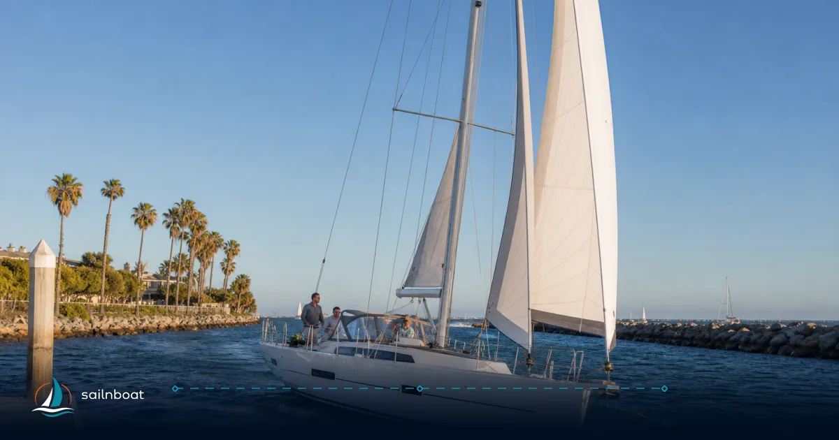
Marina del Rey’s best sailing months are the late‑spring and summer months when the sea‑breeze cycle is most reliable and rainfall is low — in plain terms, plan your charter for May through September if you want predictable afternoon wind and mild temperatures. The harbor itself is sheltered, but you will feel the sea breeze on any leg that leaves the breakwater: mornings are generally calmer; afternoons are when wind speed and gusts increase.
Optimal Months for Sailing in Marina del Rey
Short answer: May–September is the most dependable window for day-sailing and short charters because the marine environment produces consistent onshore wind and relatively little rain. Temperatures are mild and the marine layer is normally shallower later in summer.
What you’ll get in those months
- Wind: a regular afternoon sea breeze driven by inland heating — predictable for planning day sails and races. Expect lighter winds in the morning and a steady build into the afternoon.
- Temperature: daytime highs typically in the high teens to mid‑20s °C (high 60s to mid 70s °F) at the coast; Santa Monica / Santa Monica Muni station climate normals show summer highs clustered around the mid‑70s °F.
- Rain: minimal — these months are the driest of the year, which reduces the odds of an interrupted charter.
Off‑peak and shoulder months (October–April)
- Autumn (Oct–Nov): conditions become more changeable. You can still get pleasant days but frontal systems start arriving and wind direction can shift to the northeast/ northwest at times. Plan with an eye on forecasts.
- Winter (Dec–Mar): cooler air, increased chance of Pacific storms, larger swell and more frequent wind shifts; mornings are not necessarily calmer than afternoons during storm passages. If you charter in winter, set stricter weather limits for your boat and crew.
Daily Wind Patterns and Sea Breeze Cycles
The regional rule: light nights and mornings, increasing onshore winds after land heating starts, peak in mid/late afternoon, easing after sunset. This is the standard land–sea breeze cycle described for Southern California coastal waters.
Typical timings and magnitudes (operational guidance)
- Night / early morning: winds are often light and variable — commonly under about 5–10 kt in sheltered spots near the marina, which makes mornings attractive for lower‑wind sailing. Use “often” — timing varies by synoptic setup.
- Late morning to early afternoon: the sea breeze begins to strengthen as inland heat builds; you may notice a steady shift toward a westerly or northwest sea breeze. The onset commonly falls between late morning and early afternoon, depending on inland temperatures that day.
- Mid to late afternoon peak: on typical summer days the sea breeze often reaches roughly 10–20 kt and sometimes higher in gusts or funnelled locations; Coast Pilot and regional marine forecasts record frequent afternoon speeds in that band with occasional gusts above it. Expect the strongest winds from roughly 1500–1800 local time on many days.
- Evening: winds typically ease after sunset and often fall back to light and variable overnight.
How local geography changes the pattern
- The Marina Peninsula, Ballona Creek mouth and the Palos Verdes/Point Vicente headland all influence local flow. Gaps and headlands can accelerate, redirect or focus afternoon winds; sheltered corners inside the basins will feel much less wind than the entrance or open bay. Treat local topography as an amplifier of the general sea‑breeze rule.
What the Coast Pilot and NWS say in practice
- Coast Pilot and NWS marine discussions characterise the southern California sea breeze as strongest June–September, with morning speeds often under 10 kt and afternoon speeds routinely 10–20 kt, occasionally higher near headlands or during synoptic forcing. Use that bracket for planning and set limits for your crew accordingly.
Safe Departure Windows for Sailing
If your priority is a comfortable, lower‑stress day sail (or you’re running a short charter), pick your window with the daily wind cycle in mind.
Practical departure options
- Morning departures (recommended for many day sails): leave the marina between launch time and roughly 10:00–11:00 if you want to avoid the full force of the afternoon sea breeze. Mornings are often light and more forgiving for crew briefings, sail trim practice and near‑shore exploration. This is the most commonly recommended strategy for novice crews and rental charters.
- Early afternoon departures: workable if you plan to motor out to a reach where the sea breeze is an advantage and your crew/boat are comfortable with 10–20 kt winds and gusts. Expect stronger gusts near headlands and in channels.
- Late afternoon or evening: avoid leaving at the moment of sea‑breeze peak unless you are deliberately planning a passage that benefits from stronger winds; after the peak, conditions typically ease but visibility can be an issue near sunset if the marine layer lifts or returns.
Use a pre‑departure checklist focused on the weather window
- Check the current and forecast wind (direction, sustained and gusts) plus the 3‑hour trend from a nearby buoy or coastal observation. The Santa Monica Basin buoy (NDBC 46025) is a useful offshore reference, but it sits several miles west and can differ from conditions at the breakwater.
- Inspect visibility for fog in the harbor and offshore; the county publishes fog signal procedures (VHF activation) at the jetty if visibility drops. Know how to call the foghorn from VHF.
- Confirm your crew’s comfort and the boat’s reefing plan. If forecast gusts will exceed your crew’s limits, postpone or shorten the trip.
Quick operational rule (decision ladder)
- If morning sustained winds are below ~10 kt and forecast to rise: OK for most day sails.
- If forecast sustained winds are 15–20 kt with higher gusts: suitable only for experienced crews and a boat rigged for higher wind (reef early).
- If a marine forecast includes Small Craft Advisories or offshore swell with long periods (see buoy data), choose a more sheltered route or postpone.
Impact of Fog on Sailing Conditions
When fog arrives it usually comes as part of the marine layer: low clouds/fog advecting onshore that reduce visibility near the coast. This is a standard Southern California summer feature often called “May Gray/June Gloom” because it commonly peaks in late spring and early summer.
How fog behaves here and why it matters
- Typical timing: fog and low clouds form overnight and persist into the late morning; on many days the sun burns it off by midday or early afternoon, but on stronger marine‑layer days visibility can remain poor well into the afternoon. Expect the worst fog incidence from late spring into early summer.
- Visibility: in heavy marine layer events visibility can drop below a few hundred metres near the shore. That affects entrance transits, traffic separation zones and the ability to pick up marks or shore references.
Practical precautions
- Delay non‑essential departures if visibility is low; if you must go, brief the crew and run navigation lights, radar and GPS. Use the harbor foghorn (LA County gives the activation method on VHF channel 81A) and monitor VHF Channel 16/13 for traffic.
- Inside the harbor you’ll still be constrained by the 5‑kt no‑wake rules and narrow channels—poor visibility increases the risk of close calls. Keep speed down and post an extra lookout.
Typical Swell Conditions in Marina del Rey
What to expect in terms of swell and chop
- Summer: swell offshore is often modest (commonly 1–3 ft significant wave heights at nearby buoys) with short‑period wind waves produced by local sea breezes — choppy but short and manageable for most coastal sailboats. NDBC buoy 46025 (Santa Monica Basin) regularly reports small to moderate significant wave heights and a mix of wind waves and swell.
- Winter: larger swell and longer periods from northwest storms are typical; offshore wave heights often increase (sometimes reaching 3–6 ft or more at the buoy), and longer periods make for more uncomfortable and slower passages. Plan differently if you expect open‑coast legs.
How that affects in‑harbor sailing
- The detached breakwater and jetties shelter Marina del Rey’s basins; inside the breakwater the sea is usually much calmer and more suitable for training, short sails and tender work. Outside the breakwater the short, steep chop produced by the sea breeze can make a bumpy ride until you find a reach or angle that rides the swell more comfortably.
Seasonal Variations Affecting Sailing Weather
Summer vs winter — a concise operational comparison
- Summer (May–Sep): predictable sea breeze cycles, light morning winds, afternoon peaks (often 10–20 kt), mild temperatures, low rainfall, and typically smaller offshore swell. Good for scheduled charters and day sails.
- Winter (Oct–Apr): more frontal activity, stronger synoptic winds, longer‑period swell, greater variability in direction and strength, and more frequent rain and cloud. Wind and sea-state limits should be lowered for safety.
Adapting your plan by season
- Summer: give crews preseason briefings on reefing and gusts and plan for morning departures where appropriate. Watch for marine‑layer visibility issues on scheduled afternoons.
- Winter: pick sheltered coastal routes, expect re‑routing, and accept that charters are more weather‑dependent; build contingency days into multi‑day plans.
Quick Reference Table: Month vs Conditions vs Best Departure Window
| Months | Typical wind & swell | Fog/visibility | Best departure window (typical) |
|---|---|---|---|
| May–Sep | Sea breeze builds to ~10–20 kt afternoons; offshore swell small (1–3 ft typical at buoy). | May/June can have marine layer in mornings; often clears midday. | Morning before ~10–11:00 or late afternoon after peak if returning in calmer conditions. |
| Oct–Nov | Variable; possible NE or NW winds with frontal passages; swell starts increasing. | Less marine layer but more unpredictable fronts — visibility varies. | Check forecast; mornings sometimes calm but storms can arrive any time. |
| Dec–Mar | Stronger, storm-driven winds and longer-period swell (3–6 ft offshore common). | Generally clearer mornings between fronts but lower temps and rain risk. | Plan for sheltered routes; avoid exposed crossings on forecasted storm days. |
Pre‑departure checklist focused on Marina del Rey weather
- Run the latest NWS marine forecast (PZZ655 and local zone products) and the Marine Area Forecast Discussions for Santa Barbara‑to‑San Pedro waters.
- Check a nearby buoy (NDBC 46025 Santa Monica Basin) for wave height, period and wind trends — don’t assume buoy = local conditions; it’s your offshore reference.
- Inspect visibility and the marine layer; if fog is present, consider delaying or using electronic navigation and the harbor foghorn procedures.
- Confirm harbor rules (no‑wake 5 kt inside basins) and entrance hazards: shoals exist near the jetties and the harbor depth in the basins averages ≈15–21 ft. Factor tide and shoaling on low tides.
Final practical advice for the short‑term charterer or day‑sailor
- If you want the classic Marina del Rey day sail — plan for a morning departure in May–September, with the expectation that the real work begins in the afternoon when the sea breeze builds. That will get you calmer training time and an energetic reach later.
- If you’re crossing outside the breakwater (to Avalon or King Harbor) build in ample margin: buoy data, NWS marine forecasts and the Coast Pilot should be part of your pre‑departure read. Recheck the forecast before turning the key.
- Respect limits: if gusts exceed your crew or vessel comfort, reef early or change plan — the sea breeze can go from useful to punishing fast near headlands.
Plan your sail around the daily cycle, choose the months that match your tolerance for wind and fog, and use the buoy and NWS products to confirm the actual window the morning of your departure. With those steps you’ll reduce surprises and run safer, more enjoyable sails from Marina del Rey.
Frequently Asked Questions
Typically May through September offers the most consistent, predictable sailing weather—warmer air, steady afternoon sea breezes and low rainfall.
Mornings are usually light and variable (often under 10 kt); an onshore sea breeze develops midday and commonly peaks mid–late afternoon at roughly 10–20 kt.
The sea-breeze cycle is driven by inland heating: light winds overnight and morning, a build starting late morning to early afternoon, and a peak in the mid/late afternoon.
For most day-sails and short charters, depart in the morning (before the sea breeze is well established) or after the afternoon peak if you expect heavy winds or gusts.
Fog from the marine layer is common in late spring/early summer; it can reduce visibility to a few hundred metres or less—delay departure if visibility is poor and use navigation aids.
Offshore buoy data show summer wave heights often around 1–3 ft; winter brings larger swell (commonly 3–6 ft offshore) and longer periods which increase sea state outside the harbor.
Written by
Sailnboat Editorial
The Sailnboat editorial desk covers yacht and boat chartering worldwide — routes, bases, seasons, boat types, paperwork and the practical costs that decide a trip. We are a charter marketplace, not a boat owner or a local agency: what we sell is judgement and support, so our guides are written to help you make a decision, not to sell you a specific boat. Every guide is checked against live operator and marina data before it goes out.
Fact-checked against live operator and marina data, and published under our editorial standards. Last reviewed: .