Top 5 Lesser-Known Sailing Destinations for Adventure Seekers
Five off‑the‑beaten‑track sailing destinations that reward experienced crews with solitude, unusual anchorages and real adventure—plus access, fees, seasons and practical tips.

Top 5 Lesser-Known Sailing Destinations for Adventure Seekers
If you want real solitude and sailing grounds that reward careful navigation, these five lesser-known destinations deliver: Pine Cay, Rodrigues, Bocas del Toro, the Apostle Islands, and Caddo Lake. Below, you’ll find the operational detail you need to plan a safe, enjoyable trip—distances, mooring options, fees (with year and caveats), provisioning and fuel realities, and the seasonal weather windows that make each area work.
Pine Cay, Turks and Caicos
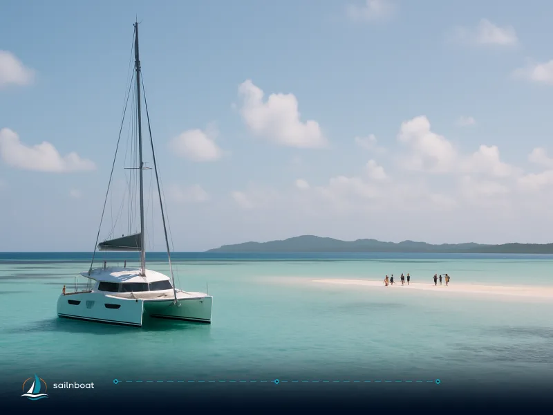
Pine Cay is a private, low-density island east of Providenciales. It’s best approached as a short leg from Provo, not as a full cruising base. The air distance from Providenciales to Pine Cay is about 10–12 nautical miles—confirm with your chart or local pilotage as conditions and exact approach routes can affect the time and distance.
Access, Mooring, and Hazards
- Approach: Most crews arrive via Providenciales (PLS), staging at Turtle Cove Marina or anchoring off and using a dinghy. Turtle Cove is the main full-service marina for visitors.
- Moorings and anchoring: Permanent moorings are very limited. Anchoring is permitted in designated areas; always check the latest guidance for any permit requirements for longer stays.
- Depth: Bank sides are shallow; if your draft is over 2.0–2.5 m, use local knowledge and keep strictly to marked channels.
- Hazards: Coral heads are common, especially around the banks and in reef passes. Use a lookout, avoid night approaches, and rely on updated charts.
- Fees: As of 2023, transient rates at Turtle Cove Marina are not always published and transient berthing may not be available year-round. Contact the marina directly to confirm if transient berths are available and to get current rates.
Provisioning, Fuel, and Connectivity
- Provisioning: Stock up in Providenciales before heading out. As of 2023, there is no full-service grocery or chandlery on Pine Cay itself.
- Fuel: Turtle Cove Marina is your main source for fuel—refuel before leaving Provo.
- Internet and Emergency: Mobile coverage from Provo often reaches Pine Cay, but reliability varies. Carry a local SIM for the best chance of data and voice service. Emergency contact is via VHF channel 16 (local Coast Guard monitors this channel in the Turks & Caicos region, but coverage may not be complete in all anchorages).
When to Sail
- Best window: December–April brings the most reliable east-southeast trade winds (typically 12–20 knots). Shoulder months (late April, November) can be calmer but less predictable.
- Weather risk: Hurricane season runs June–November. Plan accordingly.
Must-Do Activities
-
Shore walks and snorkeling on the fringing banks.
-
Wildlife watching: Sea turtles, seabirds.
-
Note: Pine Cay is private—shore access may require advance permission. Bring all provisions if overnighting away from main marinas.
-
Navigation apps/charts: Navionics, Garmin BlueChart, and local paper charts are recommended for accurate reef and channel detail in the Turks & Caicos.
Rodrigues Island, Mauritius
Rodrigues sits roughly 300 nm east of Mauritius and is as remote as any oceanic cruising stop in the Indian Ocean. It’s a single-harbour island, rewarding those who plan well and arrive self-sufficient.
Getting There, Mooring, and Hazards
- Entry: Port Mathurin is the only port of entry. Yachts anchor in the bay or, if space allows, raft alongside the quay. No marina facilities as seen elsewhere; expect to anchor.
- Formalities: Clearance is handled in Port Mathurin. Small health or inspection fees are common (allow time for these steps).
- Hazards: The approach is exposed to ocean swell. Night entry is generally not permitted—plan for daylight arrival.
- Coral: Coral heads are present in lagoon approaches; enter with good light and local pilotage if possible.
Provisioning, Fuel, and Connectivity
- Provisioning: Supplies are limited and sometimes expensive. There are small markets in Port Mathurin, but availability can be unpredictable. Bring non-perishables and specialty items from Mauritius.
- Fuel: Fuel is generally available in Port Mathurin, but large quantities are not always guaranteed—refuel as soon as you arrive and confirm supply with the quay manager.
- Internet and Emergency: Mobile data coverage is present in Port Mathurin. Consider a local SIM from a Mauritius carrier for best rates. Emergency services are based in town; VHF 16 is monitored by local authorities.
When to Sail
- Best window: May–October (dry season, southeast trades). Check forecasts—ocean swell and wind can be significant.
- Weather risk: Cyclone risk is real November–April.
Must-Do Activities
-
Creole markets and local seafood.
-
Remote reef diving and snorkeling.
-
Village visits: Traditional music and dance are part of local life.
-
Navigation apps/charts: Navionics and C-Map cover Rodrigues. Carry paper charts for backup; electronic detail can be limited.
Bocas del Toro, Panama
Bocas del Toro is a coral-rich, low-density archipelago on Panama’s Caribbean coast—ideal for exploratory reef sailing and short inter-island hops.
Access, Formalities, and Hazards
- Arrival: Anchor off Bocas Town (Isla Colón) and contact the Port Captain for clearance. Marinas like Red Frog (Isla Bastimentos) and IGY Bocas Marina can handle formalities.
- Fees: As of 2023, a typical clearance package includes customs (around US$40), cruising permit (about US$193), and zarpe (about US$13.50). Total costs are usually under US$400, but can vary—always check with your marina and bring cash.
- Hazards: Coral heads are widespread—use charts and a bow lookout. Sudden squalls and strong currents occur, especially in rainy season. Some channels are unmarked or poorly maintained.
- Security: Petty theft can occur; lock up when ashore.
Provisioning, Fuel, and Connectivity
- Provisioning: Bocas Town has decent provisioning for the region—supermarkets, fresh produce, marine supplies, and basic hardware.
- Fuel: Diesel and gasoline are available at Bocas Town and Red Frog marinas. Confirm hours and pay cash if possible.
- Internet and Emergency: Good LTE coverage with local SIMs (e.g., +Movil, Digicel). Emergency VHF is monitored (local port authorities and marinas monitor VHF 16); nearest hospital is on Isla Colón.
When to Sail
- Best windows: December–March (main dry season); September–October is a secondary dry window. Rain and wind can shift quickly outside these periods.
- Weather risk: Heavy rain and poor visibility in rainy season (April–August, November).
Must-Do Activities
- Snorkeling on shallow coral gardens.
- Touring indigenous communities by dinghy.
- Hiking on Isla Bastimentos.
- Marine parks: Respect protected zones and speed limits.
Sample 4-Day Itinerary
-
Day 1: Arrive and clear in Bocas Town. Provision and fuel.
-
Day 2: Sail to Cayo Coral, anchor off. Snorkel and visit local fish restaurants.
-
Day 3: Short hop to Red Frog Marina/Isla Bastimentos. Hike the national park trails, see sloths and monkeys.
-
Day 4: Anchor at Dolphin Bay, paddle mangroves, return to Bocas Town.
-
Notes: Each leg is 5–12 nm; all anchorages are exposed to squalls—secure well.
-
Navigation apps/charts: Navionics, Aqua Map, and local guides are recommended. Download offline charts as cell data can be patchy in outlying anchorages.
Apostle Islands, Wisconsin (Lake Superior, USA)
The Apostle Islands offer a freshwater adventure with sea caves, lighthouses, and challenging weather. This is a classic coastal-cruising ground demanding respect for local conditions.
Access, Mooring, and Hazards
- Gateway: Bayfield, WI is the main access port. Full-service marinas and transient docks are available.
- Mooring: National Lakeshore rules apply—overnight docking and camping require permits and fees (as of 2023, fees are typically US$15–25/night for National Park Service docks).
- Hazards: Sudden weather changes are common—gales, strong cold fronts, and fog can develop quickly, especially outside the July–August window. Water temperatures remain cold year-round.
- Navigation: Rocks and shoals are poorly marked in some areas. Use up-to-date charts.
Provisioning, Fuel, and Connectivity
- Provisioning: Bayfield has grocery stores, marine suppliers, and hardware shops.
- Fuel: Available at Bayfield and select marinas in the islands—call ahead for hours.
- Internet and Emergency: LTE coverage is fair in Bayfield, patchy in the islands. Carry a VHF radio (channel 16 monitored by USCG). 911 response is available, but can be slow offshore.
When to Sail
- Best window: June–September. July–August gives warmest air and most reliable conditions.
- Weather risk: Outside this window, cold storms, sudden gales, and limited services are a real concern.
Must-Do Activities
-
Explore sandstone sea caves (wind and water level permitting).
-
Visit historic lighthouses.
-
Hiking and exploring old logging sites.
-
Sample Bayfield's seafood and craft beer.
-
Navigation apps/charts: Navionics, NOAA raster charts, and the National Park Service’s own digital maps are recommended for local navigation.
Caddo Lake (Texas/Louisiana Border)
Caddo Lake is a maze of cypress, swamp, and slow-moving channels—best suited to shallow-draft boats and day-trips with a dinghy or paddle craft.
Access, Mooring, and Hazards
- Ramps and Marinas: Access via public ramps and small marinas such as Shady Glade Marina (Texas side, +1 903-789-3295), Johnson’s Ranch Marina (Texas side, +1 903-789-3213), and Potter’s Point (Louisiana side, +1 318-375-2600). State park facilities on the Texas side (Caddo Lake State Park) have boat launches and day-use fees (typically a few dollars as of 2023—check with the site for current rates).
- Mooring: Overnight dockage is limited to small private marinas; most visitors use day-use or short-term slips. Anchoring is possible in deeper channels, but local advice is strongly recommended.
- Hazards: Water levels and channels change with local management. Depths may be under 2.0 m in many areas—check with local operators if your draft exceeds 1.5 m. Submerged stumps, shifting channels, and floating debris are common. Navigation aids are limited; marked routes may shift after storms or high water.
- Wildlife: Alligators and snakes are present; exercise caution during shore excursions.
Local Navigation and Regulations
- Navigation: Local navigation charts are available at marinas and state park offices. Apps like Navionics may cover major channels, but detail is limited. Visual piloting is essential; water clarity can be poor, especially after rain.
- Regulations: Texas and Louisiana boating regulations apply—carry current registration and safety gear. Check for any seasonal closures or restrictions, especially near wildlife refuges and during hunting season.
- Marina contacts: Shady Glade Marina (+1 903-789-3295), Johnson’s Ranch Marina (+1 903-789-3213), Potter’s Point (+1 318-375-2600).
Provisioning, Fuel, and Connectivity
- Provisioning: Limited—stock up in Marshall or Jefferson, TX before arrival.
- Fuel: Small marinas offer limited fuel. Bring extra if you plan to explore widely; always confirm availability by phone before relying on marina fuel.
- Internet and Emergency: Mobile coverage varies—best on the Texas side. Local emergency numbers are posted at marinas; VHF is rarely monitored or used for emergency response on inland lakes in this region.
When to Sail
- Best windows: Spring (March–May) and fall (September–November) for milder weather and lower insect activity.
- Weather risk: Summer heat and mosquitoes can be intense; winter brings low water and cold snaps.
Must-Do Activities
-
Swamp paddling and birdwatching.
-
Guided alligator tours.
-
Photography of cypress and Spanish moss.
-
Navigation apps/charts: Paper charts from local marinas are most reliable. Navionics coverage is limited; visual navigation is essential.
Quick Comparison Table
| Destination | Nearest port/hub | Typical mooring/anchoring | Best season | Standout activity |
|---|---|---|---|---|
| Pine Cay (TCI) | Providenciales (Turtle Cove Marina) | Marina slips, marked moorings | Dec–Apr | Shallow-bank snorkel, turtles |
| Rodrigues (Mauritius) | Port Mathurin (only entry) | Anchor in bay, quay for dinghy | May–Sep | Creole markets, remote reef dives |
| Bocas del Toro (Panama) | Bocas Town / Red Frog (Isla Colón) | Anchor off, marina berths | Dec–Mar; Sep–Oct | Coral reefs, indigenous visits |
| Apostle Islands (USA) | Bayfield, WI | National Lakeshore docks/anchors | Jun–Sep | Sea caves, lighthouses |
| Caddo Lake (TX/LA) | Shady Glade, Johnson’s, Potter’s Point | Public ramps, small marinas | Mar–May; Sep–Nov | Swamp paddles, birding, alligators |
Fees, Formalities, and Paperwork
- Marina and port fees: As of 2023, expect marina visitor rates often quoted per foot (e.g., Turtle Cove rates not always published and subject to change; contact in advance), or combined clearance/anchoring charges (Bocas del Toro commonly under US$400). Rates change frequently—confirm before arrival and budget a margin for increases.
- Permits and paperwork: Rodrigues requires formal clearance in Port Mathurin. Panama (Bocas) requires a cruising permit and port clearance. The Apostle Islands enforce national lakeshore docking/overnight rules. Most Caribbean and US destinations require some form of short-term anchoring permit or park fee. Always plan to complete paperwork during daylight hours.
- Insurance and charter paperwork: Many charter operators require proof of competence (ICC or equivalent), vessel insurance, and a VHF/SRC license where applicable. Missing documentation can delay or complicate clearance and insurance claims.
- See our guide to Caribbean clearance procedures for more on paperwork and local protocols.
Packing, Equipment and Safety Checklist
- Reliable dinghy and outboard—many anchorages require dinghy shuttles.
- Ground tackle and spare anchor—reef and grass bottoms can challenge holding.
- Paper and electronic charts—local reef passes (Rodrigues, Turks banks, Bocas) are not always well-marked.
- Cold-weather gear for Apostle Islands; insect protection and shallow-water fenders for Caddo Lake.
- Local currency in small bills—some marinas and port offices require cash.
- Passport and vessel documents—keep originals handy for port clearance.
- Local SIM card for data and emergency contact.
- Personal locator beacon (PLB) or satellite phone for remote stops (Rodrigues, Pine Cay).
- First aid kit and spare fuel/water for remote legs.
Key Hazards to Watch
- Coral heads: Pine Cay, Bocas del Toro, Rodrigues—use a bow lookout and daylight for entry.
- Sudden weather: Apostle Islands (gales, fog), Bocas del Toro (squalls), Rodrigues (swell, cyclone risk).
- Shallow water and submerged stumps: Caddo Lake—follow marked channels and local advice.
- Private property and restricted access: Pine Cay—confirm shore access in advance.
Final Practical Advice and Trade-Offs
- Absolute remoteness: Rodrigues and Pine Cay outside peak season, but both require careful provisioning, self-sufficiency, and advance planning for formalities.
- Short hops and infrastructure: Bocas del Toro and Apostle Islands offer more facilities, easier provisioning, and manageable paperwork—but still reward independent exploration.
- Unique inland experience: Caddo Lake is nothing like ocean sailing; expect dense scenery, paddling, and limited marina services—stock up before you go and be ready for shallow water.
Frequently Asked Questions
Pine Cay (Turks & Caicos), Rodrigues Island (Mauritius), Bocas del Toro (Panama), Apostle Islands (Lake Superior, USA) and Caddo Lake (Texas/Louisiana border). Each offers remote anchorages and activities that differ from typical Mediterranean/Caribbean routes.
Access ranges from short powerboat hops from a main island (Pine Cay) to formal port entry at Port Mathurin (Rodrigues) or anchoring off Bocas Town and clearing with the Port Captain; Apostles and Caddo Lake are reached from local marinas/ramps—read the Access section for each destination.
Rules vary: some places use free anchorages (Rodrigues often anchors in the bay), some have marina visitor rates (e.g., Turtle Cove Marina in Providenciales charges per foot), and some require short-term cruising permits or port‑authority fees—confirm with the local port/harbormaster before arrival.
Pine Cay: December–April; Rodrigues: May–September (drier, steady SE trades); Bocas: December–March or the drier windows of Sept–Oct; Apostle Islands: June–September; Caddo Lake: spring (Mar–May) and autumn (Sept–Nov).
Expect solitary beaches and turtle nesting (Pine Cay), Creole markets and local music (Rodrigues), reef snorkelling and Ngäbe‑Buglé culture visits (Bocas), sea caves and lighthouse runs on Lake Superior (Apostles), and swamp paddles, alligator viewing and Cajun/Louisiana culture (Caddo Lake).
Written by
Sailnboat Editorial
The Sailnboat editorial desk covers yacht and boat chartering worldwide — routes, bases, seasons, boat types, paperwork and the practical costs that decide a trip. We are a charter marketplace, not a boat owner or a local agency: what we sell is judgement and support, so our guides are written to help you make a decision, not to sell you a specific boat. Every guide is checked against live operator and marina data before it goes out.
Fact-checked against live operator and marina data, and published under our editorial standards. Last reviewed: .