Top Exumas Anchorages for Your 7-Day Charter
A practical, day-by-day guide to the top Exumas anchorages for a 7‑day charter — where to drop the hook, what depths and swing-room to expect, approach notes and mooring rules.

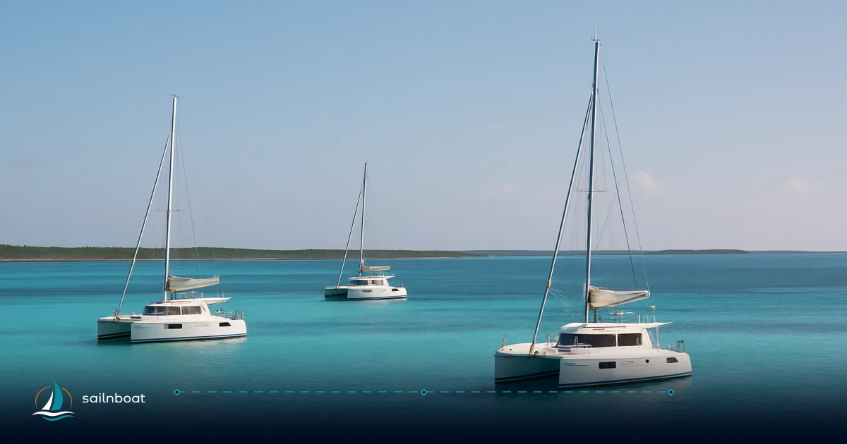
For a 7‑day charter you want sheltered nights, short daytime hops and easy dinghy access to reefs and beaches — this guide names the best exumas anchorages and tells you the anchoring depths, recommended swing room, approach cautions and where to expect mooring fees so you can plan each day with confidence.
Overview of Exumas Anchorages
The Exumas are a long, shallow chain of cays and sandbanks where anchorages trade exposure for immediate access to snorkeling, beaches and sheltered channels. The Exuma Cays Land & Sea Park covers a central strip of these cays and carries specific mooring and landing rules; many of the classic anchorages and reef snorkel sites lie inside the park. Plan to alternate short sheltered nights (Staniel/Big Major) with longer positioning days (to Warderick Wells or Shroud Cay), and always use current charts through the cuts — unmarked shoals and sand bores are common.
What makes Exumas anchorages useful for a week:
- Short inter‑island distances allow multiple stops per day if you want.
- Many anchorages sit on white sand with good holding, close to reefs for snorkeling.
- Inside the Land & Sea Park you’ll find maintained mooring fields (Warderick, Shroud and other sites) and clear rules and fees managed by the Bahamas National Trust.
Top Anchorages for Your Itinerary
Below are the anchorages you’ll use most on a typical 7‑day Exumas charter. For each I list the realistic depth range, bottom type, practical swing‑room guidance, approach cautions and what you can do from the dinghy.
Note on giving numbers: depth ranges below are typical observations from cruising and park guides — local shoals and tide can change the numbers, so cross‑check your charts and depth sounder as you approach.
Staniel Cay (Thunderball / North anchorage)
- Typical depths and bottom: 2–4 m in the anchorage areas near Thunderball and the village; sand with reef patches closer to the grotto.
- Swing room: plan 40–60 m for a 40–50 ft monohull; allow more if neighboring boats are present. (Cats need much larger radius.)
- Approach: the main objective is to avoid shallow sand banks and the small cuts at variable tide; approach the Staniel anchorage from the deeper west or NW channels in settled conditions and slow to survey depth while transiting. Arrive during daylight and slack or rising tide for Thunderball entries.
- Dinghy & shore access: easy boat‑to‑beach access at the village / yacht club; fuel and limited provisioning are available at the Staniel Cay Yacht Club.
- Why it works for a week: Staniel puts Thunderball, Pig Beach (Big Major) and nearby dive sites within short hops — ideal as a staging base.
(Operational note: Thunderball Grotto is tide and crowd sensitive — consider visiting early in the morning at low or slack tide for calmer conditions.)
Thunderball Grotto (snorkel objective near Staniel)
- Typical depths and bottom: cave approach and swim channels average around 4–6 m in the open water; reef and rock inside the grotto area. Moor on buoys where present; anchoring on the reef is prohibited.
- Swing room: 30–50 m if anchoring outside the reefed area — most charterers tie to park moorings or tender in from Staniel.
- Approach: follow local boats and flagged entries; many guides mark the safe swim entrance. Use hold‑backs on the dinghy entry rope in surge. The reef is fragile — use moorings or a proper anchor set well outside reef heads.
- Top snorkeling: cave swims, small swim‑throughs and reef fish concentrated in the sheltered grotto.
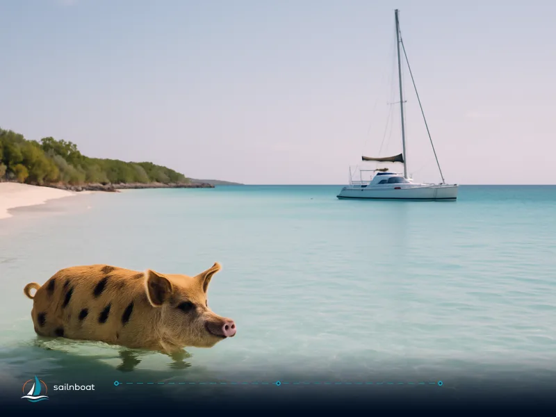
Big Major Cay (Pig Beach / “Big Major’s Spot”)
- Typical depths and bottom: 2–3 m off the beach and sheltered banks with clean sand and good holding; small reef patches farther off. Guides commonly report safe anchoring just off the beach in clear sand.
- Swing room: 50–70 m recommended — the beach area is popular and boats often raft; allow extra room if other vessels are anchored nearby.
- Approach: approach the west side shelter in prevailing east winds; watch for other boats and swimmers in the water when you drop anchor near the pigs. If crowded, move slightly off the main beach to reduce wake and congestion.
- Dinghy & shore access: short dinghy ride to the beach — expect animals and day‑visitors; follow local guidance on interacting with the pigs (do not feed inappropriate food, keep a safe distance).
Shroud Cay (mangrove creeks)
- Typical depths and bottom: 1.5–3 m in the sheltered sand/mud creek entrances and anchorage pockets; bottom includes sand and seagrass — holding is variable where grass beds exist. Enter the main creek only at suitable tide; some channels become impassable at low water.
- Swing room: 40–60 m in the larger sand basins; the mangrove creeks themselves are narrow — you will usually leave the yacht anchored in a pool and explore by dinghy.
- Approach: enter the mangrove creeks on the flood (rising) tide; currents can be strong through narrow channels and depth falls away quickly at the mouth. Mooring balls exist in some park locations and are preferred when available.
- Top activities: dinghy through the mangroves, kayak the pools, short beach hikes and protected snorkels off outward‑facing reef edges.
Warderick Wells (Exuma Cays Land & Sea Park HQ)
- Typical depths and bottom: 2–4 m around the Ranger’s Garden and mooring field; a mixture of sand, rubble and reef. Park mooring balls are heavily used and maintained.
- Swing room: when on a mooring ball you have no anchor swing concerns but should consider dinghy access and nearby vessels; if you anchor outside the mooring field allow 40 m or more.
- Approach: call the Park office on approach and request a mooring if needed — moorings are first‑come and the Park uses VHF radio to manage the fields; do not anchor where moorings exist.
- Top snorkeling: Ranger’s Garden, Pieces of Eight and several mooring‑marked reefs near the headquarters offer easy snorkels from your dinghy. Park rules are strict — no‑take zones.
Quick comparison table
| Anchorage | Typical depth (m) | Bottom | Swing room (m) | Moorings available | Top activity |
|---|---|---|---|---|---|
| Staniel Cay (village/Thunderball area) | 2–4 | Sand with reef patches | 40–60 | Yacht club moorings / marina slips | Thunderball Grotto snorkel, provisioning. |
| Thunderball Grotto | 4–6 (approach) | Rock/reef (use moorings) | 30–50 | Moorings where provided — prefer moorings | Cave snorkel / shallow dive. |
| Big Major Cay (Pig Beach) | 2–3 | Sand | 50–70 | No formal mooring field; anchor off beach | Pig Beach, shallow reefs. |
| Shroud Cay | 1.5–3 | Sand & seagrass (variable) | 40–60 (pool basins) | Park moorings in places — anchoring discouraged where moorings exist | Mangrove creek dinghy runs. |
| Warderick Wells (park HQ) | 2–4 | Sand, reef patches | Mooring ball use — anchor outside mooring fields | Mooring balls — pay via ParkPay; no reservations | Ranger’s Garden, marked reefs. |
Navigational Considerations
Approach routes and hazards
- Unmarked shoals and sand bars: many channels between cays contain shallow patches not obvious from the surface; transit cuts only during daylight and with local chart plotting. Use AIS/echo sounder and local guide waypoints.
- Sand bores and tidal effects: the Exumas have a modest tidal range (often cited around 0.8–1.0 m in guides) and currents can intensify through narrow cuts; expect a changing depth profile in creek mouths and smaller cuts. Enter mangrove creeks on a rising tide.
- Crowding and rafting: popular spots (Pig Beach, Staniel) attract day boats; keep watch, give swimmers wide berth and drop anchor well clear of dive boats and mooring fields.
Practical transiting advice
- Transit cuts during daylight only and at a conservative speed, with a crew member on the bow to observe shallows.
- Carry updated charts (official raster/chart plotter) and a reliable depth sounder — paper or electronic waypoints alone are not enough.
- When in the Exuma Park follow the Rangers’ guidance on mooring allocation; they frequently announce assignments on VHF and manage moorings on a first‑come basis.
Snorkeling and Activities
- Thunderball Grotto: shallow cave and swim‑throughs; best at slack/rising tide and early in the day before tour boats arrive. Moor where indicated rather than anchoring on the reef.
- Big Major / Pig Beach: shallow, clear water for easy snorkeling and photos; be considerate of the animals and crowds.
- Warderick Wells reefs: Ranger’s Garden, Pieces of Eight and other mooring‑marked sites make for quick, sheltered snorkels right off the dinghy or from a mooring ball. Park rules mean the reefs are well protected.
- Shroud Cay: not a reef snorkel destination so much as a mangrove and mini‑lagoon experience — snorkel at the creek mouths and explore the pools by dinghy or kayak.
Mooring Fees and Regulations
- Exuma Park payments and mooring rules: the Bahamas National Trust collects daily mooring and anchorage fees via the ParkPay system; fees are charged by vessel length (daily rate) and include additional per‑person charges for charter vessels. Moorings are first‑come and the park does not accept reservations for moorings — pre‑payment does not guarantee a ball. ParkPay lists explicit daily rates by length and categories for charter vs private vessels.
- No‑take rules: the Exuma Cays Land & Sea Park is a strict no‑take zone (no fishing, shell or coral removal). Anchoring is prohibited in certain areas and in reef zones where moorings exist. Respect ranger instructions and signage.
- Practical payment flow: pick up a mooring or anchor first, then pay via ParkPay or at ranger stations as instructed — at Warderick the Rangers manage moorings on VHF and register visits. Expect small per‑person landing fees for park beaches or guided tours.
Sample 7‑Day Itinerary (realistic day‑links)
Below is a compact, skipper‑friendly 7‑day loop that starts/ends at Staniel Cay (or the nearest base). Distances are straight‑line planning distances; allow extra time for detours, snorkeling and slow transits through cuts.
| Day | Leg | Distance (nm) | Typical transit time (sail 6–7 kt / power 8–10 kt) |
|---|---|---|---|
| 1 | Arrive Staniel Cay — anchor Thunderball / village | 0–2 nm (local) | 10–30 min |
| 2 | Staniel Cay → Big Major (Pig Beach) → return to Staniel | 1–3 nm round trips | 15–45 min (short hops) |
| 3 | Staniel Cay → Warderick Wells (park HQ) | ~18–25 nm (route dependent) | 3–5 hrs at cruise speed. |
| 4 | Warderick Wells — full day snorkeling / moorings | 0–5 nm (local) | Day ashore/snorkel |
| 5 | Warderick Wells → Shroud Cay | ~20–35 nm depending on route | 3–6 hrs (plan for tide windows). |
| 6 | Shroud Cay — mangrove dinghy runs, beach | Local | Day ashore/snorkel/kayak |
| 7 | Shroud Cay → Staniel Cay base (or onward) | ~25–35 nm | 4–6 hrs depending on stops |
Notes:
- Short Staniel/Big Major hops are minutes to a couple of nautical miles — ideal for half‑day sightseeing. The longer legs (to Warderick or Shroud) are single‑day passages; allow weather and fuel margins. Route planners and charter companies show Warderick ↔ Staniel in the 18–25 nm range depending on bank vs sea routing.
- If you want a more conservative plan, replace a long leg with a stop at Norman’s Cay (snorkel the sunken plane) or Cambridge/Highbourne to split the distance.
Final practical checklist before you go
- Charts & guides: carry up‑to‑date electronic charts and at least one recent cruising guide; mark mooring fields and park HQ waypoints.
- ParkPay & documentation: set up a ParkPay account for Exuma Cays Land & Sea Park fees and know the daily rate by vessel length; expect per‑person charges for charter vessels.
- Anchoring kit: carry ample rode, a spare anchor or snubber, and a secondary hook; practice setting and checking scope in sand and seagrass.
- Tide & cuts: run cuts and mangrove entries in daylight and at the correct tide (enter Shroud on the flood/rising tide).
- People & safety: respect swimmers and wildlife (pigs, nurse sharks), and keep a good distance from day‑boat crowds at popular stops.
Plan your 7‑day yacht charter in the Exumas today — start with Staniel as your hub, use Warderick’s moorings for protected park nights, and allow at least two full days for snorkeling and mangrove exploration.
Frequently Asked Questions
Typical depths: Staniel Cay & Thunderball area 2–6 m (sand and reef patches), Big Major Cay 2–3 m with good sandy holding, Shroud Cay tidal creek anchorages 1.5–3 m with seagrass and variable holding, Warderick Wells 2–4 m with both mooring balls and sandy patches. Depths vary with tide and local shoals; use up‑to‑date charts and depth sounder while transiting.
For a 40–50 ft monohull plan 50–60 m swing room; small boats can use 30–40 m. Catamarans and larger yachts need 80–120 m of swing clearance, and extra if neighboring boats are present. In tight bays reduce scope only with excellent holding and backup scope/rode.
Approach the Staniel/Big Major area from the west/ northwest channels in settled conditions and at a sensible tide; avoid sand bores and unmarked shoals near cuts. Enter mangrove creeks (Shroud Cay) on a rising tide and respect park mooring fields; slow down approaching reefs and follow mooring/buoy signage.
A typical 7‑day loop from Staniel Cay can include short hops: Staniel/Thunderball ↔ Big Major (minutes–1–3 nm), then a 15–30 nm passage to Warderick Wells or 25–35 nm to Shroud Cay depending on route; plan daily cruising totals of 10–40 nm depending on how many short snorkel stops you make.
Thunderball Grotto (near Staniel) — cave snorkel/dives; Big Major — shallow reefs and clear sand around Pig Beach; Warderick Wells — Ranger’s Garden, Pieces of Eight and mooring‑marked reefs; Shroud Cay — mangrove pools and cut‑edge reef snorkels. Many reef sites are inside the Exuma Cays Land & Sea Park and are protected.
Inside the Exuma Cays Land & Sea Park (including Warderick Wells, Shroud, Cambridge areas) the Bahamas National Trust collects daily mooring/anchorage fees via ParkPay; fees are charged by vessel length and include per‑person charges for charter vessels. Moorings are first‑come, no reservations; some park zones prohibit anchoring where moorings exist.
Written by
Sailnboat Editorial
The Sailnboat editorial desk covers yacht and boat chartering worldwide — routes, bases, seasons, boat types, paperwork and the practical costs that decide a trip. We are a charter marketplace, not a boat owner or a local agency: what we sell is judgement and support, so our guides are written to help you make a decision, not to sell you a specific boat. Every guide is checked against live operator and marina data before it goes out.
Fact-checked against live operator and marina data, and published under our editorial standards. Last reviewed: .