7-Day Exumas Sailing Itinerary: A Practical Bareboat Charter Route
A day-by-day, decision-ready 7‑day Exumas sailing itinerary from Nassau — realistic distances, anchorage depths, mooring fees and the entry steps you must take before you leave.

Start with the decision: you can run a practical 7‑day exumas sailing itinerary from Nassau that covers the Exuma Cays Land & Sea Park and the must‑see stops (Norman’s Cay, Warderick Wells, Staniel Cay and the swimming pigs) with comfortable daylegs if you plan for ~120–190 nautical miles for the week and pick realistic cruising speeds for your boat. Below is a working, navigation‑aware route, exact anchorage and mooring notes, provisioning and customs steps, weather guidance and clear contingency options so you — the charter skipper — can decide what to book and what to change at a moment’s notice.
Overview of the Exumas Sailing Itinerary
The route below is a practical Nassau roundtrip designed for a standard 7‑day bareboat charter. It balances single long crossings with short exploratory hops so you spend time ashore, snorkelling and hiking rather than only making passages.
Itinerary structure and highlights
- Start/finish: Nassau (New Providence) — best base for provisioning, final clearance and last‑minute checks.
- Core park visit: Warderick Wells (Exuma Cays Land & Sea Park) — mandatory mooring fields, park fees apply.
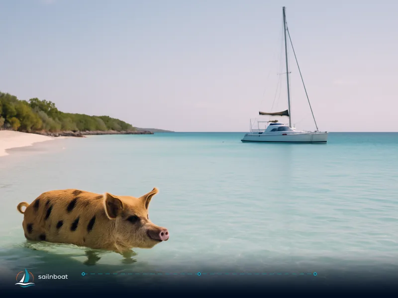
- Attractions: Thunderball Grotto (Staniel Cay), Pig Beach (Big Major Cay), Shroud Cay mangrove creeks and Norman’s Cay snorkel sites.
- Total distance: plan roughly 120–190 nm for the whole week depending on the extra detours you add; crossings from Nassau can be the longest single days (often 4–7 hrs).
Trade‑offs you need to make up front
- Speed vs. time ashore: faster boats shorten daylegs but burn fuel; slower boats should pick shorter legs (more nights inside the bank).
- Moorings vs. anchoring: inside the Exuma Park you will use mooring balls (no anchoring allowed in many mooring fields) — this changes where you can stop and how you budget.
Day-by-Day Sailing Route
The table below gives a practical daily plan with approximate distances and estimated times. Distances are nautical miles rounded to the nearest whole mile and are approximate: currents on the bank, your exact track and the speed you choose change times. Estimated times are calculated using typical charter cruising speeds; pick the number that matches your vessel and fuel plan.
| Day | Route | Distance (nm, approx.) | Estimated time (typical charter boat) | Overnight / notes |
|---|---|---|---|---|
| Day 1 | Nassau → Norman’s Cay (via Yellow Bank/Highbourne pass option) | 30–40 nm | 4–6 hrs | Anchor off west beach or use marina/dock if available; check shallow passes. |
| Day 2 | Norman’s Cay → Shroud Cay (enter Exuma Park north) | 10–18 nm | 1.5–3 hrs | Shroud Cay mooring field / protected mangrove creeks; dinghy exploration at low tide. |
| Day 3 | Shroud Cay → Warderick Wells (Exuma Park HQ) | 8–15 nm | 1.5–3 hrs | Mooring balls only at Warderick Wells; plan to arrive before mid‑afternoon. |
| Day 4 | Warderick Wells → Staniel Cay | 15–25 nm | 2–4 hrs | Drop into Staniel Cay Yacht Club for fuel, ice, and restaurants; visit Thunderball Grotto. |
| Day 5 | Staniel Cay → Big Major Cay (Pig Beach) — short hop and beach day | 2–6 nm | 0.5–1 hr | Anchor off Big Major (Pig Beach) on the bank side; busy in high season — go early or late. |
| Day 6 | Big Major Cay → Allan’s Cay (Iguanas) or Highbourne Cay option | 8–12 nm | 1.5–2.5 hrs | Allan’s for iguanas and quiet anchorage; Highbourne has marina/fuel if you need bunkering. |
| Day 7 | Allan’s/Highbourne → Nassau (return crossing) | 30–70 nm | 5–8+ hrs | Pick weather window for the return; larger single crossing so depart early and allow reserve fuel and daylight. |
Notes on planning the legs
- Longest single passages will be the Nassau crossings; many charter itineraries break that distance by stopping at Highbourne or Norman’s on Day 1.
- The Exuma Bank is shallow with many cuts; follow published tracks and follow local advice for cut depths and timing. When in doubt, reduce speed and send a crew forward to look for coral heads — the water is clear but charts and local knowledge matter.
Recommended Anchorages and Mooring Details
Practical mooring and anchoring facts for the route — depths are typical ranges in metres and reflect bank side anchorages; tidal range on the bank is generally modest (often less than 1 m) but enough to change available depth on some shoals.
Mooring / anchorage snapshot
- Norman’s Cay — Depth: often reported as 3–5 m near the west beach, but confirm with current charts or local guidance; good holding sand; beware the shallow bar at the southern approach and follow the marked cut. Facilities: informal beach docks, limited services; private marina present for deep‑draft transient yachts.
- Shroud Cay — Depth: typically 2–4 m in the mooring area and creeks; well protected on the bank side; mooring balls available in the southern approach (first‑come). Ideal for mangrove creeks and short hikes.
- Warderick Wells (Exuma Park HQ) — Depth: 2–8 m around the moorings; the park operates mooring balls (no anchoring in mooring fields) and daily mooring/anchorage fees apply by length; pay via ParkPay after you secure a ball. Plan to check in at the park HQ dock on arrival.
- Staniel Cay — Depth: 2–5 m in the approaches and popular anchorage spots; Staniel Cay Yacht Club provides moorings, fuel and dockage (limited berths and moorings, book high season if you want a dock).
- Big Major Cay (Pig Beach) — Depth: typically 2–5 m on the protected bank side where boats anchor to swim with the pigs; expect crowds and shallow sandbars near the beach.
- Allan’s Cay — Depth: often 2–3 m on the bank side; quieter and more exposed to certain wind directions; no marina facilities.
Mooring fees at Exuma Cays Land & Sea Park (selected examples)
- Park mooring – charter vessels up to 39'11": BSD $27.27 / night (≈ €24.0/night using current mid‑market rates).
- 40'–49'11": BSD $36.36 / night (≈ €32.0/night).
- 50'–59'11": BSD $45.45 / night (≈ €40.0/night). These are daily rates published by the Bahamas National Trust; the Park charges additional per‑person day fees for charter vessels. ParkPay is the payment system and pre‑payment does not guarantee a ball. (Conversion: 1 BSD ≈ 0.8803 EUR on 6 Oct 2026).
Operational tips for moorings and anchoring
- Mooring balls inside the Park are first‑come, first‑served and the park does not take reservations — arrive well before late afternoon in high season. Expect to pay on the ParkPay app after you take a ball.
- Where moorings are not available (e.g., Allan’s Cay, some bank beaches), anchor in sand at depths indicated above; set long scope and a reliable anchor alarm because tidal movement on the bank can shift your boat’s swing.
- Be respectful of the Exuma Park rules: no fishing, no collecting and no anchoring in mooring fields — enforcement is active.
Provisioning Tips and Local Customs
Provisioning strategy
- Fill the ship in Nassau: large supermarkets and provisioners give you the best selection and price for fresh, frozen and bulk items; final opportunistic top‑ups at Staniel Cay cover perishables and convenience items. Plan frozen storage if you intend to stay several days between Nassau visits.
- Typical Staniel Cay shops: Burke’s (a.k.a. Blue Store), Pink Pearl Super Market and Isles General Store — small, local stock; expect higher prices and weekly restocks. Use these for top‑ups, not a full week’s provisioning.
- Fuel and ice: staniel Cay Yacht Club and some private marinas sell diesel/petrol and ice; if you need significant fuel top‑ups, call ahead and plan a stop at Highbourne or Compass Cay where marina facilities are more reliable.
Customs, cruising permits and fees (what you must do)
- File your pleasure‑vessel arrival using the Bahamas Customs Click2Clear Cruising Permit module before arrival and clear at the designated Port of Entry; until cleared, only the captain may leave the vessel. Cruising permit requirements and fees are regulated by Bahamas Customs.
- Fees vary by vessel length and duration (historically examples include $250–$400 for temporary permits for smaller private craft) and the government adjusted permit structures effective 1 April 2026; budget accordingly and check the current Click2Clear/Customs guidance before you depart. The final cruising permit fee and any passenger arrival taxes depend on vessel size and passenger numbers.
- Practical workflow: submit Click2Clear inbound declaration, radio the Port of Entry as directed, have passports and vessel documents ready and pay the permit/attendance fees as instructed; keep the cruising permit onboard for inspection.
Money, payments and cards
- Local currency BSD is on par with USD; most island shops accept USD and major cards but small stores may prefer cash — carry small USD/BSD notes for market purchases and park payments. ParkPay and marina card readers are common at official points.
Weather Patterns and Optimal Sailing Windows
Seasonal overview
- Best months for predictable trade‑wind sailing: November through April (the dry, trade‑wind season). Trade winds typically blow from the E–SE and average 10–15 knots in the region; winter can bring stronger northers that generate N–NW winds and choppier conditions.
- Hurricane season runs June–November and brings a higher risk of tropical systems and squalls; for charters, the main booking window is outside the peak hurricane months.
Daily planning and watchpoints
- Depart early: for bank crossings and long legs, leave at first light to take advantage of calmer seas and daylight for navigating cuts on the bank.
- Monitor local marine forecasts and VHF MX broadcasts; watch for squalls that can turn wind direction and strength quickly in warm months. Rely on both national forecast services and local base briefings at check‑out.
- Wind‑direction trade: the bank side anchorages (western side of cays) are usually calmer in prevailing E–SE trades; a norther is best sheltered by eastern sides — check each cay’s shelter pattern before committing to an anchorage.
Contingency Options for Unexpected Challenges
Alternative anchorages and safe harbours
- If the weather turns: Highbourne Cay, Compass Cay and certain anchorages in Elizabeth Harbour (George Town, Great Exuma) offer more protected marina facilities and are common contingency points with fuel and repair options. Plan one of these as a go‑to and note their fuel/dock availability before departure.
- Park limits: if Warderick Wells moorings are full, you can usually move to an adjacent protected bank anchorage outside the mooring field or continue to Staniel Cay; do not anchor inside park mooring fields where prohibited.
Safety and equipment checklist
- Safety kit: lifejackets for every person, VHF fixed + handheld, EPIRB/PLB, radar/plotter backups, spare fuel, spare filter, pump repair kit, adequate fenders and warps for crowded moorings. Check that the charter inventory includes a functional anchor windlass and a second anchor/rode. (Standard for bareboat safety; check your charter contract for exact inventory.)
- Communications plan: nominate a crew member ashore contact, record marina contact numbers (Staniel Cay Yacht Club, Exuma Park HQ) and carry local emergency numbers. Keep a paper chart excerpt of the bank cuts and key waypoints — phone/GPS outages happen.
Operational contingencies
- Fuel margin: keep a reserve of at least 20% fuel for engine contingencies when crossing the bank or making the Nassau return crossing.
- Mooring backup: if a desired mooring field is full in high season, have a backup anchorage planned 5–20 nm away (Highbourne or Compass are typical alternates).
Final practical checklist before you go
- File Click2Clear and confirm port of entry clearance hours for your intended first landfall.
- Provision full fresh/frozen stores in Nassau; plan island top‑ups at Staniel Cay only for essentials.
- Budget park mooring fees and cruising permit fees (park fees published in BSD — convert to EUR as needed; example Park mooring rates converted above).
- Check the seven‑day forecast and plan your longest crossing for the calmest predicted window — early departure on your Nassau return reduces exposure to afternoon seas.
You now have a route, nightly options and the operational checks that make the difference between a hectic charter and one where you actually sleep.
Frequently Asked Questions
Typical daily legs range from short hops of 3–10 nm to longer crossings of 30–80 nm; expect the week to total roughly 120–190 nm and plan 1–6 hour passages depending on your boat's cruising speed.
Key stops: Norman's Cay (anchorage, shallow approaches), Shroud Cay (mangrove creeks, mooring field), Warderick Wells (Exuma Park moorings only), Staniel Cay Yacht Club (moorings, fuel, stores), Big Major Cay (Pig Beach anchorage) and Allan's Cay (quiet anchorage).
Stock up in Nassau at full supermarkets (Solomon's Fresh Market and similar) before departure; Staniel Cay has a few small grocery stores (Burke’s, Pink Pearl, Isles General Store) with limited stock and higher prices.
The best sailing window is November–April (trade‑wind season) with prevailing E–SE trades commonly 10–15 knots; winter 'northers' and occasional stronger systems can bring N–NW winds and rougher seas.
Return early to Nassau, shelter at protected marinas like Highbourne or Compass Cay, or pick alternative anchorages inside the bank (e.g., Stocking Island/George Town) and always have fuel and a night plan.
Written by
Sailnboat Editorial
The Sailnboat editorial desk covers yacht and boat chartering worldwide — routes, bases, seasons, boat types, paperwork and the practical costs that decide a trip. We are a charter marketplace, not a boat owner or a local agency: what we sell is judgement and support, so our guides are written to help you make a decision, not to sell you a specific boat. Every guide is checked against live operator and marina data before it goes out.
Fact-checked against live operator and marina data, and published under our editorial standards. Last reviewed: .