14-Day Sailing Itinerary Croatia: Split to Dubrovnik
A practical, day-by-day 14‑day sailing itinerary from Split to Dubrovnik with distances, estimated transit times, primary and backup anchorages, service notes and difficulty assessments.

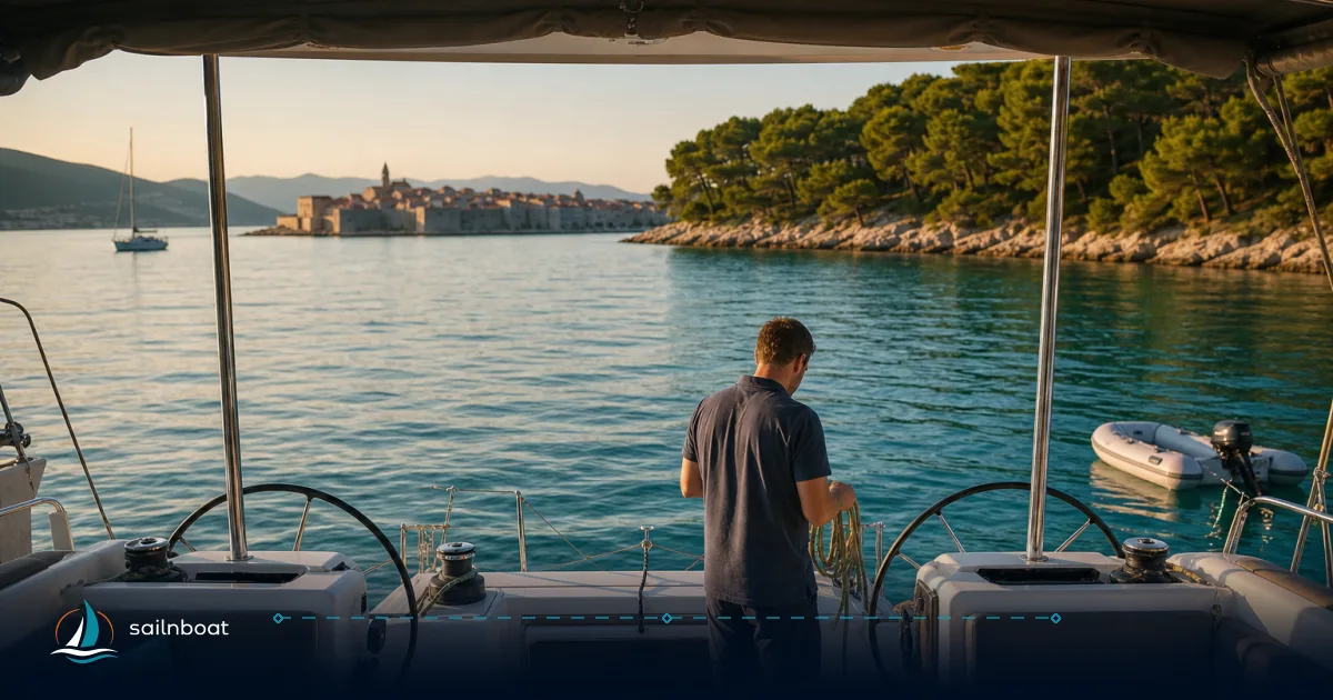
This 14 day sailing itinerary croatia maps a practical, resource‑aware route from Split to Dubrovnik with daily nautical miles, estimated transit times and two anchorage options for every night so you can plan fuel, provisioning and weather windows properly. Expect a mix of short island hops and three or four longer open crossings — each day below lists services, exposure and the cultural stop you’ll want to plan time for.
Quick comparison table (legs at a glance)
| Day | Route | Distance (NM) | Est. transit (at 6 kn) | Primary overnight (primary / backup) |
|---|---|---|---|---|
| 1 | Split → Maslinica (Šolta) | 13.6 NM. | 2–3 h. | Maslinica (Marina Martinis Marchi) / Stomorska. |
| 2 | Maslinica → Hvar Town (Pakleni) | 18.9 NM. | 3–4 h. | Hvar Town (town quay / Palmižana ACI) / Stari Grad. |
| 3 | Hvar Town → Vis Town | 16.6 NM. | ~3 h. | Vis Town (fuel / quay) / Komiža. |
| 4 | Komiža → Biševo (Blue Cave) → Komiža | 5 NM (round-trip to cave area). | 1–2 h for transfers, plan half‑day visit. | Komiža quay / Vis Town. |
| 5 | Vis Town → Vela Luka (Korčula west) | 24–26 NM (typical 25 NM). | 4–5 h. | Marina Vela Luka (Marina Korkyra) / Proizd anchorage. |
| 6 | Vela Luka → Zaklopatica (Lastovo) | ~19 NM. | 3–4 h. | Zaklopatica (park moorings) / Lučica. |
| 7 | Lastovo → Korčula Town | ~16–22 NM (route-dependent). | 3–4.5 h. | Korčula Town (ACI / town quay) / Badija island. |
| 8 | Korčula (explore) — Lumbarda / Pržina | Short hops 2–6 NM | 0.5–1.5 h | Lumbarda anchorage / Pržina bay. |
| 9 | Korčula → Orebić (Pelješac) | ~2–3 NM crossing | <1 h | Orebić quay / Trstenik or anchorage on Pelješac (wine route). |
| 10 | Orebić → Polače (Mljet) | ~17–20 NM (Korčula→Polače ~17 NM). | 3–3.5 h. | Polače quay (NP) / Pomena. |
| 11 | Mljet (lakes day) | Minimal local moves | Tender/shore visits | Polače / Pomena — park ticket required for lakes. |
| 12 | Polače → Šipanska Luka (Šipan) | ~23 NM. | 3.5–4 h. | Šipanska Luka quay / Suđurađ (east Šipan). |
| 13 | Šipan → Lopud / Koločep (Elaphiti) | 7–12 NM (island choice) | 1.5–2.5 h | Lopud (Sunj bay) / Koločep (Velika or Donja bay). |
| 14 | Koločep → ACI Marina Dubrovnik (Komolac) | 6–8 NM (inlet run) | 1–1.5 h | ACI Marina Dubrovnik (full services) / Gruž harbour. |
Notes on times: table times assume a 6‑knot average (typical for charter monohulls under motor or mixed sail/motor) and do not include stops, waiting or heavy-weather routing; adjust up or down for your yacht’s published cruising speed and the forecast.
Day 1: Split to Šolta Island
Sailing Route and Distance
Split or Marina Spinut → Maslinica (Martinis Marchi), Šolta — 13.6 NM; allow 2–3 hours at a 6‑knot average. This is an easy first-day hop that gets you out of the main harbour traffic.
Primary and Backup Anchorages
Primary: Marina Martinis Marchi (Maslinica) — a small, well‑appointed marina with water and electricity but no fuel dock. Backup: Stomorska or Nečujam bay on Šolta’s north coast (town quay or buoys) if the marina is full. Reserve Martinis Marchi in July–August.
Overnight Services
Maslinica has restaurants, a hotel and basic provisioning; the marina offers shore power and waste disposal but not a fuel pump — the nearest fuel is Rogač or Split. If you need diesel, plan to top up in Split before departure or in Rogač.
Difficulty & Exposure
Sheltered in normal conditions; watch for the afternoon maestral once you clear Split and for harbour traffic while leaving Split’s basins. Approach Martinis Marchi on VHF 17 and follow the marina’s procedures.
Day 2: Šolta Island to Hvar Island
Sailing Route and Distance
Maslinica → Hvar Town (via the Pakleni Islands option) — about 18.9 NM; expect 3–4 hours at 6 kn. You can split the day with a swim at Pakleni Islands (Palmižana) before lining up for Hvar.
Primary and Backup Anchorages
Primary: Hvar Town quay (stern‑to) or ACI Palmižana in the Pakleni Islands (if you prefer quieter nights ashore by taxi). Backup: Stari Grad harbor (north side of Hvar) — better protected and easier to secure in a busy season.
Overnight Services
Hvar Town and the Pakleni Islands offer excellent provisioning, restaurants and marine services; ACI Vrboska on the north coast is the island’s main fuel reference if you need diesel. Book Hvar town quay well ahead in July–August.
Difficulty & Exposure
The crossing is routine in settled weather; evenings in Hvar are busy and late arrivals can find the quay full — use Palmižana or Stari Grad as a plan B.
Day 3: Hvar Island to Vis Island (Vis Town)
Sailing Route and Distance
Hvar Town → Vis Town — ~16.6 NM; roughly 2.5–3.5 hours at 6 kn depending on route and traffic. This passage moves you offshore into more open water compared with the sheltered Hvar bays.
Primary and Backup Anchorages
Primary: Vis Town quay (fuel, water, pontoons). Backup: Komiža on Vis’s west coast if Komiža's buoys or quay suit the Blue Cave plan. Book Vis quay if you need shore power or fuel.
Overnight Services
Vis town provides a fuel dock, water and mechanics; provisioning is better in Vis than in Komiža. Use Vis to take care of mechanical issues or to top up fuels before longer open crossings.
Difficulty & Exposure
Open crossing — the maestral builds in the afternoon. Start in the morning if possible; if a southerly or strong westerly is forecast prefer the lee of islands or Komiža’s breakwater.
Day 4: Vis Island — Komiža & the Blue Cave (Biševo)
Sailing Route and Distance
Vis/Komiza → Biševo (Mezuporat / Blue Cave area) — ~4.5–5 NM from Komiža; plan a short transfer and a half‑day for the cave visit. You normally leave your yacht in Mezuporat bay or Komiža and take the licensed boat into the cave.
Primary and Backup Anchorages
Primary: Komiža town quay or its buoy field (stern‑to inside the breakwater). Backup: Vis town quay (if Komiža is rough with a westerly). Buoys in Komiža fill quickly in high season.
Overnight Services
Komiža has limited provisioning and no fuel pump — fuel is available in Vis Town. Expect café/konoba service and a busy town quay in summer; Komiža charges town quay fees.
Difficulty & Exposure
Biševo and the Blue Cave visits are weather‑sensitive — the cave’s light effect needs sun and calm seas; the cave operator posts the queue and conditions. Do not attempt to enter the cave with your own boat; use the authorised transfer.
Day 5: Vis to Vela Luka (Korčula west)
Sailing Route and Distance
Vis Town → Vela Luka — typically 24–26 NM (plan 4–5 hours at 6 kn). This is a longer open crossing; leave early and check the forecast for southerly swell.
Primary and Backup Anchorages
Primary: Marina Korkyra / Vela Luka harbour. Backup: Proizd or a swim stop near the islet if you want to break the passage. Reserve if you require marina services or a shore berth.
Overnight Services
Vela Luka offers marina berths, restaurants and limited provisioning; it’s a practical place to rest after a long day and prepare for Lastovo or Korčula.
Difficulty & Exposure
The leg crosses open Adriatic channels and can be rough when the jugo or strong westerlies run. Time this early, keep a weather alternate (Vela Luka or nearby coves), and be prepared to motor when winds are light.
Day 6: Vela Luka to Lastovo (Zaklopatica)
Sailing Route and Distance
Vela Luka → Zaklopatica (Lastovo) — ~19 NM; 3–4 hours in normal conditions. Lastovo is a nature park; overnighting requires observing park mooring rules.
Primary and Backup Anchorages
Primary: Zaklopatica park moorings (marked fields). Backup: Lučica (small harbour below Lastovo town) or anchor in one of the protected bays if park moorings are full. Park mooring tickets and rules apply.
Overnight Services
Lastovo has very limited provisioning and no significant fuel service — plan fuel and spares beforehand. The nature‑park fee applies for overnighting boats.
Difficulty & Exposure
Lastovo sits further offshore — crossings to/from it are comfortable in a settled forecast but exposed if the wind backs or the jugo builds. Keep conservative planning margins.
Day 7: Lastovo to Korčula Town
Sailing Route and Distance
Lastovo → Korčula Town — typically in the 16–22 NM range depending on route; plan 3–4.5 hours, but confirm exact distance with your operator. Korčula is a natural staging post before the Pelješac/Mljet leg.
Primary and Backup Anchorages
Primary: Korčula Town quay or ACI Marina Korčula (Dominče). Backup: Badija or Vrnik anchorage for quieter nights. Book ACI Korčula if you need fuel or shore power.
Overnight Services
Korčula provides fuel (nearby), provisioning and repair services; the old town quay is a premium quay (busy) while ACI Korčula offers more berth capacity and predictable services.
Difficulty & Exposure
The approach into Korčula’s east or Dominče marina is straightforward in settled weather; avoid the town quay in a southerly/SE jugo when the outer harbour becomes lively.
Day 8: Korčula — Lumbarda and south bays
Sailing Route and Distance
Short exploration hops around Korčula: Korčula Town → Lumbarda / Pržina / Badija — 2–6 NM; these are comfortable half‑day or afternoon moves.
Primary and Backup Anchorages
Primary: Lumbarda anchorage or Pržina beach area; Backup: Vrnik or Badija if you want more shelter or a quiet swim area. Note Lumbarda has shallow spots; check assigned berths and depths.
Overnight Services
Lumbarda village has small shops, bakeries and konobas (good for wine tasting — Grk). Fuel and major services remain at Korčula town.
Difficulty & Exposure
Generally sheltered, but watch for shoals near Lumbarda’s entrance and for southerly winds on exposed bays.
Day 9: Korčula to Orebić (Pelješac)
Sailing Route and Distance
Korčula Town → Orebić (Pelješac) — very short crossing of the Pelješac channel, typically ~2–3 NM (under an hour). This puts you ashore on the Pelješac peninsula to sample wines and oysters.
Primary and Backup Anchorages
Primary: Orebić quay (stern‑to) / Trstenik for quieter nights. Backup: anchor in a nearby sheltered cove on Pelješac or return to Korčula if berths are full.
Overnight Services
Orebić is well supplied — grocery, restaurants, car ferry links and taxi access to Pelješac wineries (Dingač, Postup). If you plan to visit Ston for oysters, allocate a land day or taxi ride.
Difficulty & Exposure
Short, sheltered crossing; the channel can funnel winds at times — keep lines ready if a bura gusts down the channel.
Day 10: Orebić (Pelješac) to Polače, Mljet
Sailing Route and Distance
Orebić / Korčula area → Polače (Mljet) — typically estimated at 17–20 NM (Korčula→Polače often cited as ~17 NM); 3–3.5 hours is a reasonable planning figure, but check your chart for precise routing. This transfers you into Mljet National Park.
Primary and Backup Anchorages
Primary: Polače quay (gateway to the NP) or Pomena on the west end. Backup: Sobra (east side) if you prefer the ferry port and larger provisioning options.
Overnight Services
Mljet’s provisioning is limited; Polače has a small shop and Pomena lists a few konobas. Notably, Mljet has little or no boat fuel — refuel at Korčula or Dubrovnik before this crossing. Park tickets are needed for lake access.
Difficulty & Exposure
Mljet is protected in its northern bays but the channel crossings can be choppy when winds oppose current — pick a settled window for this leg.
Day 11: Mljet National Park — lakes and St. Mary’s islet
Sailing Route and Distance
Spend the day with minimal moves; take the park shuttle boat to the islet and walk the lakes. Moor or use national‑park buoys at Polače or Pomena.
Primary and Backup Anchorages
Primary: Polače (park buoys) or Pomena quay. Backup: anchorage in Lokva or Saplunara if you prefer quiet beaches.
Overnight Services
Facilities are limited — small shops in Polače and Pomena; park ticket offices on the quay. There is no reliable fuel on the island.
Difficulty & Exposure
The NP bays are among the safest anchorages in southern Dalmatia but are sensitive to bura funneling down long inlets — secure lines and monitor forecasts.
Day 12: Polače to Šipanska Luka (Šipan)
Sailing Route and Distance
Polače → Šipanska Luka (Šipan) — commonly estimated at ~23 NM; 3.5–4 hours at 6 kn, but verify the distance for your chosen route. This moves you into the Elaphiti islands chain and shortens the final approach to Dubrovnik.
Primary and Backup Anchorages
Primary: Šipanska Luka quay (sheltered). Backup: Suđurađ on Šipan’s east side or anchor in a quieter inlet.
Overnight Services
Šipan has small village services and quiet bays; provisioning is modest but sufficient for last‑minute supplies before the Dubrovnik approach.
Difficulty & Exposure
The Elaphiti chain is generally sheltered; currents through the Koločep channel and strong bura events are the main concerns — plan the day to avoid forecasted strong northerlies.
Day 13: Šipan → Lopud / Koločep (Elaphiti)
Sailing Route and Distance
Šipanska Luka → Lopud (Sunj) or Koločep — typically 7–12 NM depending on island and anchorage choice; 1.5–2.5 hours, but check your chart for the exact leg. Choose Lopud (Sunj) for a sandy beach and easy tendering ashore, or Koločep for very short final runs.
Primary and Backup Anchorages
Primary: Lopud Sunj bay (well‑known sandy beach) / Koločep Velika or Donja Bay. Backup: anchor off a quieter Elaphiti cove if the harbours are busy.
Overnight Services
Elaphiti islands have restaurants and basic provisioning; larger purchases should be done beforehand in Korčula or Dubrovnik. Use this as your last scenic night before arriving at the ACI marina.
Difficulty & Exposure
Short, typically sheltered hops; still monitor the bura which can tumble into narrow channels.
Day 14: Koločep / Lopud → ACI Marina Dubrovnik (Komolac)
Sailing Route and Distance
Koločep / Lopud → ACI Marina Dubrovnik (Komolac) — usually estimated at 6–8 NM depending on starting point, about 1–1.5 hours; confirm the distance for your specific departure point. The inlet into Rijeka Dubrovačka brings you into ACI Dubrovnik where full services are available.
Primary and Backup Anchorages
Primary: ACI Marina Dubrovnik (Komolac) — full services, fuel, water, power and pump‑out. Backup: Gruž Harbour or the town quay in a planned short‑stay scenario. Book berths in high season and expect a short bus ride or taxi to the Old Town.
Overnight Services
ACI Dubrovnik supplies fuel, water, shore power, waste reception and maintenance services;it also handles customs clearance for international arrivals and offers a short shuttle/taxi into Gruž and the Old Town; allow an afternoon to tie up, clear paperwork and walk the walls.
Tips for Your 14-Day Sailing Adventure
Weather Considerations
Plan the itinerary around two predictable patterns: the northerly maestral that builds in fair summer afternoons and the occasional bura and jugo episodes that demand route changes. In summer months the maestral often reaches 10–20 knots by mid‑afternoon and provides reliable sailing if you start early; bura (cold, gusty northerly) can appear quickly, with gusts that commonly exceed 30–40 knots in severe episodes and should be avoided in open crossings. Jugo (southerly) brings longer periods of swell from the open Adriatic and can make exposed legs uncomfortable for many charter monohulls.
How to use that: schedule longer crossings (Vis→Vela Luka, Vis→Korčula, Polače→Šipan) for morning departures when the sea is calmer and the maestral has not yet built, and keep at least one sensible alternate for each day (nearby harbour, deeper lee bay). Check synoptic charts and local forecasts (updated twice daily in summer is common) and be ready to rearrange a 1–2 day block when a prolonged jugo or bura is predicted.
Best months: May–June and September–early October give milder crowds and more stable conditions; July–August are busiest and offer the most predictable summer maestral but also highest marina occupancy.
Safety and Navigation
Charts and equipment
- Carry up‑to‑date electronic charts and at least one paper chart for the region you’re in; changes in depths and temporary marks do occur.
- Use AIS and radar for traffic in the Split and Dubrovnik approaches; many harbours are busy with car ferries and tourist launches.
- An echo sounder is essential when entering shallow anchorages like Lumbarda or certain bays around Šolta.
Passage planning & fuel
- Base daily distances on your yacht’s cruising speed and add a conservative 20–30% margin for weather and detours. For the legs above we used a 6‑knot average as a baseline for planning times.
- Keep at least one extra day of fuel reserve before undertaking longer offshore crossings; fuel availability is reliable in Split, Hvar, Vis and Korčula but limited on Mljet and Lastovo.
Berthing and stern‑to technique
- Many historic town quays (Split, Hvar, Korčula, Dubrovnik) require stern‑to mooring — prepare spring and stern lines and know your stern approach angles. In high season these quays fill early: call ahead and, where possible, reserve a night berth.
- ACI marinas are the most consistent for predictable services (fuel, pump‑out, power). Expect alternative private marinas and local town quay fees; have small change or card ready — Croatia uses the euro.
Regulatory and emergency
- Monitor VHF for port and marina instructions; local harbourmasters will direct arrivals in busier ports. Carry a copy of the yacht’s documents and crew list; different marinas may request ID/crew data on check‑in.
- Have a simple emergency plan: nearest safe haven list, telephone numbers for local coastguard, and the crew’s roles if seas rise quickly.
Cultural Insights
Time allocation
- Split (start): allow at least half a day ashore to clear provisioning and walk Diocletian’s Palace; add a morning hike on Marjan if you have crew energy.
- Hvar: plan an afternoon for the fortress and a morning to cruise the Pakleni Islands. Book the Hvar quay in high season if you want to be in town overnight.
- Vis/Komiža: allow a day for the Biševo Blue Cave experience (operated boat transfers only) and a relaxed morning in Komiža.
- Korčula: give one full day for the old town, its cathedral and a wine stop in Lumbarda (try Grk grape); consider a late afternoon sail to nearby bays.
- Mljet: schedule half‑to‑full day for the National Park lakes and the short walk to St. Mary’s islet.
- Dubrovnik (finish): allow a full day to walk the walls, visit Rector’s Palace and cross to Lokrum island. Arrive with time to queue early or book timed tickets where available.
What to book and when
- Blue Cave visits, certain fortress entrances and popular restaurants in Hvar and Dubrovnik can require booking in high season.
- Marinas: reserve ACI and private berths in July–August at least several weeks ahead; in shoulder months a few days’ notice often suffices.
Local customs and costs
- Service culture is direct and helpful; tipping is appreciated for skippers and restaurant service but not mandatory — a small discretionary tip after a good meal or a marina service is customary.
- Most towns accept cards; keep a small amount of cash for remote islands and small konobas. Croatia uses the euro.
Quick checklist before you cast off
- Full fuel and water topped to cover the long open legs plus one extra cruising day.
- Charts updated and paper backup onboard.
- VHF tested; radio watch plan for busy approaches.
- Shore lines, fenders and a stern‑to plan for town quays.
- Reserve key marina berths and Blue Cave tickets for high season.
Plan your sequence but keep flexibility: one weather‑forced layday in Hvar or Vis is a small price for safety and a better cruise.
Plan your sailing adventure along Croatia's Dalmatian coast today. Contact your charter broker to align yacht speed, berth reservations and provisioning with this route; with the right weather window this two‑week Split→Dubrovnik circuit gives a balanced mix of sailing, culture and secure overnights.
Frequently Asked Questions
Each day in the itinerary lists nautical miles and estimated transit times (based on a 6‑knot cruising speed common for chartered sailing yachts). Times vary with sea state, exact route and whether you motor or sail.
Every day lists a primary anchorage/marina and at least one backup (town quay, sheltered bay or nearby marina) together with notes on reservation and protection.
The itinerary flags where fuel, water, provisioning and basic repairs are reliably available (Split, Hvar, Vis, Korčula, ACI Dubrovnik) and where services are limited (Mljet, Lastovo, small coves).
Key exposed passages include the Vis→Vela Luka / Vis→Korčula crossings and the Korčula→Šipan/Šipan→Dubrovnik legs; those should be scheduled early and only in a settled forecast — the text marks difficulty for each day.
The itinerary highlights decision-grade ashore options: Diocletian’s Palace in Split, Hvar Town’s fortress and Pakleni Islands, Komiža/Blue Cave (Biševo), Korčula old town (Marco Polo associations), Mljet National Park’s lakes, and Dubrovnik Old Town.
Written by
Sailnboat Editorial
The Sailnboat editorial desk covers yacht and boat chartering worldwide — routes, bases, seasons, boat types, paperwork and the practical costs that decide a trip. We are a charter marketplace, not a boat owner or a local agency: what we sell is judgement and support, so our guides are written to help you make a decision, not to sell you a specific boat. Every guide is checked against live operator and marina data before it goes out.
Fact-checked against live operator and marina data, and published under our editorial standards. Last reviewed: .