Cinque Terre Anchoring: Permits, Zones, and Safe Approaches
A practical, skipper-focused guide to anchoring inside the Cinque Terre Marine Protected Area: zoning, daily and annual permits, buoy fields, safe approaches and shore logistics.

Body
If you plan to anchor in Cinque Terre, you must comply with the Marine Protected Area’s zoning, permit, and mooring regulations—anchoring is allowed only in designated Zone C areas or on authorised buoys, with a valid Park permit on board. As of the latest guidance, daily permit fees are €6 for boats up to 10 m LOA and €11 for those over 10 m LOA. The distinction between private/bareboat and commercial/skippered charters determines eligibility. This guide details where you can anchor, how to secure permits, seasonal buoy field logistics, safe approaches, weather considerations, and troubleshooting scenarios for the Cinque Terre coast.
Overview of the Cinque Terre Marine Protected Area
The Cinque Terre AMP (Area Marina Protetta) is tightly regulated, with three protection zones managed by Parco Nazionale delle Cinque Terre. Each zone has specific rules for navigation, anchoring, and mooring. Understanding these zones is critical for planning your route and avoiding regulatory trouble.
Zoning Regulations
- Zone A — Integral Reserve: No navigation, mooring, or anchoring for visitors. Access is limited to authorised scientific or resident activities.
- Zone B — General Reserve: Mooring only on park-installed buoys, with prior authorisation. Anchoring is not permitted. Most recreational activities are restricted to residents or those with special permits.
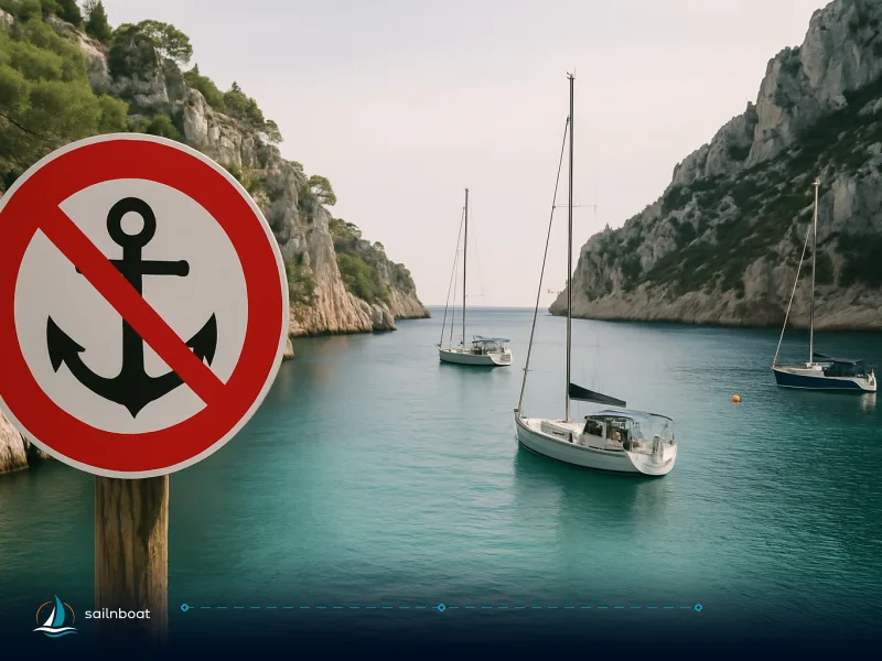
- Zone C — Partial Reserve: The largest zone. Anchoring and mooring are permitted only in designated buoy fields or polygons, and always with an authorisation. The Park publishes coordinates for permitted and prohibited areas.
Key point: Do not anchor anywhere in the AMP unless you are certain it is a permitted Zone C field or you have a specific authorisation. Always check the latest Park maps and the disciplinare.
Anchoring and Mooring Permit Requirements
Who Needs a Permit?
All recreational vessels, including bareboat charters for private purposes, must obtain a permit to anchor or moor inside the AMP. Commercial and skippered charters (operated for profit or by a professional skipper provided by the operator) require a different, more involved authorisation and are not eligible for daily recreational permits.
Permit Eligibility Table
| Charter Type | Daily Permit Eligible? | Annual Authorisation Needed? | Notes |
|---|---|---|---|
| Private/Bareboat | Yes | Only if recurring use | Owner/charterer must be on board; not for sub-charter or for-hire use |
| Skippered/For-hire | No | Yes | Commercial activity requires annual permit; paperwork is more involved |
Daily Permits
- How to apply: Register on the Park’s online portal, declare your vessel, date, and intended activity (navigation/anchoring/mooring), and pay the fee.
- Fees: €6 for vessels up to 10 m LOA, €11 for vessels over 10 m LOA (current Park guidelines).
- Permit form: The system issues a PDF/QR—keep this on board and ready for inspection.
Note: Daily permits are strictly for private recreational use. If your charter is managed by a professional skipper or is operated for profit, you must seek annual commercial authorisation.
Annual Authorisations
- Who applies: Commercial operators, professional skippers, or recurring users.
- How to apply: Submit paperwork (vessel documents, ID, administrative forms) to the Park’s office in Manarola. Allow several weeks for review.
- Fees: Assessed case by case, depending on vessel type and area of use. Expect additional concession fees for commercial use.
Seasonal Buoy Fields: Dates and Availability
The Park rigs buoy fields seasonally, typically from late May to late September, but exact dates may vary each year. Buoys are removed outside these dates, and anchoring is then restricted to alternative designated sites or nearby marinas.
- Typical rigging: Last week of May
- Typical removal: End of September
Always confirm the current year's calendar before planning your stop—fields may be de-rigged earlier in case of adverse weather or maintenance.
Safe Approach Corridors for Charter Yachts
The Park’s disciplinare marks strict approach corridors, swim lanes, and no-anchoring polygons. Always consult the latest official charts and the Park’s digital map before entering any bay or mooring field.
Navigation and Approach Best Practice
- Approach from seaward using the charted fairway. Avoid cutting close to cliffs or crossing swim lanes.
- Swim lanes (“Percorsi natatori”) are strictly off-limits to motorised craft during the bathing season.
- Respect published polygons: download and plot them on your chartplotter before arrival.
- Only approach mooring fields in calm weather; the Park requires “meteomarine favorevoli” (favourable conditions) for safe operations.
- Avoid night entry unless absolutely necessary; some fields have night-time restrictions.
Local Navigation Tips
- Load the Park’s campi ormeggio coordinates and no-anchoring polygons into your navigation system.
- Maintain a lookout for swimmers and small craft—especially near villages where the bays are shallow and busy.
- In buoy fields, engines must be stopped when swimmers are in the water near your vessel.
Weather, Winds and Swell: What to Expect
Prevailing Patterns
- Winds: The Ligurian coast is dominated by light to moderate southwesterly (Libeccio) and northwesterly (Mistral) winds in summer, but local sea breezes can shift direction by afternoon. Gusts can funnel around headlands.
- Swell: Even in settled weather, swell wraps into the bays, especially after storms in the Ligurian or western Mediterranean. The coastline is exposed, and surge can make tendering hazardous.
- Weather windows: Safe anchoring or mooring is only possible in settled seas. If wind or swell builds, holding can become unreliable, and buoy fields may become uncomfortable or unsafe for overnight stays.
How Weather Impacts Anchoring
- Field exposure: Vernazza and Corniglia fields are more exposed to southerly swell; Monterosso offers slightly more shelter but is still open in strong weather.
- Holding ground: Many fields have rocky or mixed sand/rock bottoms. Confirm holding conditions before anchoring—some fields are suited only to mooring buoys.
- Storm protocol: If the forecast turns, move to a sheltered marina at Levanto, La Spezia, or Porto Mirabello.
Designated Anchoring and Mooring Locations
Below is a practical comparison of the main mooring and anchoring sites, including depths, holding, and shore access. Buoy counts and locations are subject to seasonal adjustment, so confirm the current layout via the Park’s official digital map or at parconazionale5terre.it/page.php?id=111.
| Village / Area | Park Mooring Fields & Buoys | Typical Depth (m) | Holding Ground | Anchoring Allowed? | Shore Access & Notes | GPS Reference (approx.) |
|---|---|---|---|---|---|---|
| Monterosso al Mare | Several white buoys in field | 4–8 | Sand/mixed, some rock | In C fields only | Best shore access; small marina, shallow nearshore | 44.1476°N, 9.6546°E |
| Vernazza | Main field with multiple buoys | 5–10 | Sand/rock mix | In C fields only | Small harbour; busy in summer, swim lanes near quay | 44.1342°N, 9.6832°E |
| Corniglia/Spiaggione | Small seasonal buoy field | 6–12 | Sand/pebble | Buoys only | No marina; steep access, tendering challenging in swell | 44.1198°N, 9.7097°E |
| Punta Mesco | Limited buoys, B zone | 8–15 | Sand/rock | By authorisation | Exposed, limited shore services | 44.1543°N, 9.6300°E |
| Manarola/Riomaggiore | Several small fields, white buoys | 6–10 | Rock/sand mix | Buoys only | Tiny harbours, transfer varies with sea state | 44.1072°N, 9.7331°E (Manarola) |
Operational notes:
- Total buoys: Several dozen across the AMP, with some reserved for local operators/diving centres. Numbers may shift seasonally.
- Seasonality: Fields are rigged May–September; outside these dates, mooring options are limited.
- No-anchoring polygons: Strictly enforced; penalties apply for violations.
Mooring Options and Techniques
- Use only park-issued white biconic buoys. Pick up lines are sometimes short—prepare a boathook and fender.
- Anchor only where expressly permitted, and avoid Posidonia seagrass areas (marked on disciplinare maps).
- Approach head-to-wind; use a stern anchor or snubber if leaving the boat for shore.
- If holding is poor or weather is deteriorating, do not risk an overnight stay—move to a sheltered marina.
Anchoring Technique: Scope, Line Handling, and Avoiding Fouling
- Scope: Use a minimum of 4:1 scope in calm conditions (e.g., 32 m of rode for 8 m depth). Increase to 5:1 or more if staying overnight or if swell is present.
- Line Handling: Prepare your lines before entering the field. Plan for crosswinds and keep fenders ready due to tight quarters.
- Avoiding Fouling: Watch for seagrass beds and rocky patches. Drop anchor in clear sand where possible. If the anchor drags or fouls, reset rather than risk damage.
Troubleshooting: Full Buoy Fields or Poor Weather
If the Buoy Field is Full
- Alternatives: Divert to Levanto or La Spezia marinas (both outside the AMP and not subject to Park permit rules).
- Anchoring elsewhere: Do not anchor outside designated polygons—enforcement is active.
- Temporary waiting: Stand off in deep water and monitor for departing boats, but avoid blocking approach lanes or swim areas.
If Weather Deteriorates
- Immediate action: Relocate to the nearest sheltered marina (Levanto, La Spezia, Porto Mirabello).
- Emergency: In severe cases, contact the local Coast Guard (Capitaneria di Porto La Spezia). VHF Ch. 16 is monitored.
- Buoy field closure: The Park may close fields in adverse conditions—obey all instructions.
Penalties and Enforcement
- Fines: The Park enforces penalties for violations, and fines can be substantial, but no fixed range is publicly listed. Expect that anchoring or mooring in violation of the disciplinare, or operating without a permit, can result in significant fines and possible removal from the field.
- On-the-spot checks: Park rangers and Coast Guard patrols are active, especially in high season.
Sample Itinerary: Charter Day in Cinque Terre
Scenario: You have a bareboat charter (private use), 13 m sailing yacht.
Plan:
- Obtain a daily permit (€11 for >10 m LOA), valid for mooring in Zone C.
- Arrive at Monterosso field mid-morning; depth 6–8 m, sand/mixed ground.
- Moor to a Park buoy, check holding, and allow for swing room.
- Tender ashore during calm midday period, avoiding ferry arrivals.
- If field is full, divert to Levanto marina (approx. 3 NM north).
- Monitor weather—if wind shifts south or swell builds, plan to relocate by late afternoon.
- Overnight: Prefer Levanto or La Spezia for secure sleep and provisioning.
Shore Logistics for Charterers
Tender Docking Locations
- Monterosso: Best quay and marina infrastructure; can land in most conditions.
- Vernazza/Riomaggiore: Small harbours, limited quay, busy in summer.
- Corniglia: No marina—requires steep climb or shuttle from the beach.
- Tendering: Only attempt in settled weather. Avoid busy ferry windows.
Park Rules for Transfers
- Inside buoy fields, engines must be off when swimmers are in the water.
- Mooring and transfer rules are strictly enforced—follow the Park’s disciplinare.
Shore Transport and Ticketing
- Cinque Terre Card: Buy in advance for hiking or train use; nominative, covers trails and (with Train Card) unlimited Levanto–La Spezia trips.
- Trains: The Cinque Terre Express runs frequently in season; ferries operate seasonally (subject to sea state).
- Tickets: Keep permit and cards handy, especially on busy days.
Practical Shore Checklist
- Download and print your Park permit PDF/QR.
- Confirm the buoy field’s seasonal status before arrival.
- Carry small change and ID for train or trail gates.
- Plan provisioning and garbage disposal at marinas, not in the villages.
Overnighting: Most charter skippers prefer Levanto, La Spezia, or Porto Mirabello for overnight stays; village harbours are cramped and exposed after dark.
Responsibility: The skipper is liable for any damage or improper anchoring—ensure your approach, mooring, and shore transfers comply with Park rules at every step.
Summary Table: Cinque Terre Mooring Options
| Location | Buoy Field | Depth (m) | Holding | Shore Access | Seasonality | Alternatives |
|---|---|---|---|---|---|---|
| Monterosso | Yes | 4–8 | Sand/rock mix | Marina, best quay | May–Sept | Levanto marina |
| Vernazza | Yes | 5–10 | Sand/rock | Small harbour | May–Sept | La Spezia, Porto Mirabello |
| Corniglia | Yes | 6–12 | Sand/pebble | Beach, stairs | May–Sept | Levanto marina |
| Punta Mesco | Yes (B) | 8–15 | Sand/rock | Limited | May–Sept | Levanto marina |
| Manarola/Riomaggiore | Yes | 6–10 | Rock/sand | Tiny harbours | May–Sept | Porto Mirabello |
Final Recommendations
- Always check the latest Park maps and disciplinare before setting out; rules and buoy field layouts can change seasonally.
- Secure your permit in advance, and keep it accessible for inspection.
- Plan for realistic weather and field capacity—know your alternatives.
- Prioritise safety: if in doubt about weather, holding, or field availability, divert to a marina.
With the right preparation, you can enjoy the unique experience of anchoring in Cinque Terre while staying compliant and safe. The key is to respect the Park’s regulations, monitor conditions, and have a backup plan for every anchoring decision.
Frequently Asked Questions
The AMP is divided into Zones A, B and C. Anchoring and mooring are tightly regulated: Zone A is an integral reserve with the strictest bans; Zone B permits are limited (moorings available by authorization); Zone C is the partial reserve where authorised anchoring and mooring are allowed (daily or annual permits apply).
Daily permits are applied for and paid online through the Park's permit portal; they are for recreational private use only and must be shown as a PDF/QR aboard. Annual authorizations require submission of documentation to the park office (protocol office) and follow the disciplinare's procedures, paperwork and stamp-duty requirements.
The park disciplinare identifies prohibited anchoring polygons and swim lanes; approach the villages from seaward along charted fairways, stay outside swim corridor markers, and only enter mooring fields in calm, forecast-favourable conditions as required by the disciplinare.
Authorised mooring fields (white buoys) are located in the Zone C areas in front of Monterosso, Vernazza, Corniglia and near Manarola/Manarola–Riomaggiore; there are also a few authorised moorings in Zone B (Punta Mesco). Exact coordinates and the number of buoys are listed in the disciplinare; berthing overnight on the beach promenades is very limited, so many charters use nearby Levanto or La Spezia for overnight.
Village landings are small and change with season and sea state; tender transfers, swim-to-shore and use of the Cinque Terre Card for trains and trail access are common; check seasonal buoy rigging dates and carry your permit QR or printed PDF when going ashore.
Written by
Sailnboat Editorial
The Sailnboat editorial desk covers yacht and boat chartering worldwide — routes, bases, seasons, boat types, paperwork and the practical costs that decide a trip. We are a charter marketplace, not a boat owner or a local agency: what we sell is judgement and support, so our guides are written to help you make a decision, not to sell you a specific boat. Every guide is checked against live operator and marina data before it goes out.
Fact-checked against live operator and marina data, and published under our editorial standards. Last reviewed: .