Sailing Weather Forecast Solent: A Comprehensive Guide
A practical guide to producing a reliable sailing weather forecast for the Solent: what Met Office inshore forecasts tell you, how SWIS/Weatherweb add local value, a daily briefing template and month‑by‑month sailing implications.

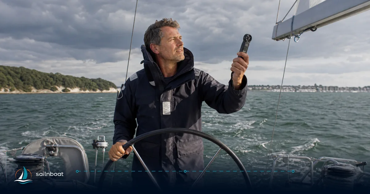
A reliable sailing weather forecast Solent combines the Met Office Inshore Waters Forecast, a high‑resolution short‑range model for local detail (the Met Office UKV is used for UK near‑coast nowcasts), and a human‑written Solent briefing such as SWIS/Weatherweb to pick up microclimates and sea‑breeze timing. Use that blend every morning: the Met Office gives the official baseline, models give spatial detail and ensembles show uncertainty, and SWIS/Weatherweb add practical, sailor‑focused interpretation.
Understanding the Met Office Inshore Waters Forecast
The Met Office Inshore Waters Forecast is the official baseline for the Solent: it covers coastal areas up to 12 nautical miles offshore and is issued four times daily in 24‑hour blocks (0000, 0600, 1200 and 1800 UTC). The forecast explicitly states wind direction and force, sea state, weather and visibility and highlights strong coastal winds. For operational planning, treat the inshore forecast as the primary published source for warnings and routine MSI (Maritime Safety Information).
Key Features of the Met Office Forecast
- Update cadence and legal context: four updates per day; broadcasts form part of the UK MSI chain used by the Coastguard. Use NAVTEX/VHF/MET broadcasts where you need the official legal update stream as internet pages can be delayed.
- What it gives you for the Solent: predicted wind direction/force, sea‑state descriptors, visibility and significant weather; strong winds (force 6+) are highlighted for the first 24 hours. Use it to set your ‘go/no‑go’ threshold and then refine locally with models and human analyses.
- How to read it practically: read the headline (wind/sea) first, then the detailed paragraphs for timing and expected changes (e.g., “veering to SW by afternoon”) and always check the latest shipping/coastguard warnings for the Solent area.
Evaluating SWIS and Weatherweb Forecasts
SWIS (the Sailing Weather Information Service hosted by Weatherweb) supplies a sailor‑oriented, written forecast for the Solent area and adjacent coastal sectors, typically with interpretation for small craft and sea‑state in Douglas terms. SWIS forecasts are prepared by human forecasters and are intended to be used alongside official forecasts and model outputs, not instead of them. SWIS also publishes area notes and sea‑state expectations tailored to sailors’ needs and offers forecasts out to seven days.
Comparison of Forecast Services
| Service | Best use for Solent sailing | Update frequency (typical) | Strengths | Limitations |
|---|---|---|---|---|
| Met Office Inshore Waters Forecast | Legal baseline; official warnings; general public/coastguard reference | Four times daily (24‑hr blocks) | Official product; covers warnings and formal MSI | Coarser on local microclimate timing, only four formal issue times. |
| SWIS / Weatherweb | Sailor‑focused narrative and local interpretation | Human updates; forecasts commonly extend to 7 days | Human synthesis of models; tailored sea‑state commentary | May be intermittent for trial areas; human schedules affect update timing. |
| High‑res model output (UKV / nowcasts) | Short‑range detail (sea‑breeze timing, land‑sea gradients) | Hourly or sub‑hourly model fields; product cadence varies | Very fine spatial resolution for coastal effects | Requires interpretation; run‑to‑run jump can occur close to coast. |
| Synoptic/ensemble models (ECMWF / GFS / MOGREPS) | Synoptic trends and uncertainty | 1–2 runs per day (ensembles daily) | Shows system evolution and probability | Lower spatial resolution for microclimates near the Isle of Wight. |
Use the Met Office for the formal forecast and warnings, check UKV or equivalent for coastal detail and sea‑breeze timing, and consult SWIS/Weatherweb for sailor‑language interpretation and local caveats.
Tidal Races and Local Microclimates
Know where the current matters: the Solent concentrates flows at its western entrance and across narrow constrictions. The principal operational tidal gates are the Needles Channel and the Hurst/Shingles area; both can produce spring flows of multiple knots and steep, short seas when the wind opposes the tide. The Solent’s eastern half behaves differently to the west because tidal timing and local bathymetry vary across the channel. Use a tidal stream atlas and local predictions for decision‑grade planning.
Impact of Tidal Races
- Needles Channel: a major gate where strong tidal streams occur on springs; planning arrival or departure through the Needles should target favourable stream or slack.
- Hurst/Shingles (Hurst Narrows): the spit narrows the approach and creates concentrated flows, eddies and the locally known 'Trap' area; expect rapidly changing conditions on ebb or when wind opposes stream. Maintain conservative speed assumptions and avoid attempting tight passages in adverse tide/wind combinations.
- Operational rule: wind‑against‑tide produces the steep, short chop that is most uncomfortable and hazardous for small‑boat crews. Plan to time critical rounding points for tide‑with‑you or slack water, and allow wide safety margins.
Local Microclimates
- Isle of Wight effects: the island deflects and shelters flows; in many setups a sea breeze will set up down the Solent from west to east with clear differences in strength from the western approaches to Portsmouth/Chichester areas. Afternoon sea breezes can turn light morning northeasterlies into stronger southwest or westerly flows along the channel.
- Harbour contrasts: Portsmouth Harbour, Chichester Harbour and Southampton Water have markedly different fetch and exposure; the same synoptic wind can feel much stronger or weaker inside these harbours and local gust patterns vary. Account for restricted fetch when judging comfortable wind limits for berthing or anchoring.
Developing a Daily Briefing Checklist
A concise pre‑departure briefing saves mistakes. Use the checklist below every day you plan to go afloat; have one crew member own it and sign off before casting off.
Essential Elements of a Daily Briefing
- Quick summary (decision): go / postpone / alternate plan with time window (e.g., "leave at HW+1 to use favourable stream").
- Official baseline: read the latest Met Office Inshore Waters Forecast for the Solent area and check for any active warnings.
- Model snapshot: pull UKV (or equivalent) nowcast for expected wind vector across route and one synoptic model (ECMWF/GFS) for trend; check ensemble spread (MOGREPS) if crossing into uncertain weather.
- Tide & stream plan: tidal times and heights for the standard port(s) you’re using and a stream plan for each tidal gate on your route (needles, Hurst, other headlands). Use Admiralty Tidal Stream Atlas or trusted tidal software for exact stream timings.
- Route & alternatives: primary route with ETA windows accounting for favourable stream; two contingency berths (east and west) with contact/marina details and minimum depth required.
- Risk points and mitigations: list tidal races, shallow patches, expected traffic pinch points and how you’ll handle wind‑on‑tide.
- Communications & emergency: VHF working channel(s), DSC checks, MOB and tow plan, and who is master‑at‑arms for each manoeuvre.
- Crew brief: sail choices, reefing plan, helm changes, lookout assignments and fatigue management.
- Fuel/water and equipment: range to destination allowing reserves (motors often used in Solent); confirm anchor, warps and fenders.
- Final check: confirm forecast updates at midday/evening and set alarms for any expected change windows.
Safety Considerations
- When wind opposes the tide (especially through Hurst or the Needles) downgrade your acceptable wind by a notch or two and allow extra sea room.
- If ensemble spread is large (forecasts diverge), shorten your operational window and stage passages to shorter legs where shelter options exist. Use the ensemble to identify low‑probability but high‑impact outcomes.
- Remember traffic: summer weekends have heavy recreational and commercial traffic; keep a vigilant lookout and treat narrow fairways as single‑lane sections.
Month-by-Month Weather Patterns in the Solent
Use climate averages to set expectations for crew comfort, likely sail wardrobe and charter scheduling. The Met Office long‑term averages show the Solent with cool winters, mild springs, warm summers and monthly mean wind speeds commonly in the ~9–11 knot range for many months; seasonal differences affect both wind strength and the frequency of strong Atlantic systems. Use these patterns for planning but always check short‑range forecasts for individual trips.
January to March
- Typical: coolest months with frequent frontal systems from the Atlantic; gales and strong southerly/westerly winds are more likely than in summer. Visibility and heavy rain are common on warm fronts.
- Operational implications: short daylight, greater likelihood of strong wind warnings. Plan shorter passages, prioritise sheltered anchorages/harbours and confirm crew cold‑weather kit.
April to June
- Typical: more settled interludes, increasing spring sunshine and longer daylight; the frequency of strong Atlantic lows falls but changeability remains. Sea breezes begin to appear on warm days.
- Operational implications: good windows for longer day sails; keep an eye on frontal transits (still possible). Use evening briefings to pick the best morning tide windows.
July to September
- Typical: warmest period, often lighter synoptic winds but reliable afternoon sea breezes that can strengthen the Solent mid‑day to afternoon; busiest period for traffic. Thunderstorms can occur locally, typically in summer convective setups.
- Operational implications: expect strong sea‑breeze fills around midday—this can change rig choice and timing for passage through tidal gates. Book berths early and expect congestion; keep an eye on lightning risk and short‑range convective warnings.
October to December
- Typical: return to more unsettled Atlantic regimes, shorter days and an increased chance of gales; autumn systems can deepen rapidly.
- Operational implications: maintain conservative weather limits for short passages; check for forecast rapid intensification and be prepared to shorten the trip or shelter early.
Month-by-month quick table
| Period | Typical wind character | Key sailing implication |
|---|---|---|
| Jan–Mar | More frequent strong Atlantic lows, gusty SW/W winds | Shorter days, favour sheltered plans and conservative limits. |
| Apr–Jun | Changeable with improving stability; sea breezes begin | Longer legs feasible; watch frontal passages. |
| Jul–Sep | Lighter synoptic winds; strong afternoon sea breezes; more thunder risk | Busy waters, plan for gusty afternoons and increased traffic. |
| Oct–Dec | Increasingly unsettled; gales return | Avoid long exposed passages in marginal forecasts. |
Practical trade‑offs: summer gives calmer seas but more traffic and strong local sea breezes; shoulder seasons give quieter waters but less predictability; winter carries the highest operational risk from strong Atlantic systems.
Putting it together: a morning workflow (10–15 minutes)
- Open the Met Office Inshore Waters Forecast for the Solent and scan for warnings (2 minutes).
- Pull UKV nowcast or high‑res product for your exact route to check wind vector and gust fields (3 minutes).
- Check SWIS/Weatherweb narrative for local notes (sea‑state, sea breeze timing) and cross‑check with model snapshot (2 minutes).
- Confirm tides/streams for the ports/gates you’ll use and compute ETA windows to hit favourable streams (3–5 minutes).
- Brief crew (3–5 minutes): weather headline, route and alternatives, reefing plan, communications.
Final note — sources and caution
The Met Office inshore forecast is the authoritative public product for coastal safety, UK maritime authorities use it for MSI, and SWIS/Weatherweb provide valued human interpretation tailored to sailors; combine both with high‑resolution models (UKV) plus ensemble thinking for uncertainty. Tidal gates and wind‑against‑tide interactions are the Solent’s consistent hazards — always plan your timing around those features and carry a conservative margin for forecast error.
Review your sailing plans and ensure your crew knows the forecast, the tide‑plan and the contingency berths before you leave harbour.
Frequently Asked Questions
The Met Office Inshore Waters Forecast is the UK’s official forecast for coastal strips up to 12 nautical miles offshore, issued four times a day and giving wind, sea state, weather and visibility for named inshore areas such as the Solent.
SWIS/Weatherweb provides sailor‑focused, human‑written area forecasts and interpretation (including sea state in Douglas scale), typically out to seven days and aimed at small‑craft planning; they complement rather than replace official Met Office forecasts.
The main tidal gates and races to note are the Needles Channel and the Hurst/Shingles area (including local features known as 'the Trap'); these concentrate strong streams and can produce steep, short seas when wind and tide oppose.
Essential items are: latest inshore forecast, model comparison snapshot, tide times and stream plan for tidal gates, planned route with alternatives, risk points and crew brief on communications and emergency actions.
Winters bring colder air and a higher chance of gales; spring is changeable; summer offers warmer, lighter winds with reliable afternoon sea breezes but much higher traffic; autumn returns to more unsettled Atlantic systems and stronger winds.
Written by
Sailnboat Editorial
The Sailnboat editorial desk covers yacht and boat chartering worldwide — routes, bases, seasons, boat types, paperwork and the practical costs that decide a trip. We are a charter marketplace, not a boat owner or a local agency: what we sell is judgement and support, so our guides are written to help you make a decision, not to sell you a specific boat. Every guide is checked against live operator and marina data before it goes out.
Fact-checked against live operator and marina data, and published under our editorial standards. Last reviewed: .