Best Anchorages in Marmaris Bay: A Sailor's Guide
A practical, decision-ready guide to the best marmaris bay anchorages — where to drop, what bottom to expect, which bays have water and electricity, and how the Lodos changes the picture.

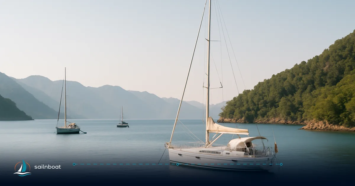
Adaköy will give you reliable N–NW shelter close to Marmaris, while Serçe Limanı is the bay’s true all‑weather haven — plan your overnight depending on wind quadrant and how much shelter you need. This guide to marmaris bay anchorages lists the practical details you need: depth bands, bottom types, where to get water or electricity, approach cautions, and the local wind risks that change the choice of bay.
Top Anchorages in Marmaris Bay
Below are the anchorages you will use most often from Marmaris harbour outward. For each I list the shelter profile, depth/bottom, facilities, and practical cautions.
Adaköy (Cennet Adası)
- Shelter: Reliable protection from north and northwest winds; good for an early-night stop when the meltemi or northerlies are in play.
- Depths & bottom: Typical anchoring zone 8–14 m over sand; holding is generally good.
- Facilities: Adaköy (Heaven Island) has a nearby marina (Adaköy Marina) and regular water‑taxi runs to Marmaris town — useful if you want to provision or dine ashore.
- Approach notes: Watch the shallow fringing features and local traffic — the inner arm can be busy with day‑trip boats in high season. Be aware that Yalancı Boğaz to the south can funnel SW Lodos squalls into this sector; factor that into your overnight decision.
İçmeler
- Shelter: Protected from north and northeast winds by the pine‑backed hills; exposed to SW and W. Good first/last night choice when the swell is from the south.
- Depths & bottom: Expect about 8–15 m on approach, predominantly sandy bottom with generally good holding.
- Facilities: Beachfront restaurants, shops and frequent water taxis to Marmaris make İçmeler convenient for crews who want shore services. Crowds are high in peak season.
- Practical: Keep clear of the marked swimming area and the hotel swim‑buoys; if W/SW wind is forecast, consider stern‑to on the quay or move to a more sheltered inlet.
Değirmen Bükü (English Harbour)
- Shelter: A compact, wooded cove on the Bozburun side – moderate protection from N, NW and W; more exposed to southerly directions.
- Depths & bottom: 4–10 m in many sheltered spots; sand is common but charts show some rocky patches near the headland — pick a clean sand patch.
- Facilities: No large marina here, but nearby Okluk (a sub‑cove) has restaurant pontoons and services; Değirmen Bükü itself is quiet and often used as a stepping stone to Okluk or remote coves.
- Caution: Some charted rock and shallow patches near the entrance — approach slowly and monitor the depth sounder.
(See the comparison table below for a quick at‑a‑glance summary of these and other Marmaris anchorages.)
Additional Anchoring Options
Turunc
- Shelter: Good protection from N, E, SE and S; exposed to W and SW. Ideal when northerlies blow but avoid in strong westerlies.
- Depths & bottom: 5–12 m, sand with some rocky patches; holding described as fair — visually check your set.
- Facilities: Village services, restaurants and regular water taxis to Marmaris; quay available for stern‑to mooring (often charged).
Kumlubük (Kumlubükü)
- Shelter: Horseshoe bay protected from N, NW, W and SW; exposed to E/SE. Good mid‑bay stop with choice of free anchoring or charged yacht‑club buoys.
- Depths & bottom: 6–10 m in the main anchoring zone (yacht‑club buoys sit deeper). Sand bottom with reliable holding.
- Facilities: Kumlubükü Yacht Club runs mooring buoys (power and water), a T‑pier with electricity and water, restaurant and seasonal services — expect fees for buoys and quays.
- Practical tip: Approach from the NW to avoid a shallow sandbank by the beach; in E/SE winds the bay becomes uncomfortable.
Kadırga Koyu
- Shelter: Pristine, roadless cove protected from S, SW and W; exposed to N/NE (meltemi). Use for daytime stops or overnight in lighter northerlies.
- Depths & bottom: 10–15 m over sand and rock; good holding in most of the bay. Expect tour‑boat traffic mid‑day in high season.
Okluk Koyu
- Shelter: Deeply recessed, effectively all‑round enclosed — one of the most sheltered options in the area.
- Depths & bottom: 7–12 m (mud in places) with excellent holding; mud holding is strong but retrieval will mine your anchor and chain.
- Facilities: Two restaurant pontoons provide water and electricity; stern‑to moorings are common (and charged). Busy in high season — early arrival recommended.
Cennet Koyu (Paradise Bay)
- Shelter: Small, wild cove protected from N, NW and W; exposed to S and SE. Quiet, no services — suited to experienced crews wanting solitude.
- Depths & bottom: Common anchoring depths 5–10 m on sand; crystal‑clear water makes it popular for swimming.
Serçe Limanı (Sparrow Harbour)
- Shelter: Legendary “all‑weather” anchorage — a narrow entrance with enclosed waters that shelter a wide range of wind directions; considered the go‑to refuge for severe conditions in the area.
- Depths & bottom: 6–10 m over sand, good holding; narrow entrance requires cautious approach and good attention to charts and local markers.
Anchorages at a glance (quick comparison)
| Anchorage | Typical depth (m) | Bottom | Main protection | Facilities | Distance from Marmaris (approx.) |
|---|---|---|---|---|---|
| Adaköy (Cennet Adası) | 8–14 | Sand | N, NW | Marina / water taxi / restaurants | ~3 nm. |
| İçmeler | 8–15 | Sand | N, NE, E | Restaurants / water taxi | ~4 nm. |
| Değirmen Bükü | 4–10 | Sand/rock | N, NW, W | Nearby Okluk services | — (local cove). |
| Turunc | 5–12 | Sand/rock | N, E, SE, S | Village, quay, water taxi | ~7 nm. |
| Kumlubük | 6–10 | Sand | N, NW, W, SW | Yacht club buoys, power, water | ~9 nm. |
| Kadırga Koyu | 10–15 | Sand/rock | S, SW, W | None (roadless) | — remote cove. |
| Okluk Koyu | 7–12 | Mud/sand | All‑round | Restaurant pontoons, water, electricity | — sub‑cove of Değirmen Bükü. |
| Cennet Koyu | 5–10 | Sand | N, NW, W | None | — quiet, roadless. |
| Serçe Limanı | 6–10 | Sand | All‑weather (narrow entrance) | Small restaurant | — famous refuge. |
Safety Considerations for Anchoring
Weather patterns — meltemi vs Lodos
- Summer meltemi: a persistent northerly to northeasterly wind that typically builds during the day in summer; it makes east‑facing anchorages uncomfortable and favours west‑facing coves. Use protection direction above when deciding a night stop.
- Lodos (SW): an episodic but dangerous south‑westerly that can appear suddenly, sometimes reaching gale force; it is known to produce steep seas and violent squalls in the Aegean. In Marmaris Bay the Yalancı Boğaz can act as a funnel, concentrating Lodos gusts into the inner bay — skippers report rapid wind increases and local news records sudden squalls in that area. Treat forecasts for SW with seriousness.
Practical rule: if the forecasted wind comes from a bay’s exposed quadrant, don’t anchor there overnight — move to the opposite‑facing cove or to Serçe Limanı/Okluk which offer all‑round shelter.
Safety tips (operational)
- Scope: For 8–15 m depths many local guides recommend long scope (commonly around 7:1) to ensure a secure set — that means 70–105 m of chain in those depths depending on your rig. Use your vessel’s chart and loading to determine exact needs.
- Anchor type & test set: Sand and mud hold well for modern roll‑bar anchors (Rocna/Delta/Mantus); after setting, back down on the anchor and inspect chain angle and boat position, or send crew to visually check the anchor if waters allow.
- Room to swing: Crowded bays require you to estimate maximum swing with wind shifts; that is why safetyanchoralarm recommends anchor‑alarm radii by bay — set the alarm wider in open bays and when neighboring vessels are present.
- Night & traffic: Many Marmaris bays draw day‑trip gulets from 11:00–16:00 — if arriving late, choose a spot away from day‑boat lanes; if staying, expect traffic and wakes in peak season.
- Charts & approach: Some bays have near‑shore rocks and sandbanks (e.g., Kumlubük sandbank) — approach slowly, watch the depth sounder, and cross‑check with your chartplotter.
Facilities and Amenities at Anchorages
Dining and services
- Restaurants with pontoons exist at Okluk and parts of Değirmen Bükü; İçmeler, Turunc and Adaköy offer shore dining and provisioning with water‑taxi connections to Marmaris town. Expect seasonal hours — many services are busiest from May to October.
Mooring and utilities
- Kumlubük Yacht Club operates laid mooring buoys and a pier with electricity and water (charged service); Okluk’s restaurant pontoons commonly supply shore services and stern‑to mooring for dinner. Some bays have paid stern‑to quays. If you need shore power or potable water plan to use yacht‑club buoys or restaurant pontoons rather than free anchor spots.
Fees and permits
- Anchoring in most Marmaris bays is free for overnight use in the cruising season; however, quay or mooring buoys (yacht clubs, restaurants) generally charge. Turkey’s regional rules can limit maximum stay in one bay during high season — many guides reference an 11‑day informal limit in some areas — but operators vary. If you plan a long stay, check with local marinas or the harbourmaster.
Choosing the Right Anchorage — a practical checklist
- Match the bay’s protected quadrants to the forecasted wind direction (meltemi vs Lodos).
- Confirm depth and bottom for your draft and anchor type (use your sounder on approach).
- Decide whether you need utilities — if so, target Kumlubük buoys or Okluk pontoons.
- Allow generous swing room and set an anchor alarm radius appropriate to the bay (guides suggest 40–75 m depending on location).
- Monitor forecasts (local meteorological office VHF/online) — a SW Lodos alert should trigger relocation to an all‑round shelter.
Final note on local weather and information sources
Marmaris Bay is well‑served by up‑to‑date local forecast services (national meteorological office and marina forecasts). Because Lodos events can develop quickly and Yalancı Boğaz can concentrate gusts, check short‑term forecasts and local VHF broadcasts before committing to an overnight anchorage. Use the practical shelter map in this guide to pick the bay that fits the wind quadrant you expect.
Plan your sailing trip and choose the best anchorage in Marmaris Bay with these priorities: pick shelter by wind quadrant, confirm depths and bottom before dropping, decide whether you need utilities, and make Lodos contingency plans to move to Okluk or Serçe Limanı if a SW squall is forecast. Safe passages and good nights at anchor come from matching weather to the bay — and leaving early if the forecast changes.
Frequently Asked Questions
Top choices are Adaköy (Cennet Adası) for N–NW shelter, İçmeler for easy access and services, Değirmen Bükü (and its sub-bay Okluk) for excellent mud holding and restaurant pontoons, Kumlubük for yacht-club buoys, and Serçe Limanı for all‑weather refuge; several quieter coves (Kadırga, Cennet Koyu, Turunç) suit day stops or calm nights.
Typical depth ranges run from about 4–15m depending on the bay: Değirmen Bükü ~4–10m, Turunç ~5–12m, Kumlubük ~6–10m, Kadırga ~10–15m; bottoms are mostly sand or mud with pockets of rock — mud in Okluk gives excellent holding.
Facilities vary: Kumlubük has yacht-club buoys with power and water; Okluk has restaurant pontoons supplying water and electricity; İçmeler, Turunç and Adaköy have restaurants and regular water-taxi service to Marmaris town; many remote coves have no services.
The prevailing summer north‑to‑northeast meltemi can make some east‑facing bays uncomfortable; the more dangerous event is an episodic SW Lodos which can blow up violently and be funnelled through Yalancı Boğaz — choose anchorages with shelter from the forecast wind quadrant.
Use adequate scope (many skippers use ~7:1 in 8–15m), check bottom type before trusting the set, avoid marked swimming zones and piers, allow room for swing when the wind backs, and monitor local forecasts and VHF for sudden Lodos squalls.
Written by
Sailnboat Editorial
The Sailnboat editorial desk covers yacht and boat chartering worldwide — routes, bases, seasons, boat types, paperwork and the practical costs that decide a trip. We are a charter marketplace, not a boat owner or a local agency: what we sell is judgement and support, so our guides are written to help you make a decision, not to sell you a specific boat. Every guide is checked against live operator and marina data before it goes out.
Fact-checked against live operator and marina data, and published under our editorial standards. Last reviewed: .